
Saturday, 11th January 2014: Hay – my second post of 2014, which actually has pictures of a 2014 ride as well. I thoroughly enjoyed my ride to Reach and back earlier in the week. It felt so good to be out in the countryside, in the fresh air.
Now I am a bit of a creature of habit – it helps me to get things done that way. I go for a ride, listen to my MP3 player and take pictures. Then when I come back I upload the ride details from my GPS, upload my pictures onto my computer and then generally have a nice warm soak. If I am in a hurry then I have to have a shower instead. Then the next time I sit at my computer I sort the pictures, do a bit of tweaking and then upload them to my Picasa account, ready for inserting in my Blog.
I listen to a variety of programs, including Dr Karl, Chequered Flag F1, Medical Matters, More or Less and of course the Archers. But when I was resting from cycling I stopped listening to podcasts. So before my earlier ride I stuck all the accumulated Archers MP3s onto my MP3 player. For some reason two hadn’t downloaded, but hey, you can easily miss one of two of the Archers series without missing out. There were around 50 programs, at ~15minutes per program - or 12.5 hours. It was great the episodes just carried on and on. However the Reach ride was relatively short as I took a fairly direct route.
This time I though I would cycle along some of the byways and bridleways – more specifically Low Fen Drove Way, Hundred Acre Road and the Lodes Way. Now I would draw a map, but my favourite bicycle mapping website – Bike route Toaster is currently out of action. Google have changed the mapping APIs. The good news is that they are working on re-writing the application, so I won’t bother looking for an alternative, I’ll wait. I will use the OSM map by linking instead when I want to point out particular areas.
I was rather looking forward to going “off-road” or “on-byway”. I headed along High Ditch Road and then around Low Fen Droveway, over what the OSM map has labelled the Cambridge Northern Bypass but I know it as the A14. Once over the bridge the track is rather potholed and this time around those potholes are full of water. They are pretty deep so I avoided them rather than splashed through them. You never know quite what hidden rocks are hidden and the edges of the potholes can be steep as well.
After crossing the old Cambridge - Mildenhall Railway line I remembered why I tend not to cycle along some byways in Winter. As you might expect farmers have to get around to their fields and when the tracks are muddy they get churned up. I tend to use the same tyres on my bike all-year round – Schwalbe Marathon plus.
They are the best tyre for the sort of cycling I do – some tread, but not very aggressive and a great resistance to punctures. Puncture resistance is my main care-about, it is quite common to see broken glass on shared-use cycle paths, road edges at this time of year are full of crap and byways and bridleways can often had problems with thorns when the hedges are flailed. (NOTE I don’t get any sponsorship or free tyre loans – nor am I looking for such.)
The only trouble with an all-rounder is that when conditions bet more extreme it can be problematic. Well I did slip and slide about in the mud, but it wasn’t as bad as it could have been. I did end up pedalling more than the distance I moved forward though – as the rear wheel slipped. The other way to look at that is a bonus bit of exercise.
The other end of Low Fen Drove Way has a better surface – well not mud so my brief additional exertion didn’t last long.
As I passed the farm shed I noticed a burnt-out car. Apparently they are stolen, used for joyriding (amongst other things) and then abandoned and set alight – to remove any fingerprints etc. What a waste (and what a load of pollution) – it looks rather like an old style Range rover.
Burnt-out Range Rover – Low Fen Drove Way

It amazes me just how flammable cars are.
Burnt-out Range Rover – Low Fen Drove Way

I then crossed onto the Fen Ditton-Horningsea Cycleway and headed to Horningsea and up to the bridleway that was once called Hundred Acre Road. You can tell that when I have to work harder because fewer pictures appear. In this case the first bit was fine, just a few puddles, however the bit around Allicky Farm and on to Lode was a bit muddier. So I just got on with the cycling.
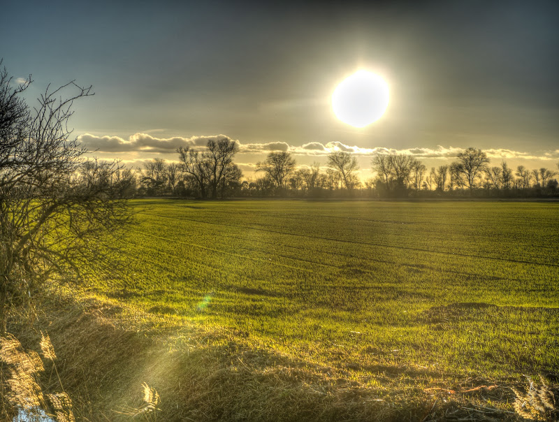
My next stop wasn’t until the corner of Headlake Drove and Great Drove to take a picture of the sun low in the sky. It can be particularly blinding when driving a car – which means, or should mean, slowing down. Unfortunately it seems to me that drivers do use the low sun as an excuse when in what can be a tragic accident – just slow down, please.
My camera is not an SLR, but has a small digital screen in the viewfinder – taking pictures towards the sun is generally not a good idea. The sun wasn’t this big – it was so bright that it white-out a larger area.
Sun Setting – Headlake Drove
With the picture zoomed in it becomes even larger. The colour of the light is rather nice though.
Sun Setting – Headlake Drove

The next stop – was along Lodes Way, after crossing Reach Lode, when I bumped into the Swaffham Bulbeck Cyclist – who I haven’t seen for a few months – because of my self-enforced rest. It was good to catch up. Although I had slightly foolishly gone out in my cycling shorts and worn relatively thin gloves. (Water and wind proof but not super thick). With the sun going down in the sky I thought I would be better prepared the next time I went out.
My plan was to get some setting sun shots so we set of in our separate directions. Although SBC had mentioned that NCN52 through Wicken Fen has been badly flooded, however they have cut some drainage channels now. So although I was feeling tired I thought I would check it out. My originally (lazy plan) was to turn down to Burwell along Factory Road rather than actually visit Wicken Fen.
Crossing Burwell Lode
Even dragging my bike over the footbridge felt harder

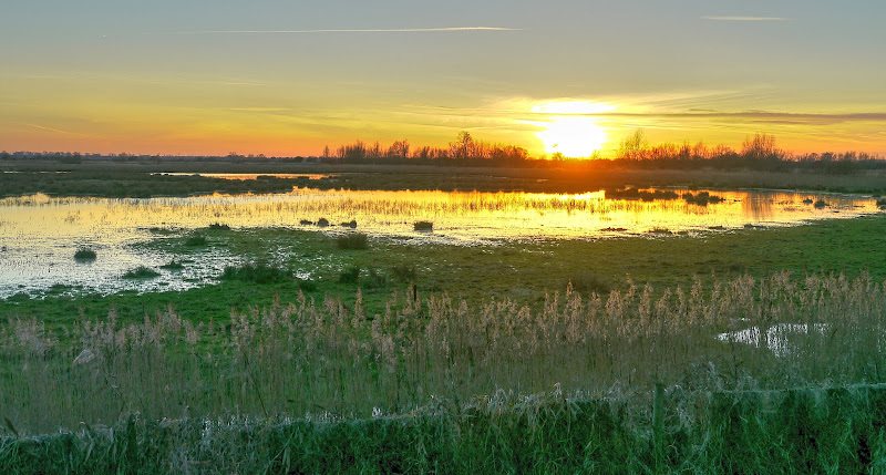
I am glad I did cycle up to Wicken Fen, the sun was perfectly positioned over Baker’s Fen.
Sunset over Baker’s Fen – (Wicken Fen)

The NCN11 path through Wicken Fen – looking much better compared with the pictures pre-drainage.
Wicken Fen – NCN11 – extra drainage channels

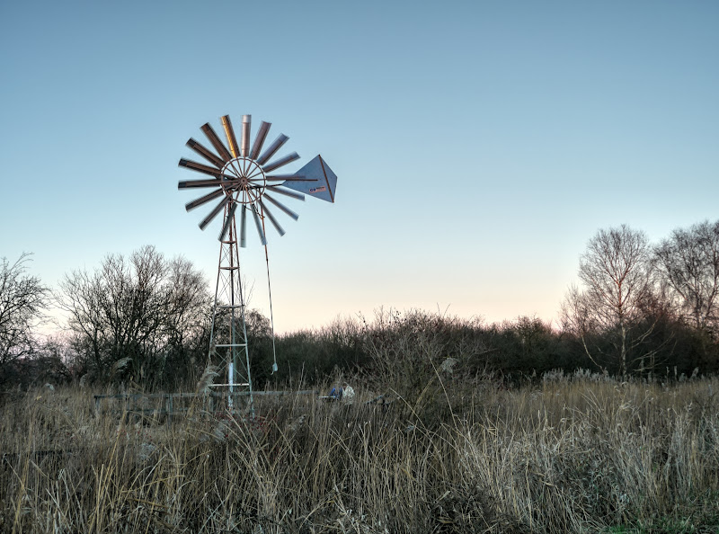
This wind pump was installed to pump water to ensure Wicken Fen gets less acidic water. Not in use at the moment though.
Most Recent Wicken Fen Windpump
On the way back I took another picture of the setting sun – getting lower in the sky
Sunset over Baker’s Fen – (Wicken Fen)
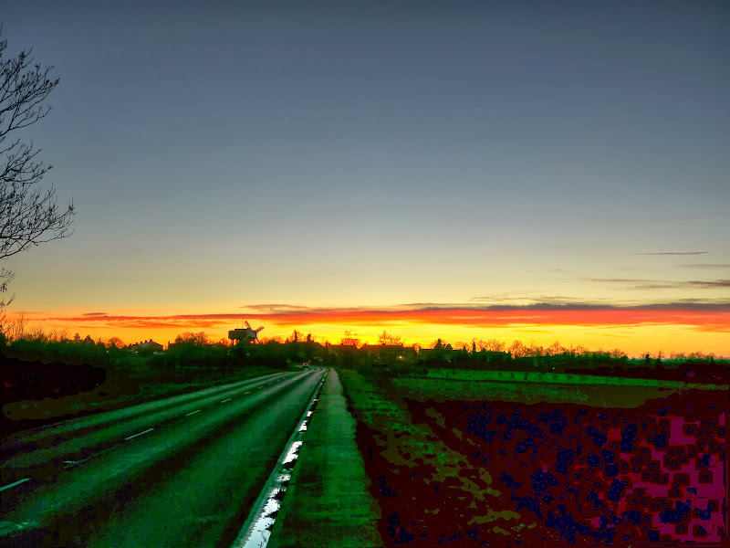
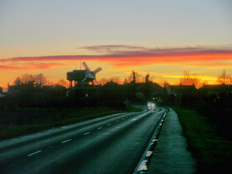
I cycled back through Burwell and up to Swaffham Prior and then joined NCN51. I forgot to mention I did take lights with me. This might look like a pavement – it is in fact a shared-use cycle path – although it is barely wide enough for one bike let alone two to pass each other. The picture looks different in this app than when viewed using Picasa?
One of the Windmills of Swaffham Prior
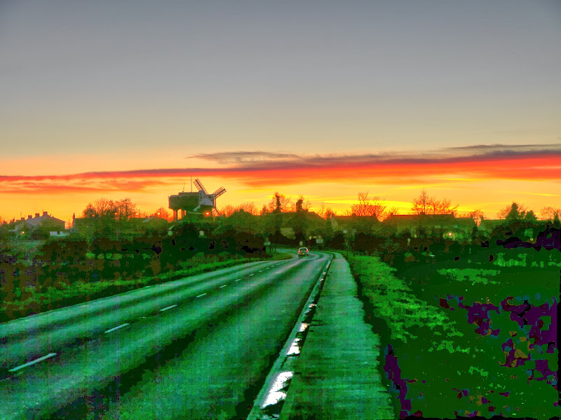
As you can see the sky was pretty clear – it was going to be a cold night. I turned down Rogers Road and to the low road through Swaffham Prior. If you look closely at the left edge in the horizon you might be able to see a sail on the other windmill in Swaffham Prior.
One of the Windmills of Swaffham Prior
I have upgraded to the latest version of Photomatix. It has more versatility so I started playing with it. I think the time has come to one down the brighter aspects of my HDR photography – much as I like the painterly look . This does resemble the scene I could actually see somewhat more closely.
One of the Windmills of Swaffham Prior
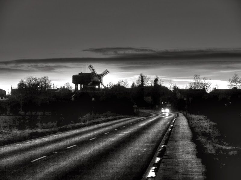
And finally the same scene in black and white.
One of the Windmills of Swaffham Prior
It was pretty cold when I got home, partly because I am not so fit having been resting from cycling and partly because I was rather foolish in my choice of cycling gear. Warmer gloves and warmer socks next time. Mind you lying in a hot bath when I got home was bliss.
No comments:
Post a Comment