
Saturday, 16th February 2013: Yesterday was a busy day, including getting the week’s shopping done. However my wife was off to see some friends perform at lunchtime (music). Which meant that I had an opportunity to get out slightly earlier and have an afternoon’s sunny sycling.
Before I start I probably ought to warn the squeamish that I am going to mention posterioral matters. I do reckon that us MAMILs in Lycra are one of the worst adverts for cycling there is. Although perhaps I am more LMA than MA – I am not quite sure when these things set in mind – I still feel young. Although in the Times today (behind a paywall so no link) it indicated that most people give up exercise completely by 56. Why?
I do have some cycling-specific clothing, including Lycra, but I have never used chamois cream. In fact I used to wonder why the chamois needed so much attention. I also can’t say that I like cycling Eventually I twigged that it was cream you applied to the bits of you body that rested on the saddle – rather than something to soften the chamois.
I did use Lycra and padded shorts when I cycled from Land’s End to John O’ Groats and I also used Sudocrem, daily – it worked for me and was a tip I was able to pass on to one of my fellow cyclists who after a few days appeared to be very, very uncomfortable on his saddle. For other long rides I have only used it sparingly – even in hot climates.
For general leisure cycling I wear unpadded MTB shorts, mainly because they are tougher. One thing I have noticed is that decent trousers I wear for work (or suit trousers) tend to wear more quickly at the crotch, which I suppose is an added expense. Although I would imagine people who drive a lot probably wear their trousers out fairly quickly.
I also wear underpants – even with Lycra and padding, it feels to weird not to and although there are extra seams around I tend not to have problems even on day-long rides. My guilty secret is that at the moment I have been wearing the same pair of MTB shorts on most leisure rides over the winter. Well they have finally worn so thin in the nether regions that they have started to split open. So it is probably a good job I also wear underpants.
I have Brooks saddles on four of my bikes and although they might be heavier find them hard wearing and extremely comfortable – pretty much from the get-go.
So I am going to have to buy some new pairs of shorts – the trouble is I tend to buy some new piece of clothing and then carry on using the old gear so I don’t get the new stuff dirty! The choice will be the subject of another post.
I have been avoiding the bridleways and byways for the last few months. I don’t mind a bit of mud, however I really don’t like it when the mud makes it impossible to cycle on. Anyway for a change I decided to cycle around Low Fen Droveway from High Ditch Road to the Horningsea Road and then across to Lode via the off-road routes. It seems like ages I cycled that way. High Ditch Road is bit of a rat-run road, it is fairly narrow, straight and undulates. Google Maps mark it as a Cycle friendly road. It is not a route I would happily take a young family cycling along, I’d feel intimidated. I do cycle along it on my own though.
I think part of the problem is that the road surface is more uneven at the edges and cars zoom down the middle at what I think are inappropriate speeds. Although I do wonder whether I am becoming less road-tolerant because I do so much cycling off-road or on quiet roads. Perhaps that is why there is a split amongst cyclists who want safe roads and those (non-cyclists) who want safe cycle routes. Personally I feel we need more safe routes to get more people cycling.
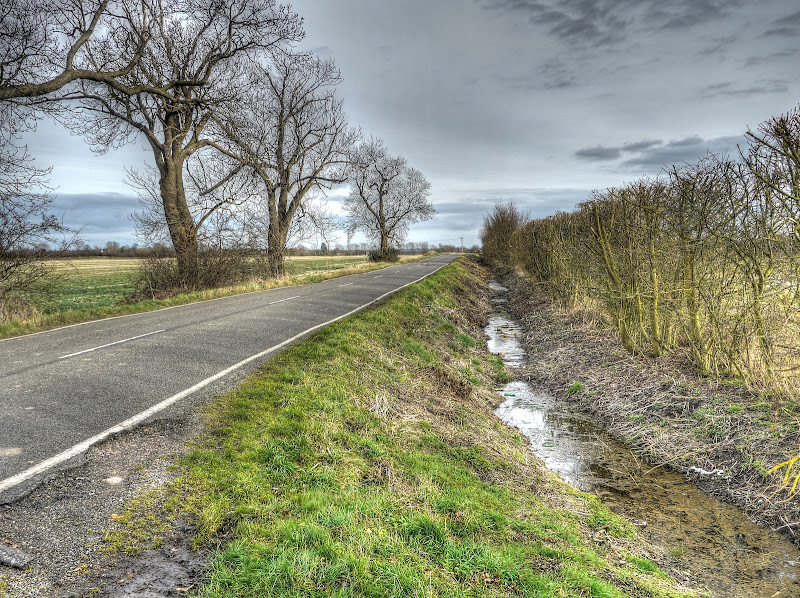
As many are aware there has been quite a lot of rain recently and although the flatlands has quite an extensive drainage network I reckon that we have become less attentive to many of the smaller ditches and drains. Well that has changed this year – there seems to be a lot of ditch clearing taking place, including along High Ditch Road. Clear ditches allow the water to flow faster as you can see here there is quite a lot of water in the ditch. There seems to be a problem further up the way where this road meets the Newmarket Road with a constant stream of water flowing across the road because of blocked drains/ditches.
The cycle route, NCN51 avoids that problem being off-road.
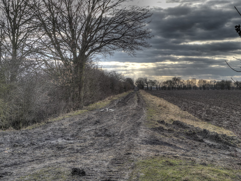
High Ditch Road – Cambridge, ditch clearance/hedge trimming
This is the view looking towards Cambridge, along High Ditch Road, the water seems to have disappeared. Here is rather a nice map of the area c 1790, pre-railway. Talking of the railway there is still an old humpback bridge along High Ditch Road – which is what counts as a hill in these parts. That can be a bit scary I have seen a car lift of the road speeding over that bridge. Under it there is graffiti.
The area between High Ditch Road and Newmarket Road is set for change as Marshall of Cambridge owns 125 acres of it and wants to develop it with plans for a school, 1,500 homes a petrol station, commercial development and playing fields. Apparently top quality land in Cambridge can sell for between £3m and £4m an acre, but the building boom is not as strong as it was, even in Cambridge.
For me the issues, is that the area is close to the A14, a very noisy road but we probably do need more housing – so how do we make it a nice and pleasant area to live in. Which means prioritising people over cars. One of the employment hubs in Cambridge is the Cambridge Science Park, another is the Cambridge Bio-Medical Campus (Addenbrookes), so I would hope that thought and investment is given to ensuring pleasant cycle routes to work that positively entice people on to their bikes and prioritise cycling over cars. Perhaps that means houses don’t have garages for cars but do have decent storage for bicycles or if they do have garages there is a premium to pay. Perhaps High Ditch Road should either become cycle only, or a no through road, or a wide cycle track built alongside.
Enough dreaming!
High Ditch Road – Cambridge, ditch clearance/hedge trimming

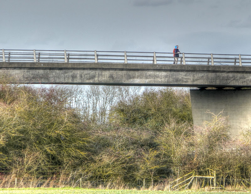
As I was taking pictures I noticed some people admiring the view from the A14 bridge along Low Fen Drove Way. I think they were having a Titanic moment. When I cycled up over the bridge I passed them – they were out for a cycle.
Bridge over the A14 (Low Fen Drove Way)
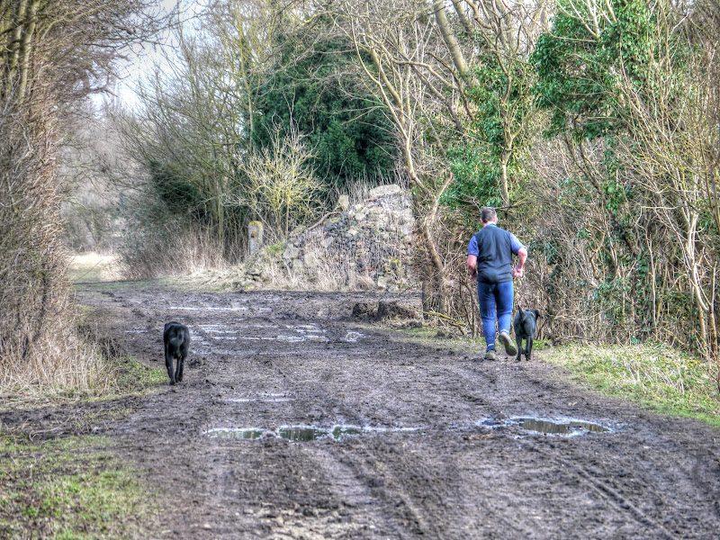
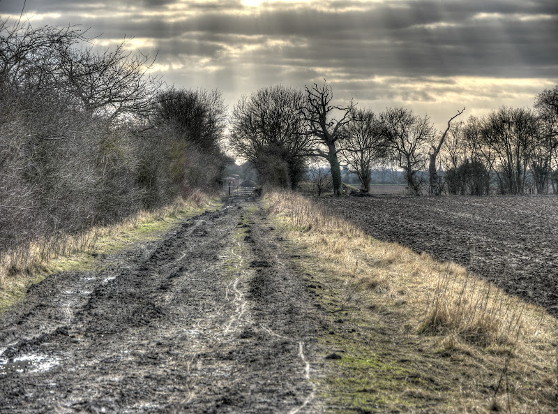
The first half of the drove way was full of puddles after crossing over the path of the old Cambridge to Mildenhall Railway line it became rather less pleasant. – very muddy. I managed to cycle, rather than walk, but it was hard work and felt like was cycling three times further than bike moved forwards.
My front mudguard also started clogging up pretty badly – which also added to the drag as I cycled. I consoled myself with the thought that it was good exercise. Near Snouts corner there are two paths the byway and a concrete track. Google Maps’ Satellite view shows the drove way going along the concrete bit. However if you look closely there is a track between two hedges that I reckon is actually the right of way.
It would seem that whoever owns the concrete track also thinks the same thing as a ditch has ben (re)dug to block access to it. In my cycling travels I tend to head for byways and bridleways. Now I am never quite clear what level of repair a byway should be in, or whose responsibility. Given that many byways are used by farmers to get from field to field, when the weather is wet and soggy then it is hardly surprising that the byways get chewed up. The Byways & Bridleways Trust makes the point that it used to be whether a route was founderous? Would it bring a horse to its knees? Well I reckon that the bit from here to the right around honey hill is founderous. I would imagine that whilst the alternate route existed no-one bothered but if the concrete track is no longer accessible then perhaps it need fixing.
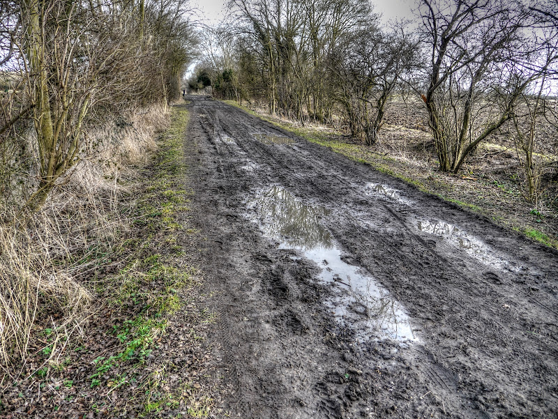
Low Fen Drove Way – pretty muddy and a barrier to the concrete track

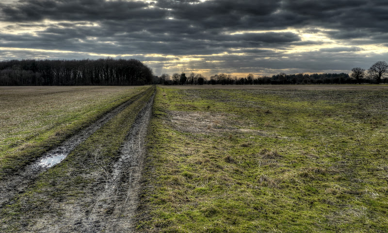
Although having said that, this is the view from the other end of the byway with an inaccessible concrete track bypass. It doesn’t look as bad at this end. You’d get a horse along there – the ruts are a bit deep for a bicycle though as the pedals would foul the sides. (Here is a byway map that I found in my travels in the internet – Low Fen Drove Way.)
Low Fen Drove Way – pretty muddy in places

It was rather pleasant to get onto a decent bit of tarmac on the Fen Ditton – Horningsea shared-use cycleway. Now the cycleway ends as you get to Horningsea. It would seem that this village suffers a bit from being on a rat-run route. It is mentioned in the British History section on Horningsea with respect to traffic calming. As far as I am concerned an awful lot of money is p*ssed away on traffic-calming that either has a temporary effect of hardly does anything.
The reason it happens is that it is cheap and keeps the natives happy. When entering villages you see gates on the verge at the boundary, or painted SLOW signs on the road, or “Kill Your Speed” signs on lampposts in fact that’s a topic for a set of pictures.
Cambs County Council do have information on what to expect from Traffic Calming, bumps can effect reductions of up to 10mph. Islands – not very effective (2-3mph) and for a cyclists they act as pinch points, come to that so do speed bumps. Rumble strips – not sure – 3mph maybe. Gateway Features – 4-5mph but speeds creep back up again. So there you have it – not much good but cheap – the lot. The other thing that traffic calming schemes do is they alter the patterns of traffic flow in other parts of the network. If you put a barrier to free traffic flow then some percentage of traffic will take an alternate route and might even increase speed to compensate for the new route being longer. (Sustrans take on traffic calming measures.)
It would seem that owners of cars in Horningsea do not feel confident in the driving skills of other road users and feel the only answer is to take to the pavement for their parking.
Pavement Parking Horningsea

After passing through Horningsea with its red tarmac I then headed out along a bridleway, to the north of the village, that heads east. I have looked for a reference to the track – but until seeing the Horningsea c. 1800 map had not come up with a name – well it is called Hundred Acres Road (or Lane) and is marked as going to Stow-cum-Quy. This is The Drove Way as it intersects the old railway line (Cambridge to Mildenhall).
Muddy but not impossible to cycle down – the silver lining was to consider how I was getting more exercise and improving my bike handling skills.
The Drove Way, near Quy – muddier than usual
I had stopped to take a picture of these flowers – Winter Aconites – not for a rest honest.
Winter Aconites on The Drove Way

If you think I am whingeing too much about how much effort it takes – well the track is reasonably long (360m). In general this route is pretty good – even in bad weather.
The Drove Way, near Quy – muddier than usual
I then turned on to the track of the old Cambridge to Mildenhall line – the first half is as bad as I have ever seen it. There was a field of beet (on the right of this picture) and the vehicles used on the lifting and transportation seem to have lifted some of the tracks foundations, as well as churning up the mud.
Old Cambridge to Mildenhall Railway Line – near Anglesey Abbey
The same view – but with more zoom. You can see my cycle tracks on the picture.
Old Cambridge to Mildenhall Railway Line – near Anglesey Abbey
Towards Lode there has been some tree management.
Neatly Stacked Logs – Lode

At the gate by Harvey’s Drove a view back down the line – not quite as badly chewed up at this end.
Old Cambridge to Mildenhall Railway Line – Anglesey Abbey
On my way to White Fen I bumped into Doug, who farms in the area and is the man behind the popular LodeStar festival (opening on the 30th August 2013 at 9am this year). We had a chat about the Festival and the crops he has planned to grow. I really must get along this year, the trouble is my wife is not into this type of music.
![]()
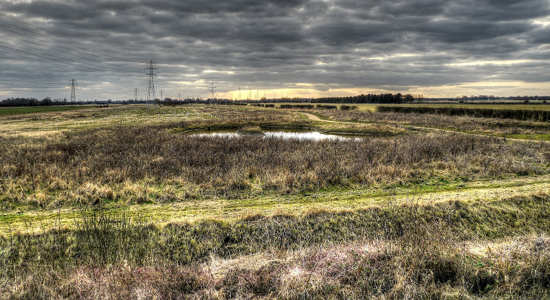
White Fen
I know I mentioned seeing people – well I did, lots of people on all bits of the off-road routes. People walking their dogs, riding horses walking their humans, cycling. In fact I was amazed at just how popular the area has become in a relatively short space of time. It was officially opened on September 12th, 2010. Less than a year and a half later and with no other evidence than my eyes I reckon it has attracted good numbers of people.
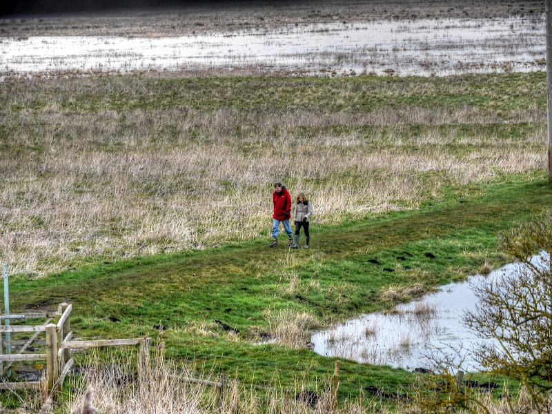
When I got to Reach Lode Bridge I took some pictures. Two walkers coming across from the footbridge at Burwell lode (I am guessing) by way of what is now looking like a causeway with the water levels rising.)
Walking on a causeway on Burwell Fen
Also as I cycled from Headlake Drove onto Split drove I passed a horse rider. Usually I call out – or rather say hello. It isn't a good thing to cycle past a horse particularly if it has blinkers as it can get a surprise to see a cyclist appear out of nowhere.
This time around I gave some gentle tings on my bell whilst I was still some distance from the rider as she approached the corner (Headlake and Split Drove). That allowed them to realise I was there and for me to pass on the corner with a wide berth. With the sun shining and spring flowers out it felt like Spring was in the air.
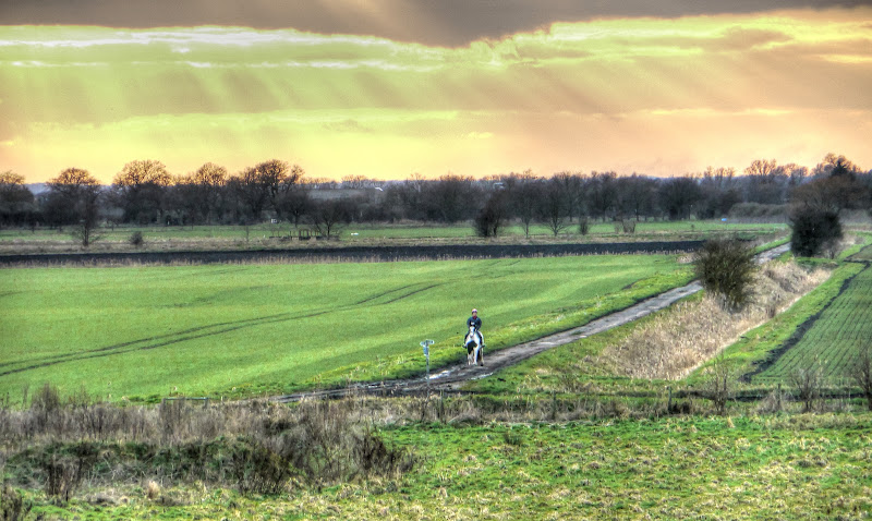
Here s that rider and her horse having made their way down Split Drove
Horse rider on Split Drove
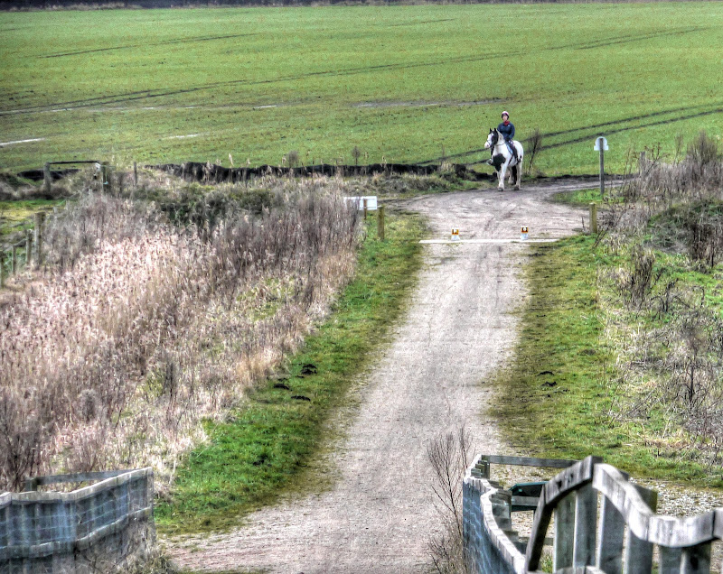
As you can see the last picture had a bit of zoom. I didn’t notice at the time, when I was taking the pictures. However on the right of the bridge one of the rails has come loose and is pointing up in the air. This hunk of invisible wood then appeared in all oft he pictures of the horse and rider. You’d think I would be wise to that sort of photography problem by now.
Horse rider on Lodes Way (near Reach Lode Bridge)
So two of these pictures got cropped to exclude the errant plank of wood. I didn’t look to see which way they went!
Horse rider on Lodes Way (near Reach Lode Bridge)
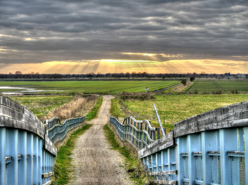
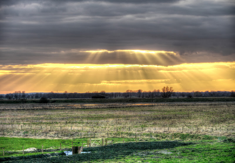
As bridges are a high point around these parts they also make good places to take pictures. There are golden rays beaming down from the sun on Burwell Fen Farm
Burwell Fen Farm – lit by Sunbeams
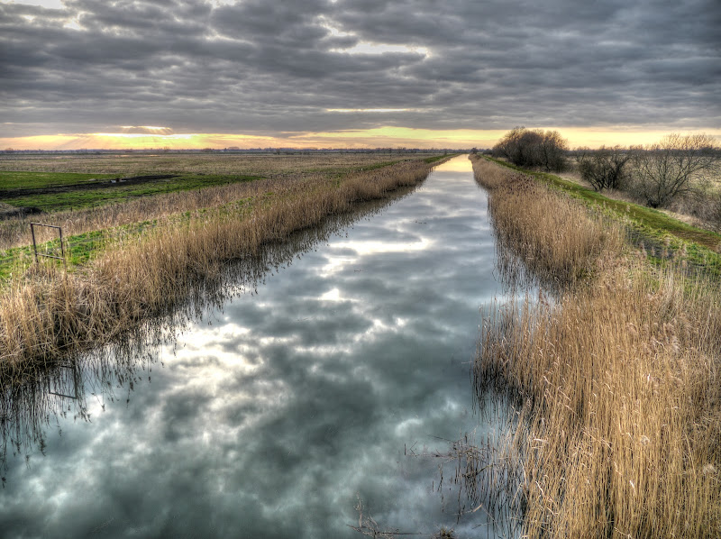
This is my last picture – the clouds reflections in Burwell Lode. At this point it was starting to get a bit darker. Although the days are getting longer sunset was at 5.15pm. I had my Knog light with me, so was “street legal”, however what with the time it took for me to get around the muddy bits and then talking to people I met on the way I was out later than planned.
Burwell Lode
My tiny Knog front light is good for alerting others to my presence, however I wouldn’t want to cycle along a dark and muddy byway relying on it as my sole source of front light though. Some cycle paths are a bit convoluted and I prefer to have lights that illuminate the eccentric nature of those paths. It was fine for my journey back in the twilight though.
As an experiment I have inserted what the app I am using with Windows Live Writer calls a Slideshow. It just looks like a black rectangle to me.
Slideshow
Now I have finished writing the post – I will find out what it looks like.
UPDATE – It appears as a white empty space – I won’t be using that again then!
No comments:
Post a Comment