
Saturday, 20th April 2012: With ¾ of the day available for cycling (my wife had other things to do) I braved the April showers and set off, sarnies in hand (well in my rack pack) for a slightly more scenic tour of places I hadn’t been to for a while. A ride that took me around the satellite dishes of the Mullard Radio Astronomy Observatory (MRAO). By the time I reached Bourn Brook I had eaten my sandwiches and seen some satellite dishes and barely felt any spots of rain so I wasn’t complaining.
You see a lot of yellow flowers at this time of year and both seem to spring out of nowhere . the oil seed rape in the fields seems to turn yellow all at one time and less noticeably you also suddenly get loads of dandelions appearing en mass. This is a picture of Bourn Brook looking left along the bank. It joins up with the River Cam a little bit further down.

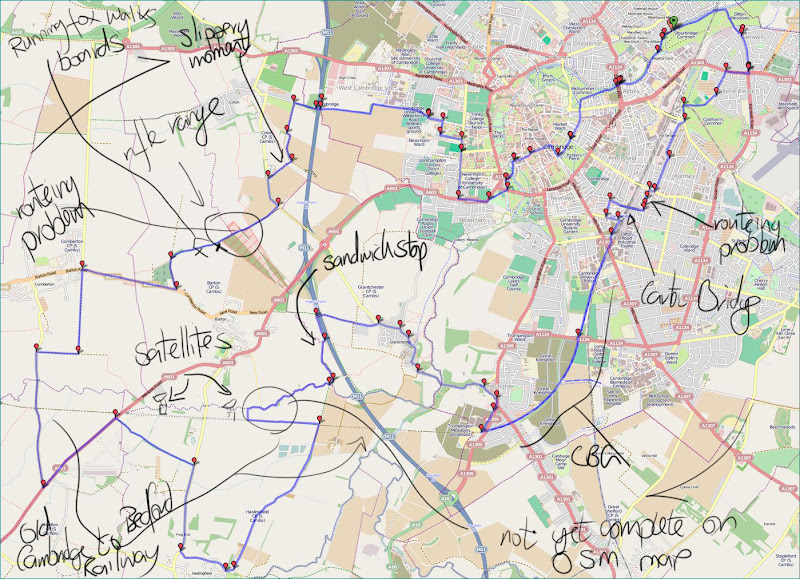
Here is a map of my route, which was a lot shorter than it felt. here is the Bike Route Toaster Link, it is only 40Km long (25 miles) . It takes in a few bridleways though and a new (to me) one as well.
Map of my Ride around the Satellites of Cambridge
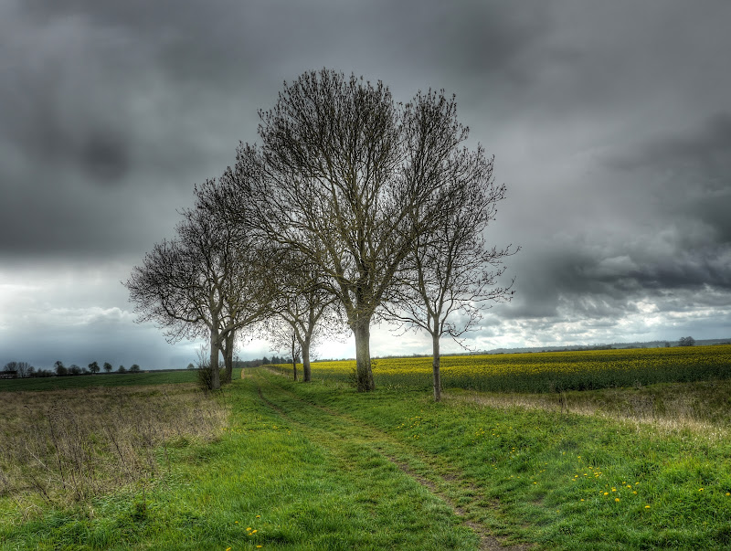
This is the route I was anticipating taking – it leads along the track to meet Cantelupe Road which then takes you to Haslingfield. (I think I might have spelt Cantelupe wrong in part 1, no “o”. As you can see the skies were quite dark and threatening. There were some larger patches of yellow as well.
Bridleway from Bourn Brook to Cantelupe Road (near Haslingfield)
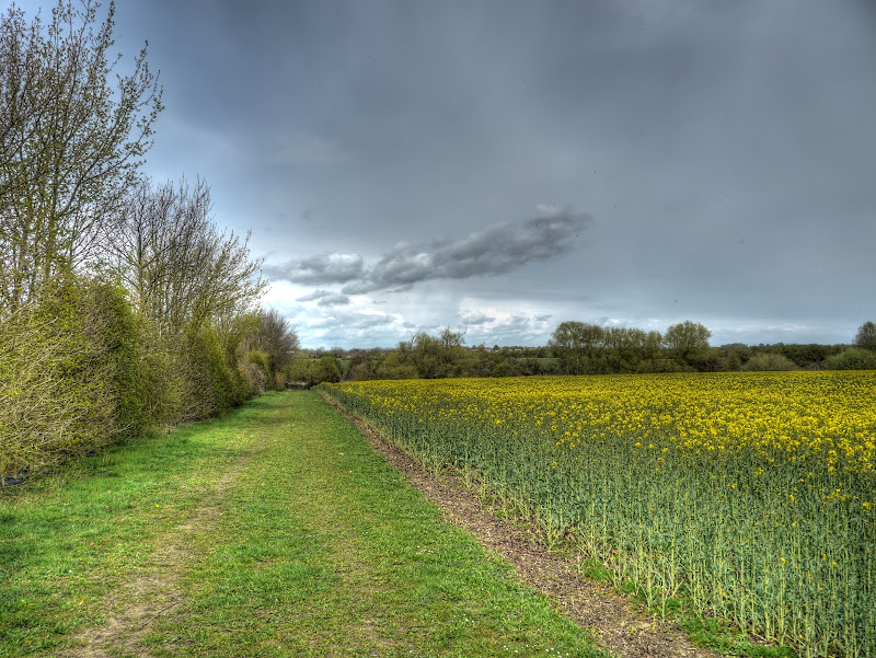
For completeness here is the to the right of the bridled along Bourn Brook in the Bourn direction. There are also quite a few dandelions as well.
What I didn’t know until I checked out some of the nearby signs/maps was that a permissive bridleway had been created along this track around some fields and then back along the line of the old Varsity Line (and now used for the satellite dishes). The OSM map shows the first part running alongside the Brook as a permissive path, but does not currently show the full length of the path nor the bit where it joins the old railway line and returns to the original bridleway. The OSM map also refers to Bourn Brook as River Cam or Granta.
Permissive Bridleway along Bourn Brook near Barton

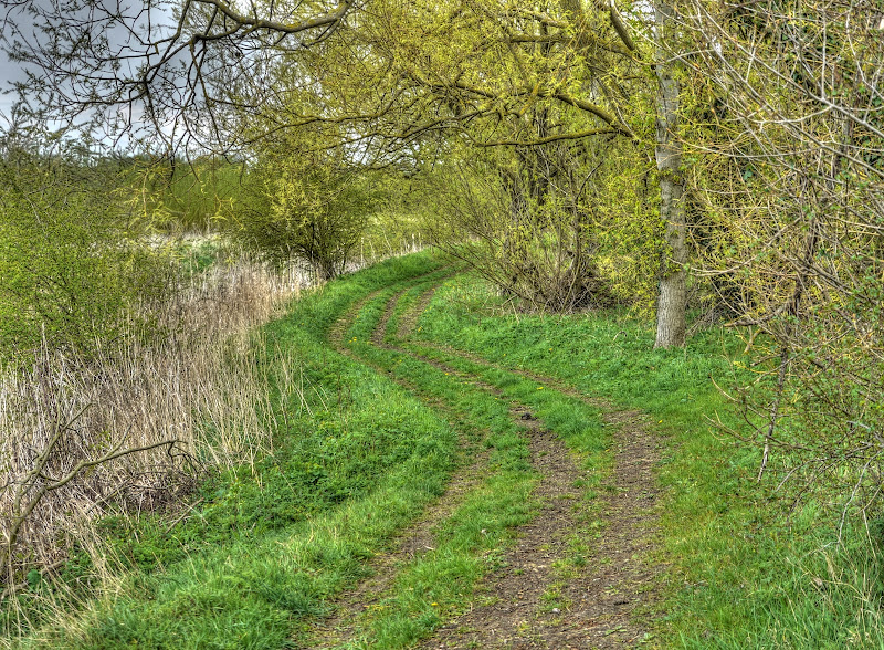
It was a rather nice detour – the track surface was bumpy but OK and quite wide as it ran between the brook and the Oil Seed Rape.I didn’t like the look of those clouds in the direction I was cycling though. Still the route would take me in the other direction soon.
Permissive Bridleway along Bourn Brook near Barton

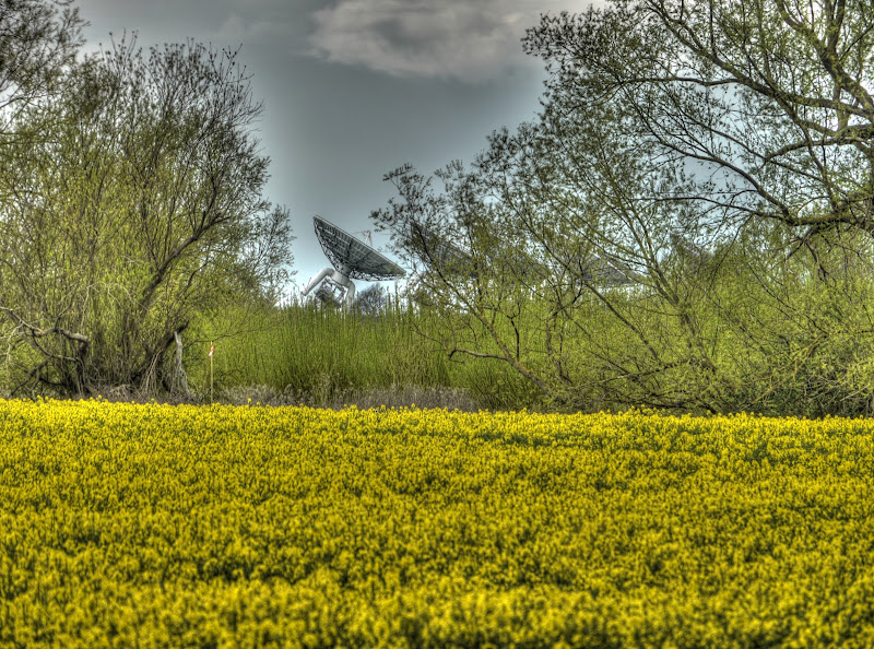
Although I have not shown it I was cycling alongside huge fields of Oil Seed Rape – which has a distinctive, but not unpleasant smell. I was also getting closer to some satellite dishes as well.If you look at the map you can see how the brook wiggles about – every now and then a dish or two would come into sight.
MRAO Satellite Dish peeping through the trees along Bourn Brook near Barton
And to show you what was to my left as I cycled along the permissive bridleway a massive slightly rising field covered in yellow flowers.
A Field of bright-yellow Oil Seed Rape near Barton

The permissive path also cut through these willows growing alongside the Bourn Brook to change the view.
Willows alongside Bourn Brook, near Barton
This looked more interesting in real life than it did in the picture. In real life the channel looked longer and was more pronounced, There was also a bit of a rise to the land. The brook was at around 10m above sea level whilst the ridge was at 15m+
The hills are alive with Oil Seed Rape in bright yellow
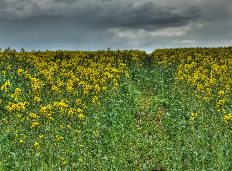
I managed to hardly touch upon the yellow fields in Part 1 and now it seems that every other picture has swathes of yellow in it. I took this because of the way the tree stuck out at the top of the rise. The tree’s leaves are yet to appear whilst the field is full of flowers.
The hills are still alive with Oil Seed Rape in bright yellow

As I cycled along the track the satellite dishes were getting closer and Iat some stage i would have to turn away from the brook. It was certainly one big Oil Seed Rape field that’s for sure.
Satellite Dishes coming into view as I cycled alongside Bourn Brook

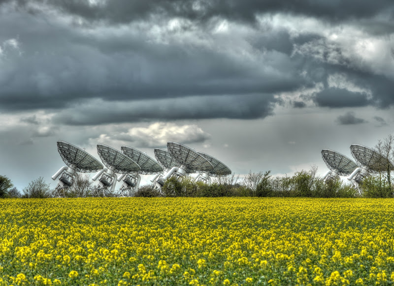
By this point the dishes were really pretty close – that is quite a bit of kit just staring into the sky – “is there anybody there?”
MRAO Satellite Dishes having a co-ordinated look at the sky
At regular intervals there were maps posted. the little red dot marks my position it would soon be time to turn away from the brook and then shortly after to cycle alongside the satellite dish track.
New Permissive Bridleway along Bourn Brook and the MRAO satellite Dish Track

This is the view along the short leg of the bridleway after I had turned right twice and was just about to cycle alongside the dish track. As you can see from the sky the last leg of my ride had been dry with blue skies. and barely any clouds.
Permissive Bridleway near Bourn Brook/MRAO
And this was the last leg of the new bridleway alongside the satellite dish track and the huge yellow field. This would take me back to Cantelupe Road.
Alongside the MRAO satellite Dish Track

And if you thought that was it for Satellite Dishes – then think again – more in part 3.
No comments:
Post a Comment