
Saturday, 30th March 2012: A quick recap I have put the map picture second in the post as a picture looks more interesting than a map when seeing summaries of Posts. I also forgot that I was going to try and label my pictures as I have found it tricky sometimes finding pictures in my Blog.
Here is the Bike Route Taster map link to the map shown below this picture and the next, it is 54Km/34miles and hovers between 7 metres above sea level and 1m below sea level
After reaching the little Hamlet of River Bank I decided to give a peaty bridleway Rand Drove a try. It is a track I probably cycle along once or twice a year. It runs alongside some very peaty fields and is a bit like soft sand. On my hybrid with 25mm tyres it can be hard work. The tyres seem to dig in and then slide sideways. It is pretty straightforward on my MTB with 2 inch plus tyres.
As I cycled along it I there were signs of tree felling – three quite distinctive trees which have featured in some of my pictures lie along the track. Well only one seems to be there now. I’ve no idea why they were chopped down – they could have been rotten or suffering some form of blight – it still seems a shame though.
They get a mention in this Post: Mist and Sunset in the Fens, the picture below shows a bit of lean – which explains things.
Three Trees on Rand Drove, River Bank, Cambs
Well now there is one. (As a complete aside there has been another update to Chrome Beta – it now seems to have some problems displaying image searches from the URL bar.)
In the old maps Rand Drove is shown has heading to Blinkers Hill at the end of Headlake Drove. I can’t find many mentions of Blinkers Hill Farm – although it does appear in the London Gazette for July 1995, May 1980 and December 1975, in connection with water abstraction licences.
After reaching Blinkers Hill you can head down Headlake Drove and onto Lodes Way. I turned left along a rather bumpy tarmac “road” to Straight Drove and then up Straight Drove to Harrison’s Drove (one of two in the area – the other being in Wicken Fen. )
This was taken near Blinkers Hill.
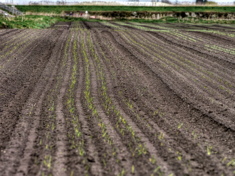
Swaffham Prior seen from Blinkers Hill with Onions in the field

The map for reference – as you can see I wasn’t sure whether the plants were onions or leeks. Actually I thought they were onions and didn’t look closely – but on looking at the picture I thought I’d admit to my uncertainty..
A ride around Horningsea and Wicken Fen from Cambridge

This is the unnamed bit of tarmac heading form Blinkers Hill toward Straight Drove. If you turn right it gets you to Reach, left to Upware. I have on the odd occasion seen cars drive along it – not recommended unless you have a 4x4. The bank straight ahead is stopping Reach Lode from pouring down over the fields.
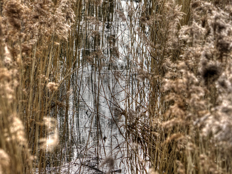
Reach Lode ahead from Blinkers Hill

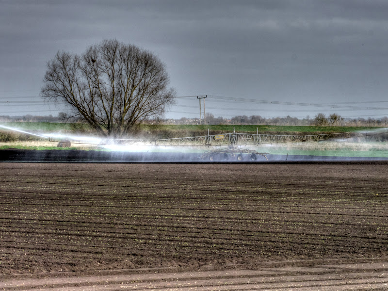
As you can see we really are suffering from drought – the farmers are having to irrigate the fields to help the seedlings germinate. Isn’t it comforting to know that our water companies must be doing something right as they are paying out bonuses.
To me it seems to be another feature of the weird world of UK Bureaucrapitalism. We regulate them with various rules and expect them to make lots of money. What was the name of the Quango Oftwat, Ofwat or less advertising from Wikipedia’s Ofwat entry.
What irritates me is the condescending way in which those bl**dy water companies seem to imply it is our fault and we have to pull together to save water, despite them failing to meet their targets for minimising leaks on the water system. They then blame the weather – but isn’t the point that they should be investing in facilities to smooth out the weather issues.
One interesting fact is that water is transferred from Denver sluice, near King’s Lynn to Essex. That is from a region with a drought ban to a region without a drought ban.
Irrigation in the fields near Reach Lode
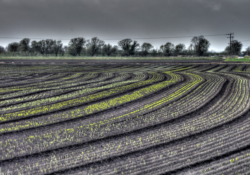
As I was cycling back towards Upware along Harrison’s Drove there were some interesting contours provided by the planting in the fields.
Newly germinated crops following contours, near Upware
And just before Upware a fair bit of colour by the roadside.
Bright colours on the road into Upware

It does not seem that long ago that we used to see fields of daffodils being grown around here. That was before the time of this Blog - but I did cycle around the area in those days. Here is one such picture:
Upware Daffodils – April 2006
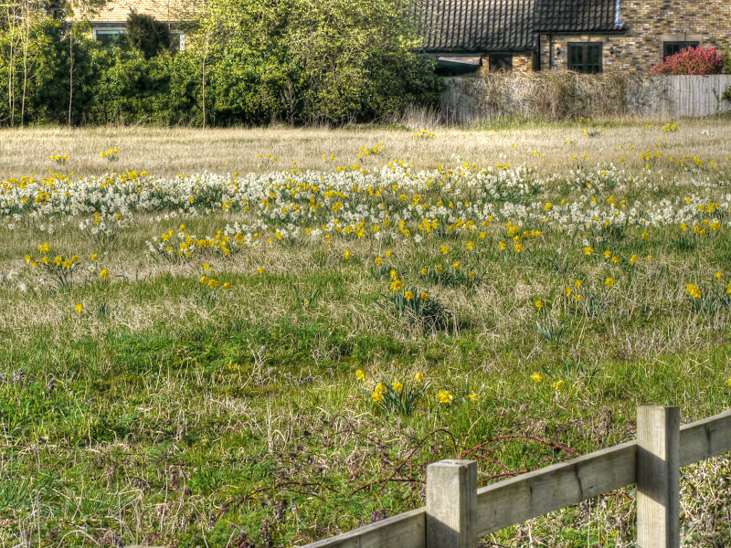
These are all the daffodils you see nowadays, six years later. It isn’t the same field, this in in the village. But you can see how it was once used to grown daffs. The field does have a Guard Dog warning sign on it – which seems rather odd.
Upware Daffodils – March 2012
After Upware and a rather dry Docking’s Lane byway I returned to Wicken and then onto the Lodes Way. This time around I heaved my bike over the Burwell Lode footbridge and stopped for a rest to take some pictures. (My advice wait – Chrome beta is being a real pig at the moment 18.0.1025.151).
Burwell Lode from the Lodes Way footbridge
In part 1 of this post I mentioned how as a kid I was used to wandering through fields and woods without worrying overmuch about paths. Well it seems that the National Trust has gone in the opposite direction – the paths around Wicken Fen seem to be turning into fenced corridors with a topping of barbed wire for good measure.
Out for a walk with the dog – Wicken Fenced Paths
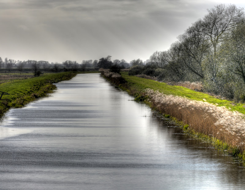
Taken from the Burwell Lode footbridge

Talking of bridges – here is the Reach Lode Bridge – I think they did a neat job of providing a bridge – but one that adds to the form of the countryside, rather than dominates like the electricity pylons.
Reach Lode Bridge – seen from the Burwell Lode Footbridge

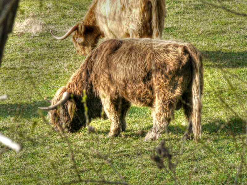
It was quite a long rest stop taking pictures. Here are some highland cattle enjoying being out to grass.
Wicken Fen Highland Cattle – out to grass
Taken from the Burwell Lode Footbridge
After heading back there was more irrigation to be seen from the Reach Lode Bridge (and more problems with Chrome not drawing the lines on my Bike Route Toaster map). So I have been driven to using Internet Explorer!! Why well I noticed that the routing suggests I jumped the Lode.
Lodes Way – “avoiding” Reach Lode bridge by jumping the Lode ![]()

Irrigating the fields near Reach Lode

After crossing the bridge I did stop along Split drove to check how well the crops were germinating – there was no sign of them last week. I did pass a car heading towards the bridge – you can just about make it out in this picture.
Plants spring up in the field alongside Split Drove
I also took a picture looking the other way along the drainage ditch – more for the almost abstract form.
Drainage Ditch alongside Split Drove
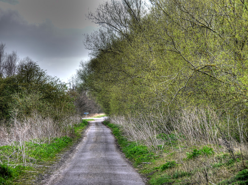
A last picture before finally getting my head down and heading home. The south facing leaves always seem to come out first – this is Headlake Drove just before the crossroads with the Swaffham Prior Upware road.
Headlake Drove – spring leaves on the trees
And finally some pictures – lightening does strike in the same place twice. And some cycling “celebs” – Samantha Cameron in a leather jacket (and helmet), Naomi Watts? and family and Conan O’Brian.
No comments:
Post a Comment