
Saturday, July 30th: This is just a plain and simple post about my cycle ride – no moaning, not too much straying of the topic and in case you hadn’t noticed this is the second part of the ride. The overall length is just over 58Km/ 36miles and the map is shown below and here is the BRT link. There are a couple of climbs in the middle which is the best place for them. Now when I say climbs we are only talking about climbs of 50m to 60m and the maximum elevation is around 110m so you don’t have to worry about altitude sickness. The first part covered the bit from Cambridge to Linton and this is the rest. Linton to Great Chesterford and then back, off an on the NCN11.
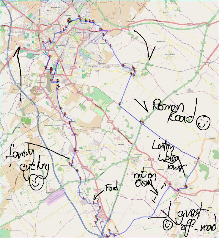
As I mentioned in the first part of the Post, the turn off from the A1307 onto the route through to Great Chesterford does not look very cycle friendly. You basically cycle into an “industrial” site, past various signs indicating where you should go to be weighed and then unload your lorry. it is worth it though because after passing along a corridor surround by large grain silos you emerge onto a rather pleasant track. It is a bridleway but the surface is good for cycling along. Here is the view looking back along that track at the grain store. I forgot to mention the pylons, they also pass overhead at this point.
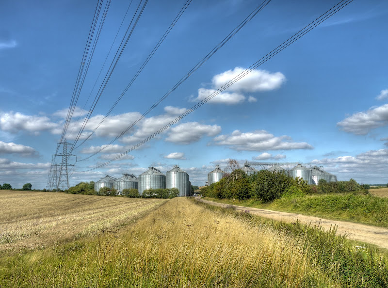
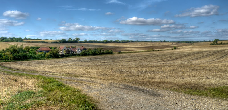
This is the view ahead, the pylons conveniently head away whilst the track heads of to a wooded area and a gently rolling hill. As you can see the farmers around here have been busy, although there are still more fields that need harvesting.
As you reach the wooded area you find there are some dilapidated buildings on what is the second rise of the cycle ride. This is what I wrote about it in a previous Post – A Loop from Cambridge to Great Chesterford.
The hill rises to 105m by a place called Catley Park on the map. Apparently Sir Thomas Sclater settled at Catley park around 1674. Further history is available in this History Survey of Linton. (it is a pdf – search for Catley). Catley Park was also the scene of a Steam Engine Explosion on June 16th, 1904.
I haven’t tracked down the fashionable fruit gardens yet. Looking at my old Cassini 1805- 1836 map there were several larger woods marked on the map and I would have passed Linton Wood and the smaller patch of trees around the buildings was called Burton Wood. The track I was took was marked as a “road”. There is also a trig Point nearby at 114m. It would also appear that I take the old route through the “park” rather than the diversion (pdf) around it.

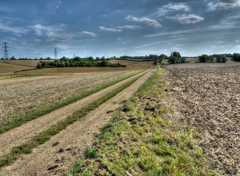
This is the route looking back towards Linton, at this point the quality of the path drops to what you might expect of a bridleway.

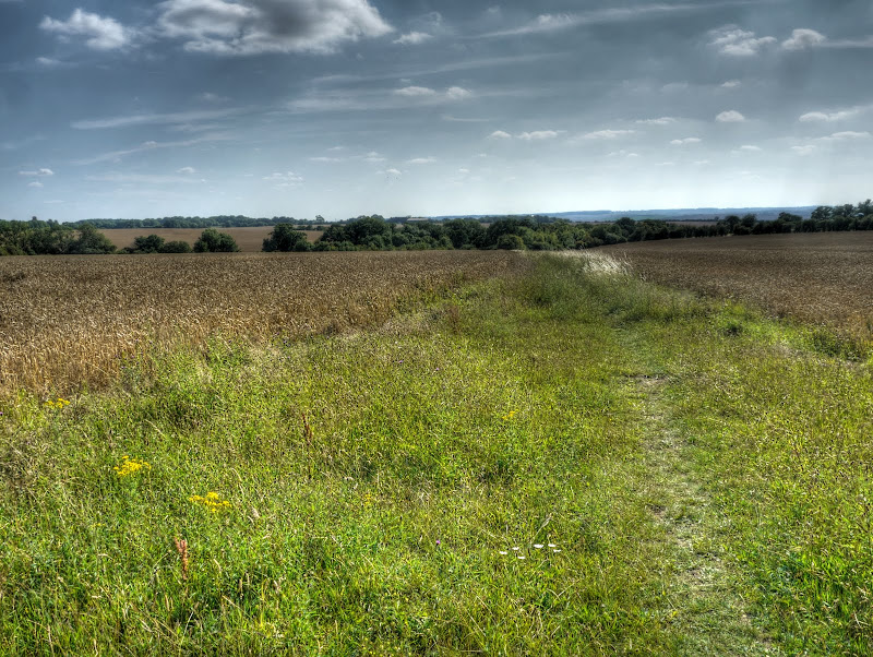
A close-up of the view looking back. You can see the Grain Silos back on the edge of Linton in this picture.

After passing through (which should be around the Catley park area?) the bridleway appears as a grass track between two fields with open countryside in the distance. The bridleway is heading for that small patch of trees. It doesn’t like like but you do drop down about 30m in height between here and the start of Cow Lane which takes you to Great Chesterford.
The bridleway can be quite soggy in that little patch of wood and seems to be a popular horse riding route. As a result the path is well trodden with large hoof prints in places which seem to catch the wheels when wet. I don’t think I have cycled down it without a dab or two of my feet. This time around it was dryer and I thought I was in with a chance of a no-dab ride. The only trouble was that there were large brambles protruding at arm level. Every now and then as I was cycling I had to let go of one or other side of the handlebars and lift my arm up to avoid getting raked by brambles.
I did avoid getting raked, but on letting go of one side of the handlebars and then banging into a large hoof print I lost control and it was either stop or fall off. After no moments of consideration I stopped, luck rather than judgement. Oh well perhaps next time I’ll take my MTB, although that would be cheating really.
The bridleway passes Crave Hall Farm, with 6 bedrooms, three bathrooms, three reception rooms and a tennis court apparently. it would seem that this farm was part of the Chesterford Park Estate sold on the 3rd October 1916. In those days The Farm House had five bedrooms and a Scullery with Two Coppers and Sink in those days. The water source was a Well by Horse-driven Double Cylinder Pump. In in all there were 127.551 acres of land.
This is the view of the land from Cow Lane looking towards the North (on the western side of the lane). Not only has the Combine been busy the fields are also being ploughed ready for the next crop.

This appears as Grumble Hall on the OS map. (Here is a picture of the Hall with a hot-air balloon in the distance.) It is mentioned in Evidence gathered regarding the development of Wind Turbines in the area. The document does mention one of the real attractions of this area and perhaps why I like to cycle through – the low ambient noise. Here are some pictures of Grumble Hall from the air taken in 1997 and 2007 – it has a website but with bits missing.
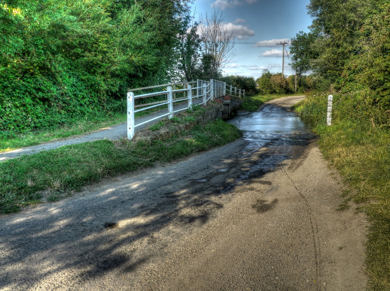
After being in the dry high plains between Linton and Great Chesterford it was time to wet my wheels. So I took the NCN11 route from Ickleton and then diverted onto the National Byway route in Hinxton. This route took me through the River Cam or Granta). I am always a little worried that hidden below the water surface will be a super-slippery layer of green slimy plant life. Which will result in me sliding of my bike in a rather undignified way. As you can see it was hardly deep so it only have hurt my pride. Nothing untoward did happen though – you can see my wheel tracks emerge from this picture taken looking back after the successful crossing. (no point in tempting fate was there!)
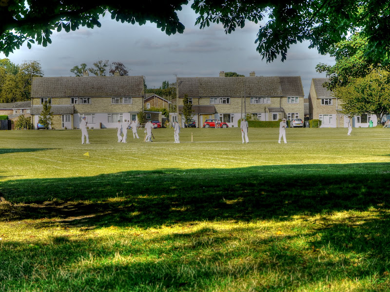
I followed the National Byway route up to Whittlesford where that quintessential Summer activity of village cricket was taking place.
I then used the new route form Whittlesford past Spicers to Sawston. It was well used with one large family grouping cycling along it. One of the reasons that these sorts of tracks is so important is that it gives younger kids the opportunity to get out and cycle safely. As is often the case a young cyclist will stop anywhere to look at something – oblivious to the others around them.
Why mention this – well one of the mums was rather embarrassed by her son stopping and blocking my path without any warning. She apologised – although there was no need – I’d much rather see kids out learning what it is like to get out on a bike than be stuck indoors playing computer games all the time. That is why these paths are so important.
The other nice thing about this path is it passes though a nice patch of countryside back over the river. The route seems to have been justified as a route to school (IMHO) and to get back onto NCN11 you can either cycle through Sawston or as I do cycle along the A1301 for a short distance and meet the NCN11 there.

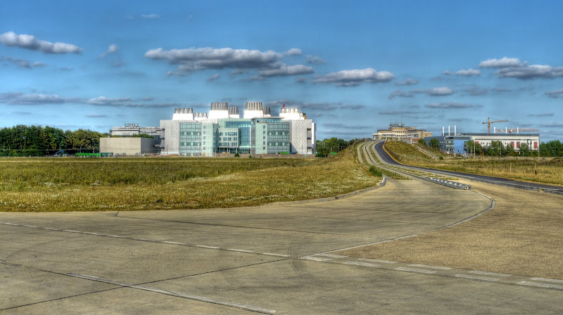
For a change diverted form the NCN11 route at Addenbrooke’s and carried onto the Southern Section of the Cambridge Guided Busway. I dare say this will all change as the campus gets developed, For now it is still open and green. There have been plans for a 1,200 space multi storey car park submitted to support the upgrading as the Cambridge Biomedical Campus takes shape! In one of those taken out of context quotes – one local Councillor said “it was brilliant” but did add he wants to see proposals including more shuttle services from the Trumpington Park and Ride.
It would seem to me that people go where the jobs are – if they build the Campus then that will draw people in, however there does need to be some joined up thinking in terms of provision for transporting those people that encourages mass transport methods as well as cycling and walking and positively discourages car use. (Although I could consider car-use by visitors to patients are supportable.)
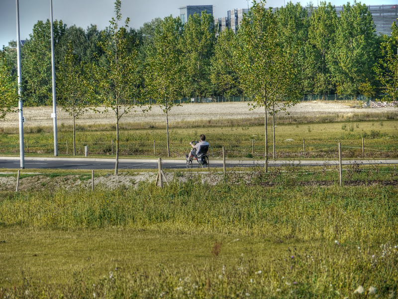
For those of you who feel cycling is too much like hard work – well sit back and pedal instead.
One of the first buildings on the Biomedical Campus – here is their vision for 2020 – which doesn’t seem all that far away now.
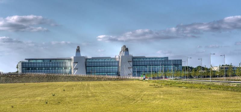
The Campus has its own link to the CGB including tracks and a bridge over the railway line.

This is the view looking from the main CGB Southern Section track to the side of that new building..
This is the CGB route that heads towards the Railway Station. it is currently closed at the Station End, let’s hope they get it open in time for the Grand Opening of the CGB.
As the time draws near – tomorrow as I actually write this – there are more pieces of news. Here are the Guided Busway timetables. You might also be pleased (or not) to know that the “Guided Busway bosses (are) prepared for terrorist attack”. The Cambridge News cycling blog also features the benefits of the CGB - for cycling. If you are interested you can also checkout the CGB’s sisters around the world! For a less reverent view then perhaps try out NoGuidedBus (shame about the old pictures going though). Alternatively there is also Cast.Iron.
![]()
There will also be a Cambridge Cycle Campaign ride to promote the Cycleway
No comments:
Post a Comment