
Friday, 15th July: POVETSATWFING – (A slight expansion of the usual POETS’ Day – Push off very early tomorrow’s Saturday and the weather forecast is not good.) A quick recap. My “plan” was to cycle to Bury St Edmunds along NCN 51 and then find a route back to the north of the A14. Here is the map of the route I ended up taking and here is the Bike Route Toaster link (BRT). It was just under 128Km or 80 miles long and there are a few short hills to climb some even reach 100m above sea level.
This Post covers the return journey. I had not got a route planned and after heading North out of Bury St Edmunds tried a head West back towards Cambridge. If I went slight North then at the next choice of turn I would head slightly South. I was using the map on my Edge GPS for clues, however to get the level of detail that shows the small country lanes I had to set it at quite a high zoom factor and you only get to see an area of around a kilometre.
When I crossed the A134 Bury Road, the GPS showed a road almost directly ahead. In fact it looked liked the junction used to be a crossroads but the minor road had had a kink added to stop people from accidentally (or otherwise) driving across. If you compare the current OS with the Historic OS you can see that is the case.
After crossing over the B1106, the road came to another “cross roads”, shown here. Although when I reached the crossroads the route was shown as a no-through road. Looking more closely at the Google Streetview picture you can see that the street sign has been knocked over but does show the no through road as well.
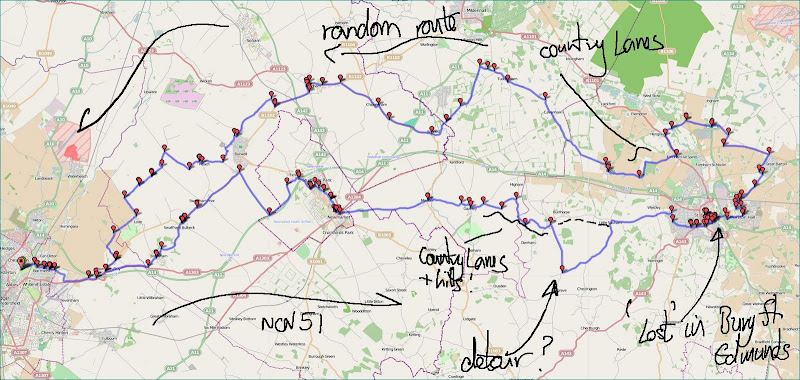
Regular readers of my Blog will know that I frequently ignore road closed notices and have found some rather nice through cycle routes on closed roads. A closed road helps to reduce traffic flow after all. It does depend upon how tired I am as to whether I am willing to take a “risk”. In this case I felt it was worth a go as my GPS showed a continuous path through. The Streetview trace also implies that the road is continuous as well . Although if you zoom in you can see that there is a barrier across the road.
It turns out that there was a road bridge there but it no longer exists and has been replaced by a footbridge. My hunch was right it was passable by bike. This is a view downstream, from the footbridge of the River Lark.

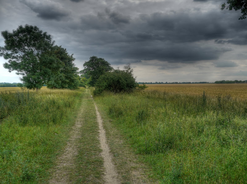
This is the footbridge looking in the direction I was heading. Technically the path over the river between the two “Mill Roads” is shown as a bridleway so it is not just a footbridge. The other side then brought me to the A1101 after heading south-west. There were no obvious roads on the other side of the main road so I had to take a guess as to whether to head right or left. I chose left and carried along the main road, which wasn’t actually to bad before reaching the outskirts of Fornham All Saints, one of three Fornhams in the area. This village has two websites as well. The village shop has closed but it “boasts” two golf courses. I’ll let my prejudice show here and comment that I can go for a walk without waving a stick at a ball.
![]()
I took the first road west from the A1101 – shown as Mere Lane on the OSM Cycle map and Hyde Road on the OS map. In what might well be the answer, Google Maps shows the bit just off from the A1101 as Mere Lane, then as the road forks the left fork is Hyde Road. I did stop where the road forked for a drink and lunch. In my case lunch was some jelly babies. They are delicious and make for a great cycling snack although I am not sure how wise it is to eat nothing but jelly babies on a day’s cycle ride.
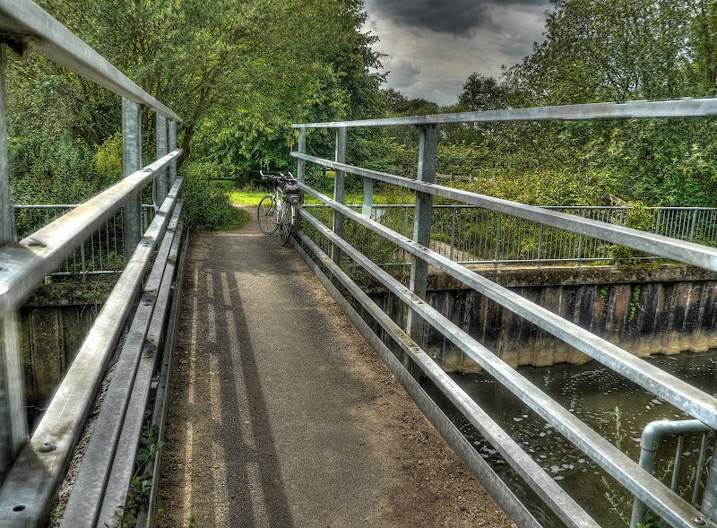
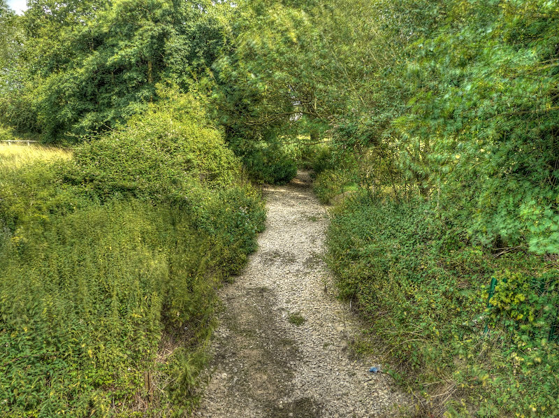
Hyde Road was delightful, this was the sort of lane I like cycling along. A lane where there is so little traffic that grass grows in the middle of the road. This is the view looking back. Hyde Road skirts two edges of Hyde Wood – a square wood. If you follow that link the fifth photograph is almost an identical view as my previous picture. The link points to a blog written by a long-distance runner with a camera. (Although he/she uses Wordpress and has been blogging for a few more years than I have.)
Although I didn’t know it at the time this view of the fields looking north from Hyde Wood shows Queen Elizabeth’s Walk – that stretch of trees to the left of the picture. As you can see the day got quite a lot more gloomy – where had the blue skies and sun gotten to? As long as I kept moving I stayed quite warm though.

As Hyde Road reached another road, where I had to make a choice about direction I did stop and wonder whether it might actually start raining, the clouds looked a little threatening. Mind you there was a small patch of blue sky there as well. The fields were huge, they seemed to go on for ever.

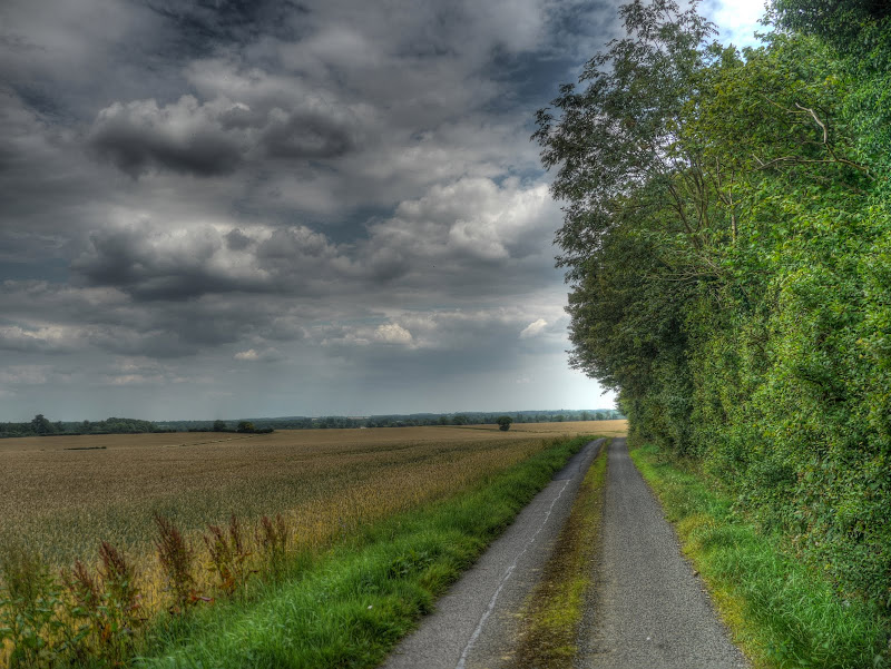
When I reached the junction the choice was easy, I headed right, I could see the A14 in the near distance and I wanted to stay North of it. Right brought me to Risby, where there was another of those 40-odd round church towers. Wikipedia has a nice picture of the Risby Signpost with the tower getting pride of place.
In the wall alongside the church was an old, but still in use letter box.In case you were wondering the cut-out area for the Posting times notice is 57mm W x 50mm H. It is a good job they let you know as it doesn’t look like it at all.

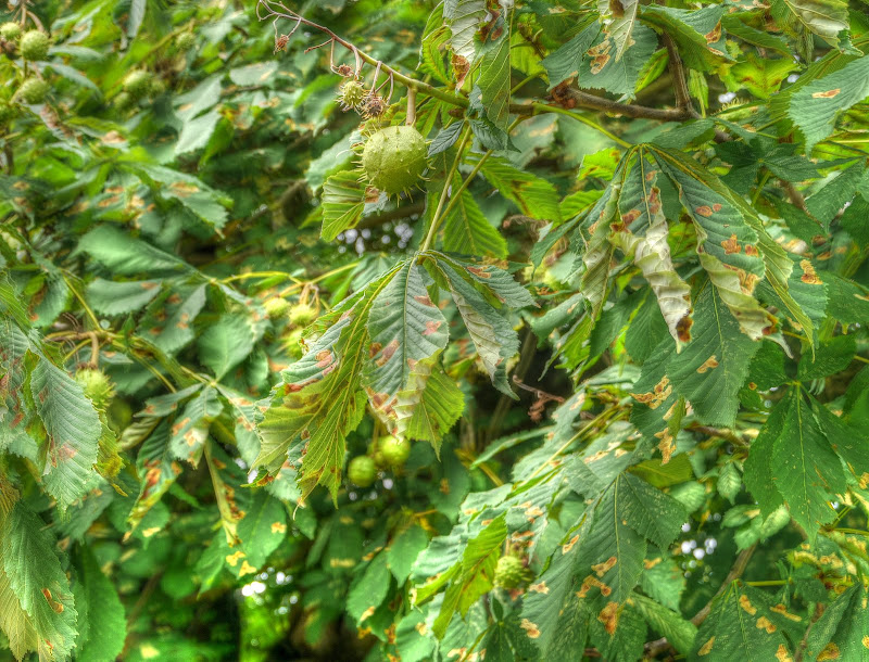
I’ve mentioned the problems that Horse Chestnut Trees are having with leaf miner, well it seems that the effect on the trees is quite varied – this tree somewhere near the church doesn’t seem too bad considering. The brown patches are caused by the larvae that hatch and then eat and tunnel through the tissues of the leaves.
On my way out of Risby I tried Welham Lane, but it was a dead end for cyclists as it turned into a footpath. So I tried the next available westerly lane whilst heading away from the A14. The road wasn’t quite so rural, by Hyde lane standards but wasn’t too bad. The Mayweed seems to be well in flower at the moment or perhaps it is wild fennel next time I ride past some I will take a better picture.
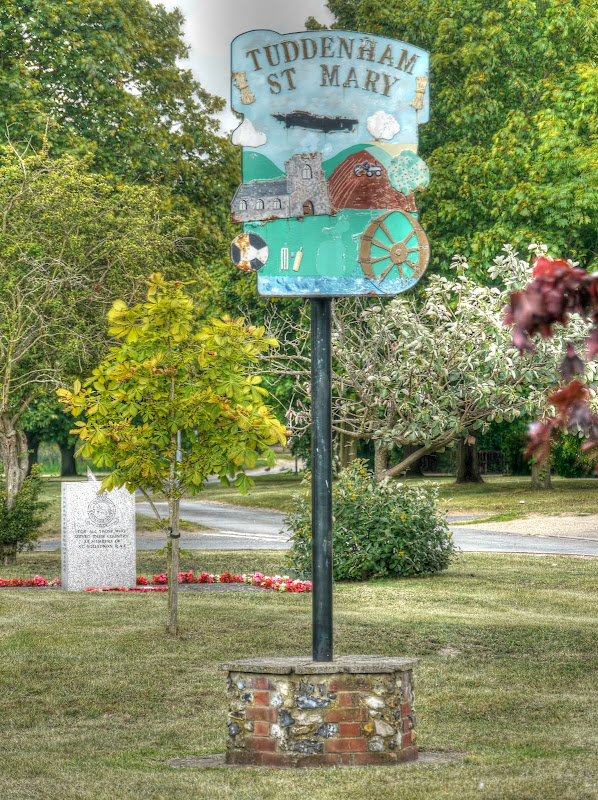
I stopped on reaching Tuddenham St Mary for a drink and a few jelly babies. I assumed that the village sign incorporates a picture of an aeroplane because of the old RAF bases in the area. (Which it mentions in the weblink, but it turns out that the chapel was damaged by a second world war bomb and rebuilt in 1952. the plane does look more British, Wikipedia, suggest that Short Stirling and Avro Lancaster Squadrons were flown from RAF Tuddenham. I think the plane on the sign could be an Avro Lancaster, but am not too sure to be honest. After the war, the airfield did house three Thor medium range missiles until it was closed in 1963. Yes these were nuclear missiles, the rockets could only be fired by British personnel, but the warheads were under American control – the cold war was an “interesting time”.
Earlier I showed a picture of slightly affected Horse Chestnut Tree leaves – here are leaves that have almost completely been destroyed somewhere on the road towards Herringswell. I found myself heading pretty much south as well as I found myself heading towards the A11. Not a road I wanted to cycle along and the road I was on didn’t cross the A11, but just joined it.

After Herringswell I headed for Kennet, which took me over the River Kennet. I stopped to take a picture of the rather dry river and this Red Admiral butterfly was on the dry river bed. Where I lived in Somerset we used to see more SmallTortoiseshells than these Red Admirals.
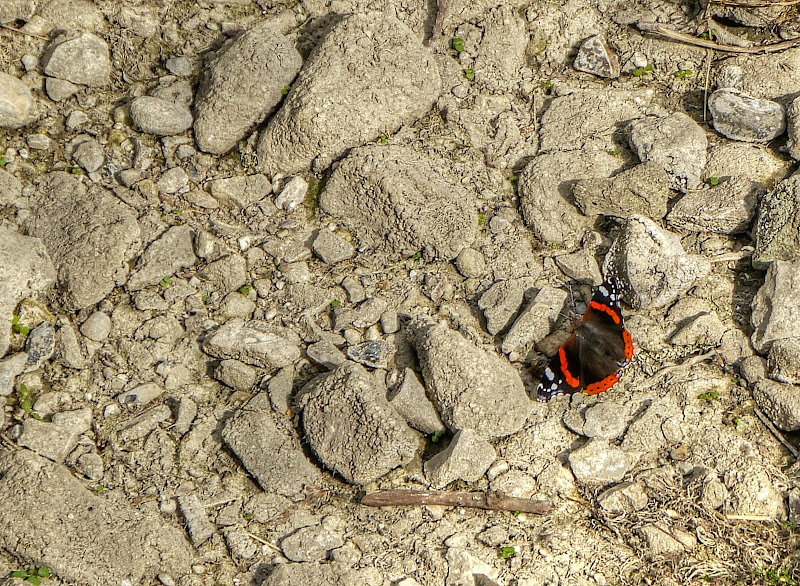
Here is the rather dry River Kennet. I am used to seeing water in drainage ditches and Lodes all year round despite the drought. This shows it is biting around here though.
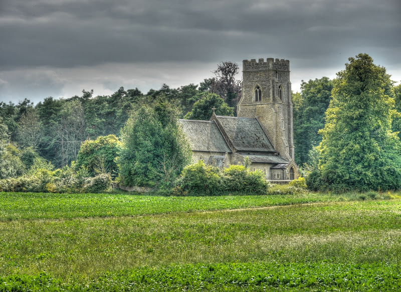
I’ve taken a picture of this church before on the outskirts of Kennet – St Nicholas.
After that it was head down and head for home. I went back through Chippenham and Fordham and along the byway between Ness Farm and Broads Road into Burwell. Although I had covered a reasonable distance those jelly babies did there job and I still had enough energy to take a more picturesque route back and passed through Reach to join the Lodes Way.
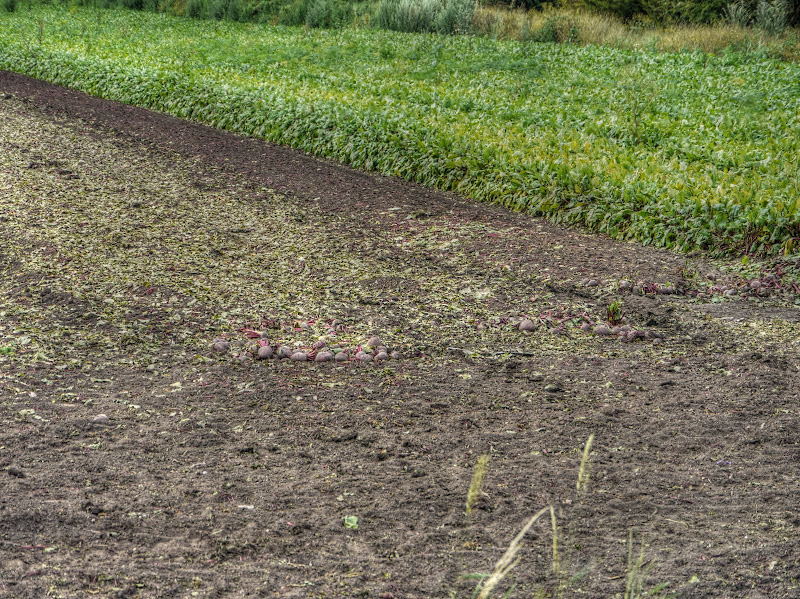
It is the time of year when “vegetarian-roadkill” is available. Depending upon the crop you sometimes see quite a few beetroot by the roadside that have escaped from the trailers taking them from the fields. These beetroot didn’t even make it from the field though. Still there are more to be harvested, I expect a few will jump out onto the grass verges.
Beetroot are delicious as a freshly cooked vegetable, you don’t have to pickle them.
At the Lode end of Lodes Way I noticed that someone had turned the bumpy-road road sign around.

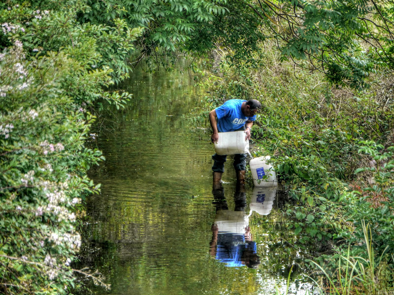
Then as I was heading along the old railway line along the back of Anglesey Abbey I noticed this chap standing in Bottisham Lode. I have no idea what he was doing, whatever it was he was engrossed and paid me no attention.
At this point I was starting to tire and instead of heading out towards Clayhithe and back into Cambridge alongside the River Cam is took a short cut and headed along this bridleway to Station Road, Quy where I re-joined NCN 51
I was glad to have caught the better weather and been able to get in a decent ride and done a bit of exploring to boot. Despite all my moaning about noisy, smelly, nasty traffic there are some delightful and peaceful country lanes that are definitely worth exploring round these parts.
No comments:
Post a Comment