
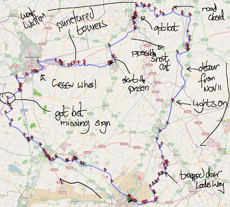
Friday, 6th May: Just to recap this is Part 2 of 5 posts covering my day trip by bike from Cambridge to Peterborough to March, to Wisbech, to Downham market and then back to Cambridge. Here is the Bike Route Toaster link (BRT) to the map shown below. The summary of the distance suggests 220Km/137miles, however I did take a couple of wrong turns and my actual distance was 228Km/142.5 miles a bit further than planned because in the end I followed Sustrans routes and as you can see the Peterborough to Wisbech section involves going an extra bit further north before heading back down to Cambridge.
Why? you might ask – well it was a nice day and yes it was a bit tiring – but it was really pleasant out cycling the flatlands. The first Post covers the journey from Cambridge to the outskirts of Huntingdon. This bit goes from Huntingdon to the outskirts of Peterborough.
The road out of Huntingdon is Ermine Street and although only a B-road (B1043) does lead onto the A1 and so has its fair share of traffic. Although it is perhaps not as clear as in some places the pavement is shared-use according to the Sustrans green circles on the OS map. A side-by-side comparison of the OS and OSM Cycle maps shows a bit of disagreement though as it is only shown from Huntingdon to Great Stukeley and then just before the A1(M).
What I do notice as a dweller in the flatlands is that my GPS starts showing contour lines on the map as the road rise up above the Fens. Of course I can also see that by looking around me. It also seems that the route passes a Sewage Works, now either someone in the route-planning at Sustrans has a thing about Sewage Farms, or maybe there are just a lot of them about. They are quite recognisable from the air with their distinctive circular tanks. If you follow the link the OS map appears to call it an Hotel! I would like to think the label is slightly oddly placed – or perhaps it is a bacterial hotel. This picture looking down slightly with the A14 in the distance, is the “Hotel” or rather Sewage works in question.

As a young lad I used to buy Airfix models and assemble them, my two favourites would probably be the Spitfire (in various guises) and the English Electric Lightning (and here for real). As my brother and I got older we used to “blow them up” with bangers, no longer allowed to be sold in the UK. (Perhaps the reason lies in my last sentence.) (We also used to use “Rookies” for the same purpose. Rather like bangers but more explosive and with a shorter fuse on a rope that would smoulder and then set off one of the rookies every now and then. They were called Rook Scarers – hence rookies for short.
The main building season for these models was when we went on holiday. We stayed in England/Scotland for our holidays in those days and the weather would not always be that kind. So these building these models was a good way to keep two young lads quiet for an afternoon.
Back to the ride – now that is a pretty big model. When I was a boy I used to think that the aircraft placed at the gates of military airfields were real, but apparently they are now made of fibre-glass. I did not get close up to this one to check though. I had thought that this was a disused airfield – well according to Wikipedia RAF Alconbury is a non-flying airfield under the control of the USAF. The plane is a replica F-5E. There were quite a queue of lorries going through a security check though as it is still a base.

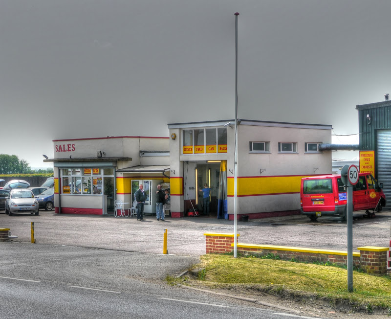
A little further up the road on my nostalgia trip was an old-style petrol station, this picture does not do it justice though, but having cycled past I had to stop and get a picture. This was a multi-exposure picture and so one of the people standing in front has two faces.
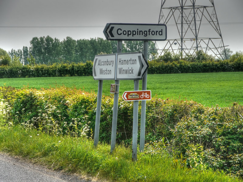
After the Stukeleys the route crosses over the A1 twice! once where the A14 joins it and then again where the A1 joins it. The first time you go over it the second under it into Alconbury. The last time I cycled this route I missed the turning towards Alconbury Weston and I did it again this time – I am convinced that either there is no Sustrans sign or it is minute. (For reference you turn left off Chapel Street by the Manor House Hotel. Here is a zoomed-in link to the signpost opposite the turn – alright I wasn’t paying enough attention. The route from Alconbury to Alconbury Weston goes off-road briefly although the path was popular with dog walkers that day. I saw three including one the size of a small horse (the dog not the walker) in the half a kilometre or so of path.
The village straddles the Alconbury Brook and has its own Ford(s) well the map says two here is a picture of one.

Either side of the Ford there are warning signs “Caution Ducks Crossing”

I assume this is the other ford, at the far end of the village. It also has a somewhat dilapidated stone footbridge along side. Or maybe there were two such sides to the Ford once upon a time.
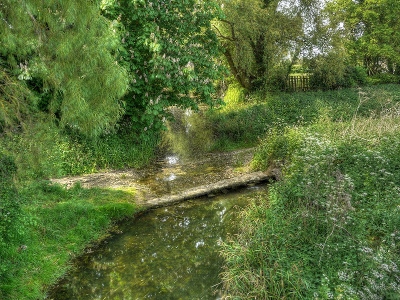
All along the Brook there were also modern wooden footbridges which is where I was standing when I took the last picture and this picture. This is looking back into the village along the brook.

After Alconbury Weston the road is fairly level to Hamerton, the brook also finds its way through, although by a slightly more meandering route. About halfway between the two villages there was a road to Coppingford that seems to have found itself on the National Secret Byway – it does say that on one route a user survey indicated 15,000 journeys took place on one section of route on quiet roads. That is 41 each and every day day or 20 rounds trips per day. For comparison here is a count by the Cambridge Cycle campaign on the cyclists per hour along Trumpington Road. During the morning rush hour over 200 for 22nd May 2007.
What I really don’t understand is why they don’t publish maps on their website if they want to encourage usage of these secret routes? Oh flip, Where’s The Path has a limit of 200,000 map tiles fetches per day and that number has been exceeded, back to Streetmap.
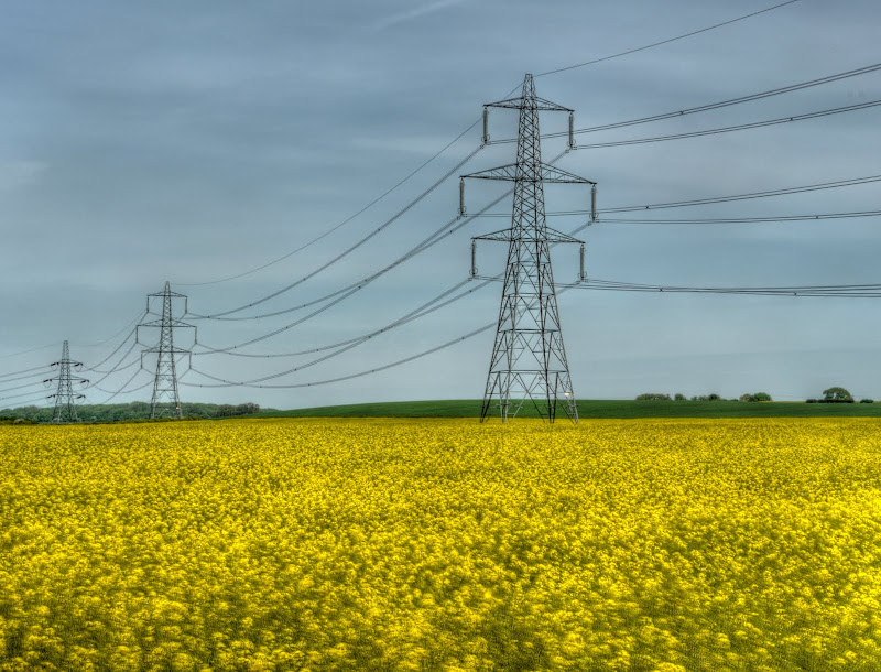
As usual there are hulking-great electricity pylons marching through the countryside and yellow fields.
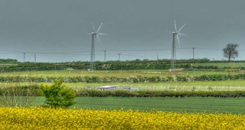
The route turns right in Hamerton and heads up a hill past the Hamerton Zoo park where two Wind Turbines come into view. Actually you can see them from some way off really. They were erected in February 2011 so are quite recent and generate 11Kw each. Although it does not look like it from the picture they are actually only twin-bladed and run at a constant speed and are made in Denmark by Gaia Wind. This is what they look like before turning up the hill from Hamerton.
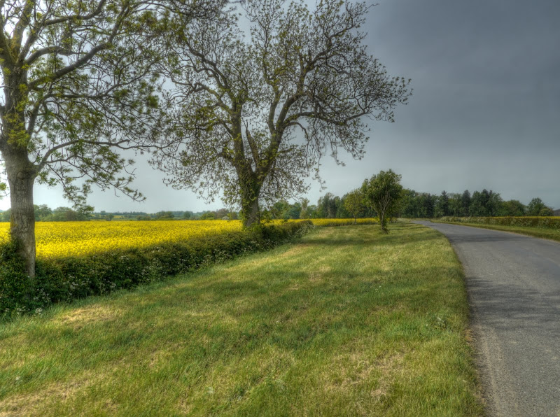
This road was very pleasant and not busy with wide verges and yellow fields. I was surprised that these two trees did not have a lot of leaf cover.
After Hamerton and the small Hill there is another turn, well signed with both Sustrans and National Byway signs sharing the pole. You can see a horse rider going down into the village and the blades of both turbines as they are really.

Anyone want a former windmill with three bedrooms and 1 acre of land up for sale by auction? The guide price is £450,000. It was at this point that I turned right along Milking Slade Road, just by Great Gidding. Round here there is also a collective term for the villages – The Giddings; Great, Little and Steeple Gidding.

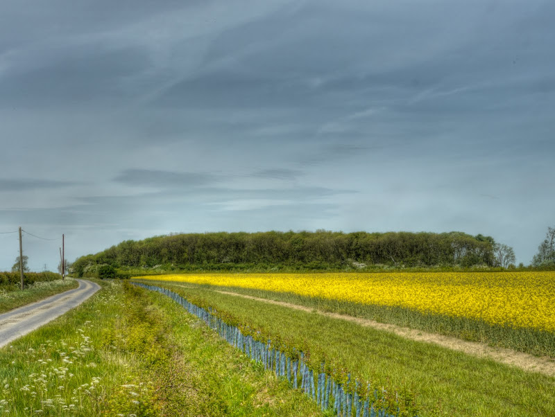
Milking Slade Road then leads onto Bullock Road where to the right it is a road and to the left a track that pretty much makes it to Alconbury Weston that must be worth exploring some time in the future. This is the view and direction that Sustrans 12 heads off to. The wood is Sawtry Gorse where Poplar trees were felled in 2006 and replanted with broad leaved trees. It clearly can’t have been the whole lot.
I think that this is Connington Round Hill – it looks as if it should be, but I can’t quite remember which way I was pointing when I took the picture.

What I can remember is that I missed the turn off to Stilton and that is the second time I have missed it. The last time I carried on and met up with Sustrans NCN53, this time I back-tracked and still did not see any signs but checked my direction using my GPS. A look at the Streetview link clearly shows there has been a sign there. Perhaps I have Sustrans Sign blindness.
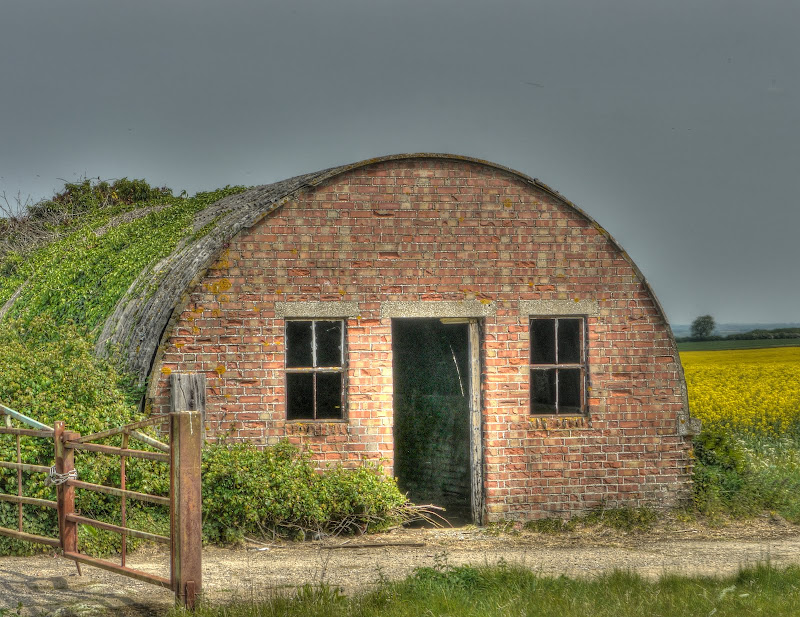
I did pay more attention for a while anyway. Intentionally exploring and taking long-cuts is fine, going the wrong way and having to back-track is not ok. The road passed Moonshine Gap. I did find a cycle ride on Bikely called Moonshine Gap which loops around the area. Moonshine Gap Farm is down this track as it happens. The building on the right is on the OS map and the building on the left which looks to have a wartime heritage is not on the map.
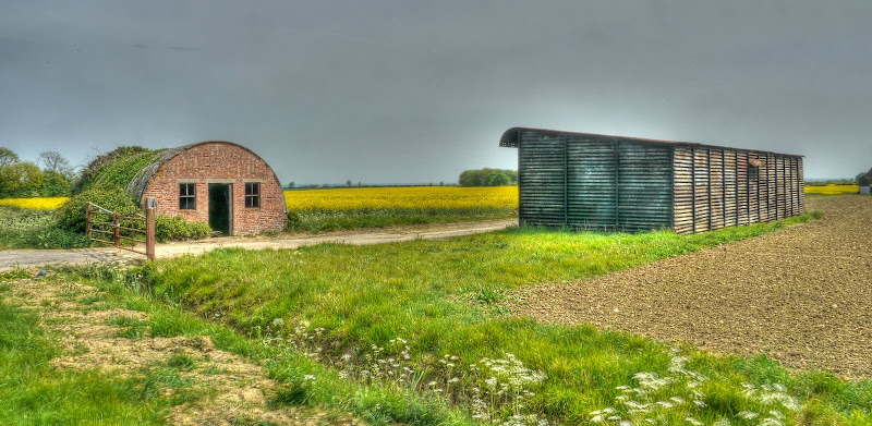
Here is a close-up of it for good measure. I like the way that the bricks look in the sun. That asbestos is not a good look anymore though.
I then cycled through Caldecote (as in Denton and Caldecote Parish) to Stilton. Here is the Stilton Cheese Inn. The village did give its name to the Stilton Cheese – which can only be made in Derbyshire, Leicestershire and Nottinghamshire which have received Protected Geographical Status. It is not quite as daft as it seems as the cheese came down to be sold at the coaching inns in Stilton but was always made elsewhere.

After reaching Stilton which lies alongside the A1(M) the next challenge was to find the small bridge over the A1(M) just outside the village and the off-road track towards Peterborough.
To be continued… coming next the Green Wheel.
No comments:
Post a Comment