
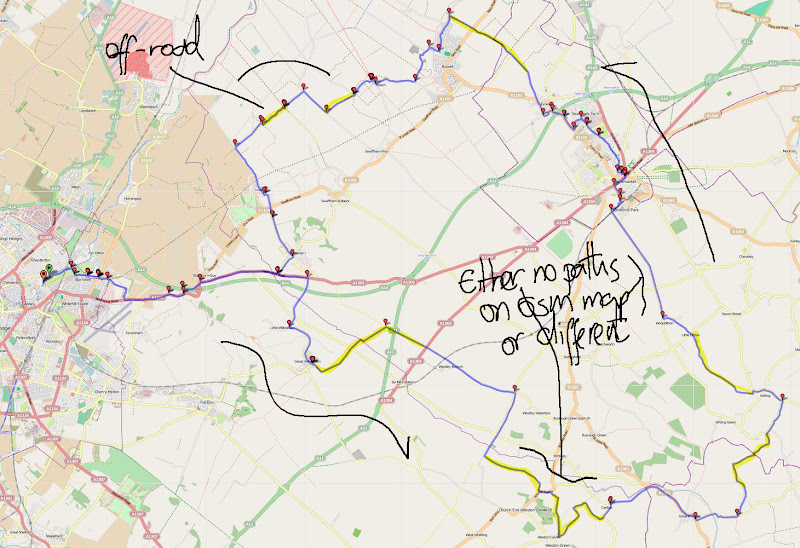
Sunday, 10th April: To make it easier to follow I have included the map of the ride and here is the Bike Route Toaster link in the second part of this Post as well. The route is around 80Km/50 miles long and is a mix of country lanes and byways and bridleways. They were all cycle-able, at the time of writing, on my Marin Hybrid bike. However one bit in particular was hard work, although there might be an unofficial alternative track?
I am a fan of the OSM Cycle map. It is visually clear and informative and generally up to date and sometimes more accurate than the OS map (as available to Streetmap and Where’s The Path). If you are cycling somewhere you don’t know then I would generally also advise cross-checking routes. This is the OSM Cycle map view around Weston Green, which if you follow the link you can see is not complete. I am not complaining, we should be grateful for the work undertaken by the volunteers who have created it. (I also really ought to see if my GPS data would be of some use.)
I left the journey approaching Carlton along Roodhall Lane, which if you search for as “Roodhall Lane” on Google gives two hits, one is my Blog and the other is the Carlton Parish Council. There will be more with this post of course. Apparently “Rood” has a number of meanings including an “Obsolete English measure of area” and a term for a cross or crucifix.
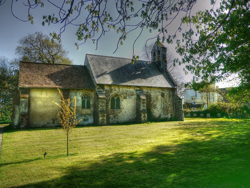
As the byway, as it is now, leads to the Church I assume that it is really an older variation of Church Lane. Here is a picture of the current Church of St Peter. Apparently the thick nave walls are probably 12th century. The link also references a 15th Century rood-screen which was still in place in 1750. Also the Church has been “ruinous” several times with its most recent restoration cited as happening in 1885.
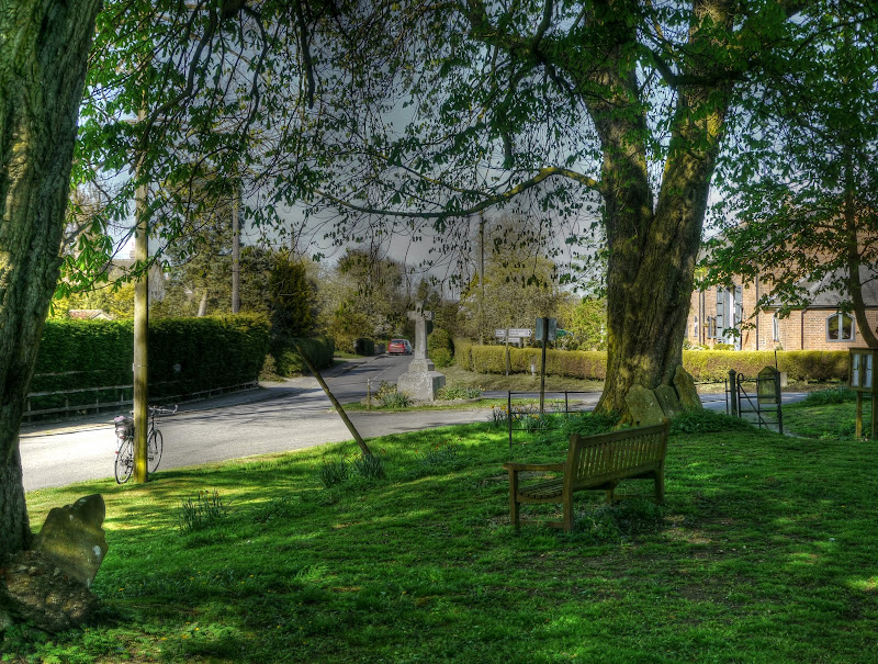
This is the view from the Church down the lane, withChurch Road to the left and Carlton Green Road to the right. This seat would be a nice place to sit on a hot Summer’s day
I then headed towards Great Bradley along Acre Lane onto the B1061. One road I passed was Water Lane – which is an interesting route to explore up alongside the Kirtling Brook to Kirtling Green. The Brook is part of a water transfer scheme and there are various warnings along points of it to be wary of sudden increases in water flow. From 1972 it was part of a system that allowed the transfer of water from the River Ouse (at Blackdyke intake, Feltwell in Norfolk) to the River Stour at Great Bradley.
It seems strange that in this day and age a Brook is used in such a way, although actually why not. They do have to be careful not to damage the natural environment along the banks of the Brook though.
However this scheme is being superseded as part of the Abberton Scheme (Abberton Scheme pdf) which includes expanding the Abberton Reservoir, obtaining additional water from Denver and Blackdyke and increasing the capacity to transfer water from the source to the reservoir. The Brook is being “replaced” by a pipeline. I presume that the brook will presumably revert to its normal water flow.)
I hadn’t really given the Scheme any thought. although I had seen reference to it when I last cycled along the aptly named Water Lane through to Kirtling in July last year (2010). this time my plan was to follow Hall road out of Great Bradley and then turn off at East Green along a no-through road and follow a different off-road route to Kirtling.
After passing The Hall on Hall Road I passed the route of the new pipeline as it makes its way across the countryside. Here you can see it snaking off into the distance. Here is a map of the route (pdf) from Kirtling Green to Wixoe. In general it follows the route of the River Stour and quite closely in as it gets closer to Kirtling Green. If you zoom in on the map it shows the Water Lane route as the Newmarket Cycle Way. I can’t find a good reference to this Cycle Way, which is a pity as it looks interesting and worth promoting as it passes through some beautiful countryside along some very quiet roads.
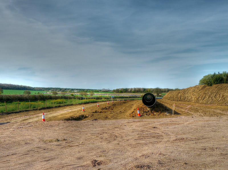
I think those pipes will need a bit more alignment before they weld them together.

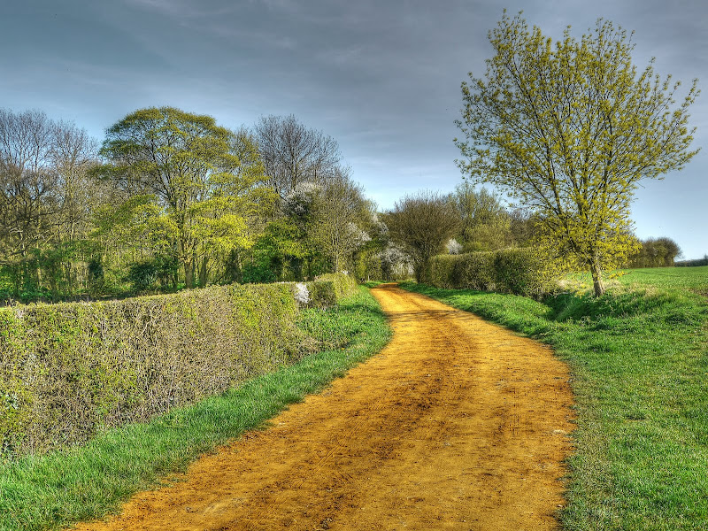
My route followed a no-through road past East Green Farm and Freedom Farm Stud where it went from a tarmac road to a rather good concrete “road”. This is the sort of bridleway I like to cycle along. This is the view – wide open countryside and blue skies – what more could you ask for.

After a while the track became a bit more basic and headed slightly downhill past a Grove of trees (College Grove). The track was sufficiently bumpy so thatI had to do a bit of judicious braking just in case. When I am going to do some real Mountain Biking or fast single-track riding I usually wear a helmet, for my sunny-Sunday afternoon exploring I prefer not to. This means that I have to cycle with a little more care.
All good things come to an end and the path ended up as a more traditional grass track along the edge of a field. Actually it was a bridleway T-junction and if I had gone left would have taken me to the Water Lane route. But as I was exploring I went right along pastures new. The bridleway headed to the corner of a field, turned up and then out of the field. The footpath carried on. As I stopped to eat a jelly baby and check my route some large dogs came into view. As it turned out I had stopped in the right place – and the path would also take me away from the dogs. (The dog bite in Ousden has slightly affected my outlook on dogs I’m afraid.)

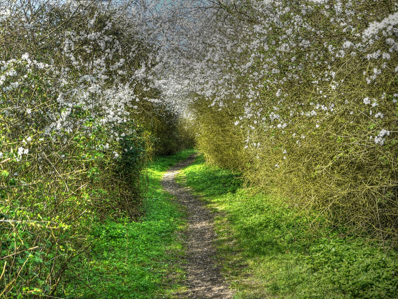
This is the route taken by the bridleway. What surprises me is that the standards of byways and bridleways can vary so much. This was quite a thin path and although used by horses was also pretty good for cycling and walking along. (The earlier bridleway I was troubled by in part 1 would not have been suitable for walking.) What I really do enjoy is that sense of exploring, I know I am really not in the middle of nowhere, and that very soon I will be back to civilisation (but not as we know it Jim). But you can’t help but be impressed by nature Springing to life along an unexplored path.
As it happens the place you come out by was nothing like my expectations, and neither have the Google Streetview people gotten quite that far either. I had the impression of a sort of small car scrapping place – but it probably was just a farm building behind some large metal-sheeted gates.
I then headed through Kirtling to Lucy Wood and a bridleway that runs up to Woodditton. This bridleway though is better than some roads – well maybe that was a slight exaggeration. It is really pretty good. I have been up here before and was planning on taking a left turn onto another bridleway but was confused by the quality of the route – I thought it was a private drive and there weren’t any signs. I should (could) have checked on my map – but sometimes a cyclist has to do what a cyclist has to do and just carry on.
I probably also ought to mention that the track is a bit more grass-like towards the end and there are some potholes for the unwary. I was so over-confident that I had stopped paying any attention to the track and was just looking all around me, with only one hand on the bars and whoof, straight into and out of a pothole before I knew what had happened. It did bruise my hand a little (the one I had bruised last week) but I stayed on the bike. I also paid more attention to the track after that.

At one point as this track ends it does feel rather as if you have unwittingly stumbled (or the cycling equivalent) onto a horse racing track. Fortunately the going is good to firm though, and I reached Maypole Lane in Little Ditton in no time.
Normally I would follow a bridleway along Dane Bottom, but I have been along it a few times recently and sometimes you just need a change so I took the road route (Woodditton Road) to Newmarket. Here the road swoops down a dip and then back up the other side and is quite exhilarating. despite it being straight and quite a narrow road all the cars/4x4s that overtook me gave me plenty of room. I then followed NCN51 out of Newmarket to Exning and switched back to an off-road route to Burwell along Haycroft lane and Howlem Balk. These two byways are very different – Haycroft Lane is quite bumpy because of horses hooves, Howlem Balk (check out the gallery) because of tractors.
If you follow the link you’ll see someone else's pictures of the area – it is rather nice (for me) seeing a place I know through someone else's lens.
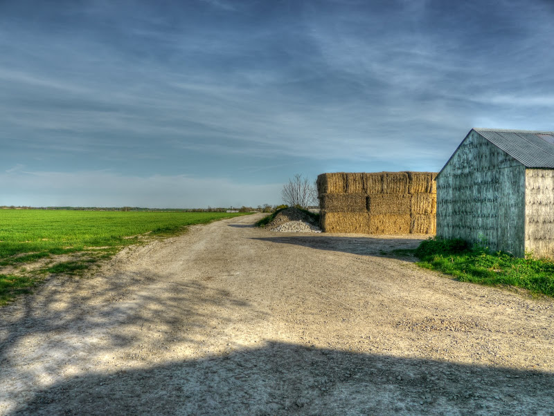
Back to my lens – there are a collection of farm buildings at the Burwell end of Howlem Balk, which look to be part of Baulk Farm (yep two different spellings on the OS map.)

This is the view back over Howlem Balk looking towards the Exning direction.
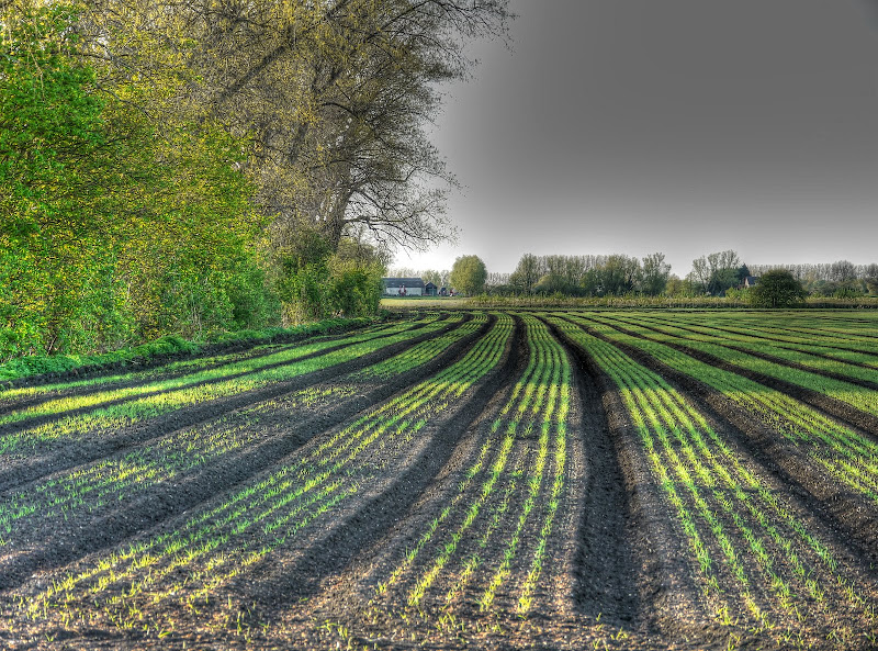
I then joined NCN51 through to Reach and took a short cut along Black Drove to the Lodes Way. Just before crossing Swaffham Lode Bridge I stopped to check how the crops were growing in this field alongside the Lode.
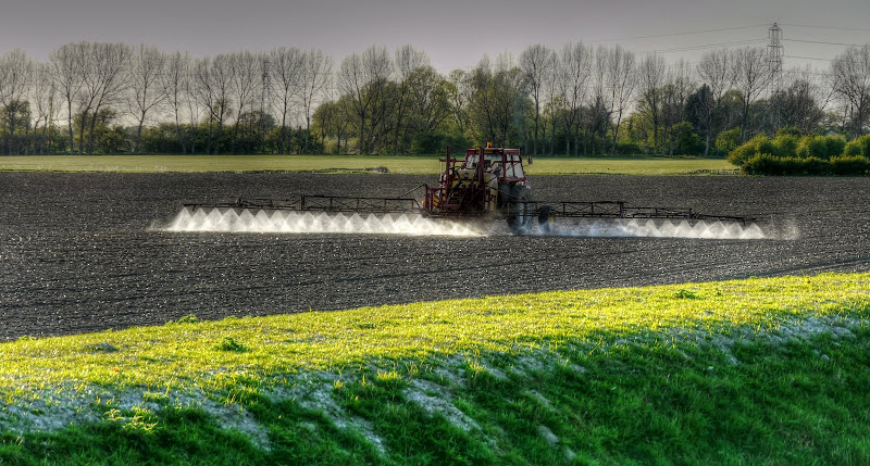
Cycling along Fen road into Lode I saw a tractor preparing for take-off with all its jets in action. I am not quite sure whether this is some form of weed control, fertiliser application or combination. By chance I did read a BBC website article indicating that Nitrogen Pollution ‘costs EU up to £280bn a year’. If you read the article it does say that farmers are not the only ones to blame, however livestock farming is one of the biggest causes. The article does also mention further down that the cost estimate is £44-£280Bn, large numbers, but also a pretty large range. I guess I’d have to read the report to understand quite why the costs are so high. It also mentions that is reduces the average European lifespan by 6 months.
A little further on I also saw some sun dogs. They were clearly visible to the naked eye, but not quite so visible to the clothed camera. It is there in the middle. I even positioned myself so that I was in the shadow of a tree to avoid the sun causing lens flare. (Wikipedia has a nice picture of some very visible sundogs in North Dakota.)
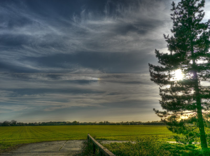
When I got home I had a play with my pictures to see if I could “enhance” the sun dog – the sky does look a little too blue but it does look a little more visible. It also made the contrail stand out as well.

There are times when you return home after a ride with a big grin and that was one of them – exploring, sun, beautiful countryside and no aches and pains as I get a little fitter.
No comments:
Post a Comment