
Sunday, 10th April: It was a sunny Sunday and apparently the weather was going to get a bit colder later in the week– so what better excuse do I need to go out for a ride. Well excuses are one thing, but responsibilities are another. Oh yes there was also a Formula 1 race to watch. Despite me being a bit disillusioned with societies’ doomed love affair with petrol (and diesel) fuelled motor vehicles I do like to watch the Formula 1. I think it must be the combination of driving skill, technology and strategy with a bit of luck thrown in that appeals. That and seeing how it unfolds during the course of the season. The race was in Sepang in Malaysia and was actually run at around midnight here in the UK I was going to stay up, but in the end watched the complete re-run at 8am.
I do have to make sure I don’t hear the result of the race before watching it, but early mornings are best for me as they then don’t interfere with whatever the plans are for the day and I am not too tired. The motor vehicle theme continued as my daughter’s driving test is looming and so we went out for some practice. I have mentioned this before, but at the moment I cannot ride in a car or bus as a passenger without thinking through the journey as if I were driving, in order to be prepared to offer advice. Its both weird and pretty neat the way your brain will take on extra tasks.
So the antidote to all this petrol-head behaviour a bit of exploring of pastures new – or rather bridleways and byways. Whenever I start to feel that the opportunities to explore the area on my bicycle are diminishing I find routes I have over-looked. Mind you what I really want is a relatively easy and straightforward route in the solitude of the countryside. Preferably with country lanes to and from the route and even more preferably with others near by so I can build up a longer journey, but if the going gets too rough with the option of taking a short-cut.
This route came about because I noticed a bridleway near Willingham Green that I had passed by but never cycled along and a second, interesting route from Great Bradley to Kirtling. If you look at the route I took on the Bike Route Toaster map below (here is the BRT link) there are a sprinkling of other off-road bits added in. You could add more if you wanted. The route is around 80Km/50 miles in length and has has a climb at the start and a descent near the end. In the middle it varies between 80m and 110m elevation.
I also noticed that there are various byways/bridleways that have not yet been added to the OSM Cycle map. In those cases I used my GPS trace and the Satellite images to “sketch” them in. On the ground it is usually pretty clear, although there aren’t always signs and some of those are a little ambiguous – well to me anyway. Most of the route falls into the category of I would certainly do it again, the bridleway between Willingham Green and Weston Green is one I would take a little less frequently. Not that it matters as the area seems to have a few routes to choose from.

After heading East out of Cambridge on the NCN51 route I detoured near Bottisham and headed off to Wilbraham. My plan was to pick up a byway known as the Street which joins with another byway, which at one end is called Heath Road and would take me to Westley Bottom. You might wonder why I did not just head on down to the Heath Road turn off from the A1303. Well there is a Scrap yard there just by the entrance to the byway – the Scrap Yard has a guard dog and given my recent dog bite I didn’t fancy adding another to it. I would never normally “chicken out” but that dog has barked and chased out a couple of times as I cycled by. Mind you it has only ever barked at me.
I cycled along Angle End through Great Wilbraham and then onto the byway. It feels like cycling along a green “road” with, at this time of year, reasonably hard packed mud tracks and hedgerows springing into life on each side.

This route is a bit of a detour and you end up cycling up back up to the aforementioned Heath Road, crossing a road to Six Mile Bottom. You also pass under a line of electricity pylons that I seem to block out when cycling, but notice how they creep into loads of pictures. This line is making its way to the Burwell substation and beyond. I don’t quite know where the smoke was coming from, somewhere in the Newmarket direction.

This is the Heath Road which more or less takes you from Bottisham to Westley Bottom. This must be the green road equivalent of a motorway.

After crossing the Cambridge to Ipswich railway line at Westley Bottom you end up climbing up onto the high plains, well around 100m anyway. The Westley Bottom Road takes you to Balsham Lane and after turning right and carrying on across a road it becomes Grange Road. Not long after passing the Brinkley Woodland Cemetery you reach the Icknield Way Trail, which at this point is a bridleway and takes you to Willingham Green.
Judging from the type of track I would say that it is a fairly well used farm track to get to and from the fields. It passes Crick’s Farm – a collection of buildings rather than a Farm House in the middle. When dry it is fairly easy to cycle – you just have to watch the deeper ruts don’t catch your pedals. This is a view of the way I had just cycled.

This is the way forward. The first bit is the most rutted and can get a bit wet when it rains. I did find a bullet cartridge on the ground. It was not a cartridge I recognised. (Air rifles were more a feature of my youth –although I was never allowed to have one, some of my friends did.) The cartridge was marked Winchester 243 and turns out to be a “sporting rifle” cartridge used for “varmint” and medium to large game and is the entry-level calibre for deer-stalking. It always makes me wonder when I see shotgun or bullet cartridges in areas where I cycle – I hope I don’t get mistaken for a deer!

The bridleway then reaches the B1052, but after turning left you soon reach the next off-road part of the route a byway. I am sure that it did not have these barriers the last time I cycled this way. the council is working hard to maintain the integrity of the byways. Here is a Public Rights of Way guide leaflet for Farmers (pdf). Whilst checking the path on the Where's The Path website it seems that the 1940s OS maps have been replaced with Historic Maps. (I sometimes use the old maps to check routes and old railway lines.) The byway is labelled as Brook Lane on the OS map.

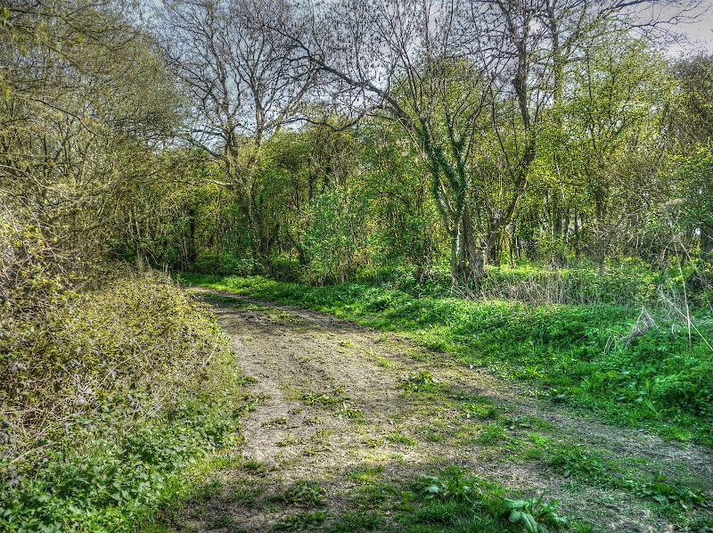
The bridleway is a short cut to Weston green and cuts alongside Great Coven’s Wood and Lower Wood it starts off quite well – this is the view looking back up the field with Great Coven’s Wood to the left. The track was pretty flat and ok for cycling.

A view through the Wood, up near the Brinkley Road there is Moat Farm, Moat House and Moat Bungalow, all taking their name from the moated house. The moat is a seasonally water-filled and is on the site of what is thought to be Colville manor, dating from the 1200s The current House dates from the 19th Century.

This is where the path runs alongside the hedgerow and started to get a little bumpier – it seems to be a popular spot for horse-riding and can you blame them. After hits bit the bridleway seems to follow a thin path between two hedges. There is a track on the right of the bridleway with a sign saying “No Horses”. As a result the path is fairly well chewed up as the horse riders are constrained to a very narrow path. Next time I will have a look at cycling along the track. This time around i followed the thin hedge path and struggled to keep my bike going. I just made it without any dabs.

As I approached Weston Green there were some dogs and a horse rider,. This time I only got my ankle licked rather than bitten (by one of the dogs, not the horse rider). I didn’t cross using the ford I used a thin bridge and headed down the byway (Clamp’s Lane) which joined up with Brook Lane by the River Stour (also responsible for the ford in Weston Green.)
The track wasn’t brilliant, for cycling, but wasn’t bad and the countryside was lovely. You skirt around a wood back to the Ford. This is the view from the way I had come alongside the wood.
This is the ford over the River Stour (or should that be through). Ahead is Brook Lane, which would have taken me back to the Brinkley Road (B1052), the way I had come. I turned right towards Carlton.

This was the byway in the Carlton direction. The surface from here on to Carlton was really quite cycle-able.

Although the first bit did look like a field, it was not rutted by vehicles or horses.

The path turned right towards the village of Carlton and the byway shows the name Roodhall Lane on the map. The Carlton website shows some Green lane maintenance in action. This is the view of the hedge-lined Roodhall Lane from the outside as I approached it.

This is Roodhall Lane from the inside – there is a good solid gravel surface and although you are going uphill it makes for a pleasant ride. the first time I rode this stretch there was quite a sense of anticipation.

Unfortunately you will have to wait for part 2 to see what the village of Carlton is like, or at least my pictures of the village.
No comments:
Post a Comment