
Monday, 4th April: Well after yesterday’s slightly negative comment from the press and me on the CGB it was good to be reminded that you can view the glass half-full. Cambridge First reported on its website: “Transport bosses hatch plant to get Guided Busway up and running”. I believe that in business once a decision is made then it is incumbent on the team to make it work and there is no room for foot-dragging and whingeing. I guess the same is true of the CGB is has been built (almost) the focus should now be on making it useful – especially the high-quality cycle path. Although perhaps the reason that cycle routes are so convoluted and often give way to traffic they would have had priority over if they’d stayed on the road is that the bicycle is such a fantastic getaway vehicle.
Whilst on the glass-half-full end of the spectrum I probably should also note that despite the increase in bicycle theft “crime falls say police”, well in Cambridgeshire anyway. Crimes for the year ending March 31st fell six per cent to 56,620 crimes. There were also more detections as well. It was also reported that “Residents get power to alter speed limit” – hum I think I’ll make it 95MPH, but just when I go down my road! Apparently if changes are made then the residents have to pay for it.
Apparently the £590k plan for real-time bus information has been given the go ahead. Perhaps I am sceptical because I am not much of a bus user, my daughter who does use them finds the problem is that they sometimes just don’t stop or are too full and she ends up walking across town. At the same time we have a “School bus set to be scrapped”. Apparently this takes pupils from a traveller site to Cottenham Primary School and is used by 44 children. The problem with bureaucracy is that it doesn’t not really encourage joined-up thinking. In this case either more children will miss school, in a demographic that would probably suffer more than many, or more cars will end up driving the route to the school. Which will probably cost more money in the long run. The good news is that the decision will not be finalised until a risk assessment and appeals have been heard.
A bit of good news though – the “Cycle Cambridge Programme Boosts Cycling Levels”. There has been an increase of 12% in cycling trips since 2008 and that 21% of all journeys are made by bicycle in Cambridge versus 18% in 2007. The important thing is that cycling is increasing the modal share. Mind you it does make me wonder about the 2001 Census in which suggested that 25% of residents travelled to work by bicycle. Actually according to the Cambridge City Council website (on the 2001 Census data) the number was 25.9%.
Birmingham has also gotten some new cycle lanes – including this additional 50ft.I really must spend a bit of time thinking about cycle lanes – advisory versus mandatory and whether it makes any difference to driver and cyclist behaviour. We have seen a bit of both in Cambridge recently.
And finally, before I actually talk about my cycle ride – apparently we are seeing a salt-loving plant that normally lives on the coast starting to come inland – by more than 100miles. The plant is Danish scurvy grass and has white or pale-pink flowers – the spread is because of all the winter gritting altering the soil structure of the roadside verges. Snettisham Beach is only 55miles/88Km so I wonder if they have reached Cambridge?
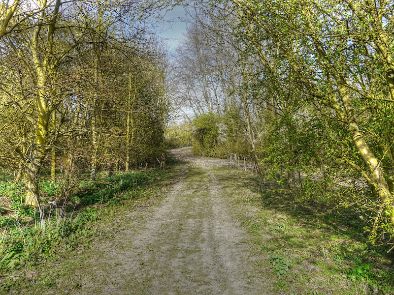
So the ride: Well it was “inspired” by looking at the map and seeing that there was a bridleway between the American Cemetery and the A14 Girton Interchange. I passed it a while back and have only just gotten around to checking it out on the map. A closer inspection showed that it was possible to get through the Interchange and onto Washpit Lane and then into Girton. Well at least it looked like it could be possible after studying Right of Way maps and the Google Satellite images. Mind you I wasn’t 100% certain – if in doubt explore – the worst that could happen is that I would have to re-trace my steps.
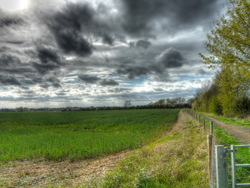
As it was a pleasant afternoon, free of work commitments (the advantages of working from home and working part-time) I took the long way as you can see from the map below. Here is the Bike Route Toaster Link. It looks further on the map than it is – 44Kms / 27.5 miles in length with two hills – one reaching the dizzy heights of 65m and the second around 40m. There is one really unpleasant road – more of that later and some really quite nice countryside although it hardly moves away from Cambridge at all. I was pleasantly surprised anyway, I can seem myself cycling this route with occasional variations again.

The route headed out East through Fulbourn and back up the Shelford Road alongside the Gog Magogs. This is the highest hill, although I cringe when I call it that as only a flatlander would really think that a 65m hill was really a hill. It then follows along Long Road, which when I went past was busy as it was kicking out time for Long Road college. The pavement is shared-use and I would normally use it, but not when it is packed, What I did find is that the Long Road road-surface is pretty appalling, incredibly lumpy and bumpy. I then cycled down the Trumpington Cycleway through New Bit eventually through to the Coton cycle path. (Whilst checking the BRT map I’ve just noticed a small glitch in the track on the Trumpington Road – no I did not do a strange double-back.)
Once I was cycling along the Cambridge Road past the American Cemetery I started paying attention to possible tracks off the road. I did stop and look at the footpath just before the Cemetery but was pretty certain that the path I was looking for would either be signed as a bridleway or nothing at all. The footpath had a footpath sign.
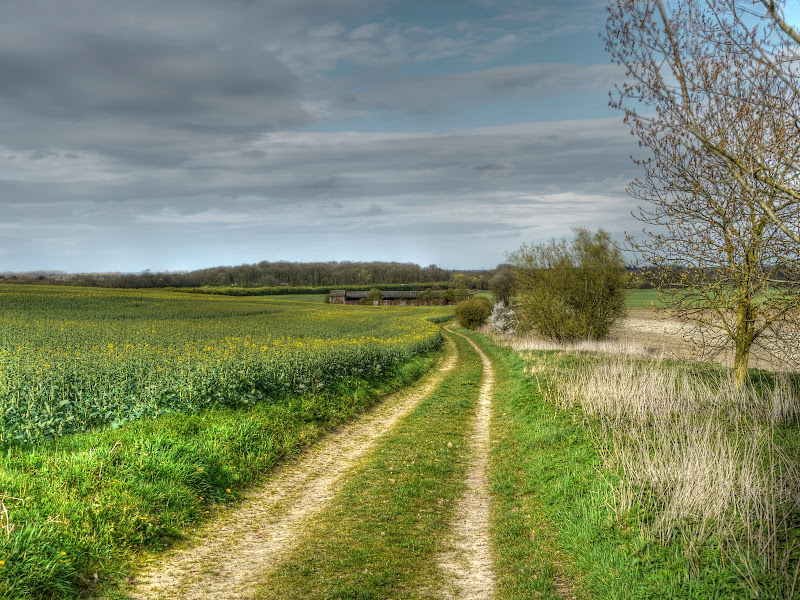
Just after passing the American Cemetery I reached the bridleway which starts as a track down to some dilapidated farm buildings. Here is the track with the oilseed rape coming into flower in the adjacent field.
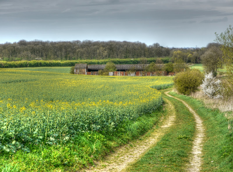
The same view bit with a bit more zoom – now that looks as if it could make a rather nice house set in the middle of a field – mind you the A428 is just this side of the trees – a dual carriageway.
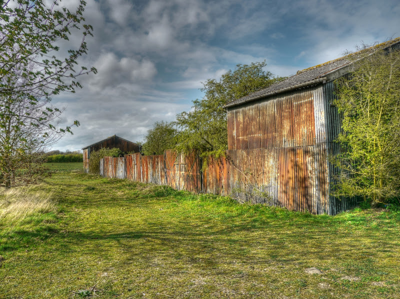
The buildings were overgrown and rather like a fort made from corrugated iron.
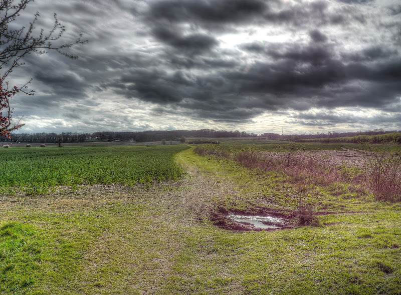
This is the view back along the track is it neared the A428. Although a main road was nearby I was listening to music on my MP3 player so can’t really comment on whether it was noisy or not. The communication Tower you can just about see on the horizon is just next to the A1303 roundabout near Hardwick.
The track passed through a small patch of trees and joined a “road” after passing through a gate.
The “road” led to the bridge over the A428 – a dual-carriageway that apparently connects the cities of Coventry and Cambridge by way of the country towns of Northampton and Bedford.
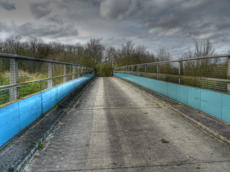
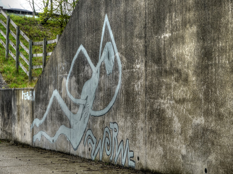
After the bridge the track takes you down to the Girton Interchange, which looks rather different from underneath than it does when you are driving around it. You pass under slip road and then the M11. This is the urban construction, but in a rural setting, as I was referring to. It is basically mainly concrete with the inevitable graffiti. Which for some reason I found fascinating – it was not your usual run of the mill graffiti (IMHO). I don’t mean this one.

If I had to guess then I would say this has some Mexican or Peruvian overtones to it.
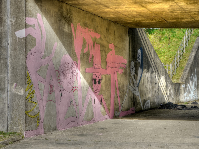
And so did this one.

Although I am not so sure why I think that. The previous picture did look like an Incan Bird
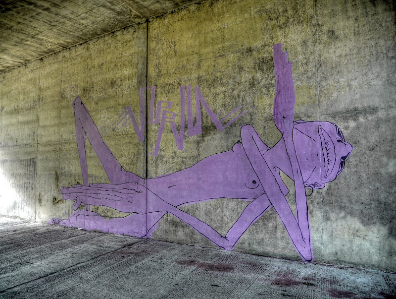
Some of the graffiti had a slightly disturbed theme as well. Including this one that has a more sexual theme to it, but I chose not to have it display. For some reason it is more acceptable to show a “creature” reaching into its stomach!
An establishing shot to show you the tunnel – actually it was pretty much clear of rubbish which is surprising, but this is not the easiest of places to reach by car. Fly-tippers look for easy ways of dumping their rubbish I would imagine.

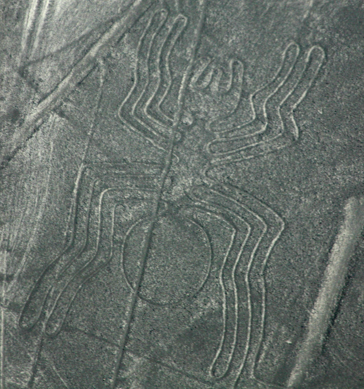
Here is a picture of one of the Nazca Lines images in Peru that I took earlier. (Augsut 2006 as it happens).
After the underpasses you are halfway across the Girton Interchange you then have to cross the A1307 slip road that feeds onto the M11, it joins it at the point it becomes the A14. There was quite a long wait before a gap in the traffic appeared. I did not cycle across I walked my bicycle – it seemed safer that way.
Then you have to cross another road which feeds off the A14 onto the East bound A14 (and also into Cambridge). This road seemed even busier, I didn’t bother taking any pictures I just waited for a large gap and then crossed onto a pavement. Now it seemed very odd to come across a pavement, but there are houses a bit further up and a bus stop. I headed left after crossing, up the pavement to Washpit Lane just by a bus stop.
A short way up Washpit lane and you forget the urban jungle just behind you and once again you are on a tree-lined country lane. (I think listening to music on my MP3 player made it easier to forget the urban jungle.)
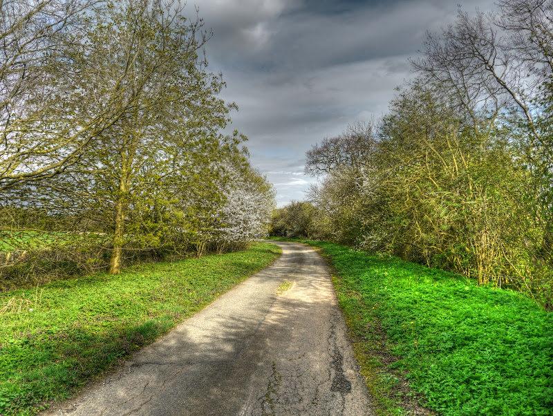
Washpit Lane (on the OSM Cycle map) appears as Washpit Road on the OS map and crosses Washpit Brook just before reaching Girton. I joined the NCN51 route through Girton and headed in the Oakington direction. Just after passing Manor Farm Road I went along a bridleway along the edge of Beck Brook, it is unmarked on the OS map on Streetmap and WTP but marked on the OSM Cycle map (and on the CCC Rights of Way Map).
It is a path with a tarmac surface that take you up through to Histon across the CGB. .This is a picture taken looking back along it. It is not the most direct route, at this point it runs almost parallel with the CGB. it is not a bad path though.
After passing through Histon without any major problems I carried on to Impington. It was in Histon in February 2009 that I was SMIDSY’d by a car – despite the fact the lightning doesn’t strike twice I am always extra careful cycling through Histon. The car driver who hit me was not speeding, or being reckless, he just did not see me before turning into me. I guess I was probably shielded by a door pillar and he only looked once. The second time was as I bounced off his car – “shouting what the he… oof”.
As I left Impington I was more than pleasantly surprised to see that work had started on the Impington-Milton cycleway.It caused some issues because of the possible withdrawal of a school bus. In this instance I think the correct thing to do is put in the cycleway and withdraw the free bus.
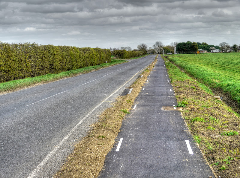
This is the cycle way – smooth flat and with white dashed lines either side. I wonder if it will get LED lights as well.
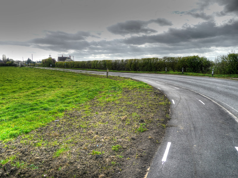
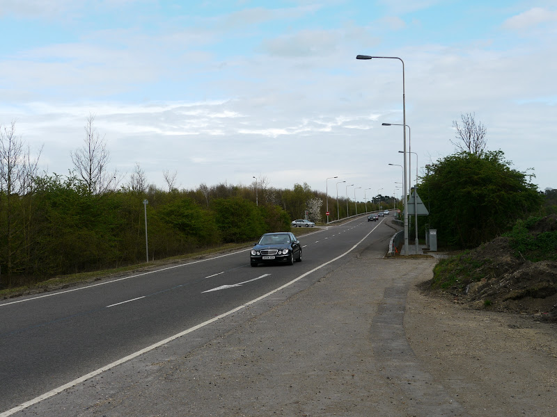
The view of the path looking forwards. This road is a very unpleasant road and it would have been nice to see the path a little further away from the road, perhaps with some sort of dividing barrier. Unfortunately the path has not yet been finished, about half has been completed and the second half past the Recycling centre on the aptly named Butt Lane has yet to be started. So I cycled along the road, where some idiot went past at 60-70MPH with what seemed to be around 6 inches to spare. Plonkers who drive like that are the reason that these roads are not safe. It was one of the times when I wish I had a video camera on my bike there is not doubt I would have reported him to the Police.
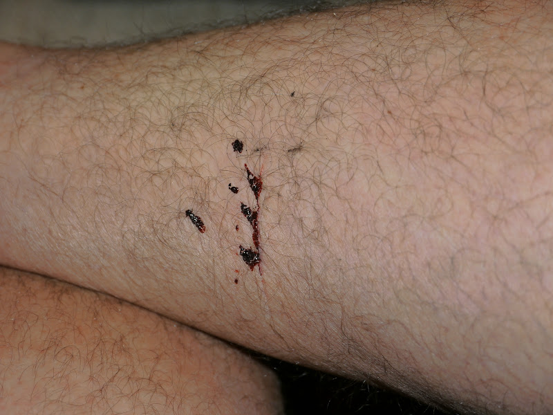
After Milton I cycled alongside the River Cam on NCN11 for a relaxing end to my ride. As usual I passed quite a few cyclists going the other way. Somewhere along the way I had been scratched by a bramble – here is the wound. Much more blood than my dog bite near Ousden.
As I said at the beginning this is a route I will follow again although I might give Butt Lane a miss until they build the rest of the cycleway.
No comments:
Post a Comment