
Saturday, 16th April: Well here I am, I did try and catch up on my Postings, but once again I am practically a week behind. So as such a lot can happen in a week and this cycle ride does feature that tribute to human engineering attempt to rewrite the rules on railways – yes the Cambridge Guided Busway or CGB for short I have included its latest news.
So what has been happening in the world of the CGB – well in no particular order.The County Council have had the election of a new leader – with four standing for the position. Of the four Nick Clarke got it and in the Cabinet re-shuffle that followed, what a surprise the CGB program has new leadership. Cllr Roy Pegram who was in charge returns to the backbenches and the responsibility for the CGB now lies with Cllr Ian Bates (former leader of Huntingdonshire District Council.)
Just as we thought that the CGB really ought to be finished it turns out that there was further critical documentation that was missing, or as the Cambridge news put it “Another day, another delay on the guided busway”. However there has also been some good news. The high-quality path alongside the concrete tracks has been due to be covered with tarmac from Milton Road to Longstanton, well the new plan is to extend the tarmac surface up to Swavesey, just before the Fen Drayton Lakes. And finally (as of the 21st April 2011), the CGB has been handed over to the County Council. The news item in the Cambridge News reads as if there has been a sudden love-fest though with delight on both sides (the Council and BAM Nuttall). There is now 28 days for BAM Nuttall to fix defects (flooding car park, flooding cycle track, viaduct problem – to name but a few). If they don’t then the Council take over – I am sure there is more wrangling to come.
Back to this ride – it was a Saturday, chores done and as my mother-in-law was over and my wife was entertaining her I had a bit longer for my ride. As the previous few days had been rather clogged up with meetings and so only short rides around Cambridge it was time for a longer ride. There are times when I look for inspiration for a ride. I have ridden around the area quite a lot and it is getting harder to enthuse about yet another ride around a well-worn route. This time it was easy though. It was a comment from the Cottenham Cyclist that gave me the idea. He mentioned a route between Earith and Over that I had been along once before (Long Holme Drive) and it seemed a good idea to check it out again.
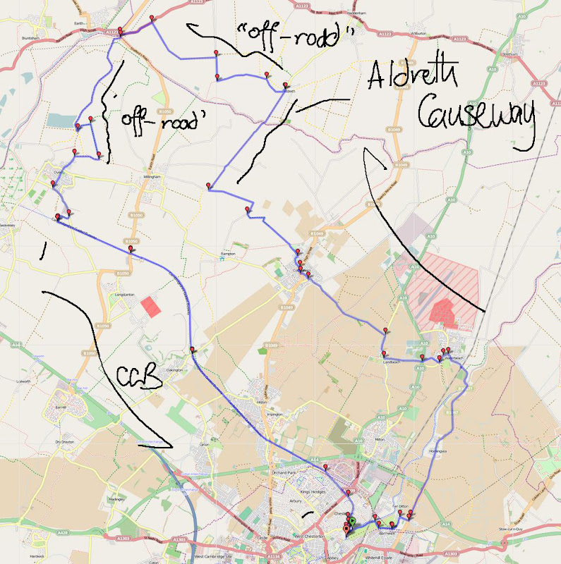
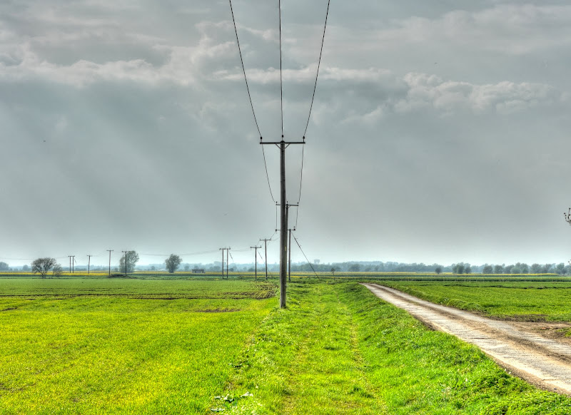
Here is the route I took, as it was Saturday I avoided The Halingway alongside the River Cam just in case it was busy and headed out via Waterbeach and Landbeach to Cottenham. I then rode along Archie’s Way along Irlam Drove to the Aldreth Causeway and then almost to Earith over country lanes and bridleways. I then reached Long Holme Drove (a BOAT or Byway open to all traffic) - and headed to Over and then back to Cambridge on the CGB. This route is mainly off-road, in fact if I had cycled alongside the River Cam then most of it would have been. Whilst it is not a route for a skinny-tyre racing bike it is perfectly ok on my non-suspension 25mm tyre, Marin bicycle.
Here is a link to the Bike route Toaster map shown below. The route is 53Km/33 miles, flat and pleasantly free of traffic for most of the route. You might meet the odd horse and rider though. (Where that is odd as in occasional rather than odd as in strange.)
I did take quite a few pictures along the way which is why it is split into two parts.
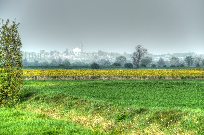
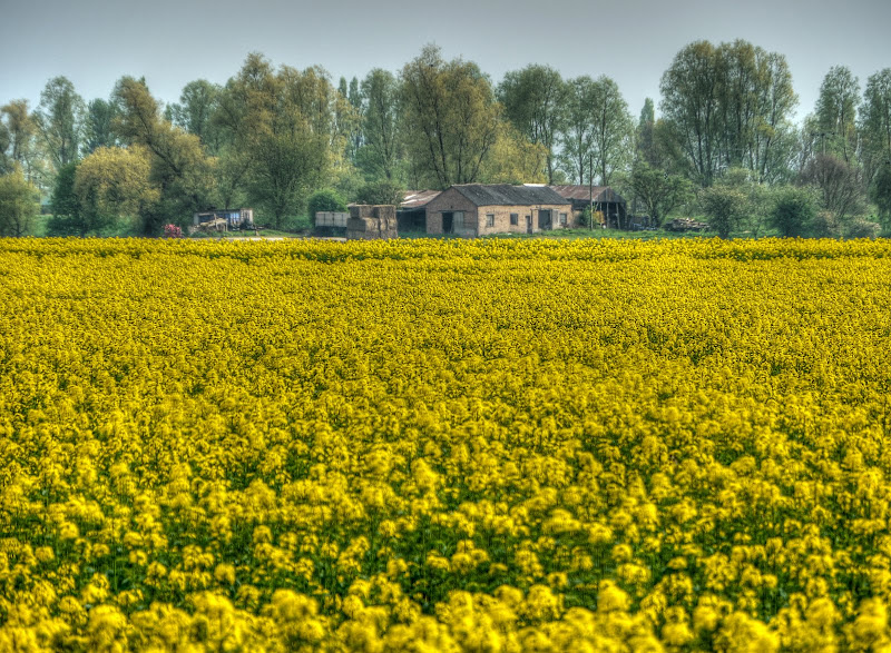
Whilst it wasn’t a very hot and sunny day I did wear a t-shirt and shorts and sandals and a jacket. It turned out I was a little bit over-dressed, but I did not get too hot. Since the point of the ride was to cycle along Long Holme drove I was not intending to take too many picture on the way. However the fields are turning yellow at the moment and I can’t resist taking pictures of such solid blocks of “natural” colour. I ended up stopping along the Beach Road (nothing to do with the sea – it is the road between Cottenham and Landbeach). Actually I think when I took the picture it was still the Cottenham Road. This is the view looking towards the south. .
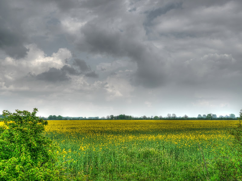
This is the view towards the north – there was yellow all around.

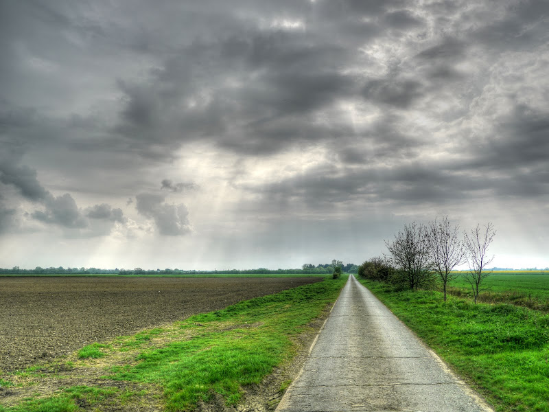
I then cycled through Cottenham and along the road through the Great North Fen over the Archie’s Way bridleway to The Irlams. The road you meet is a single country lane, which was originally constructed from concrete slabs and has since had a tarmac layer – which has worn away somewhat, as you can see here. You occasionally meet other vehicles, but this route is the long way between Rampton and Willingham there is a quicker route. At this point the road is called Cow Lane and leads onto Irlam Drove.
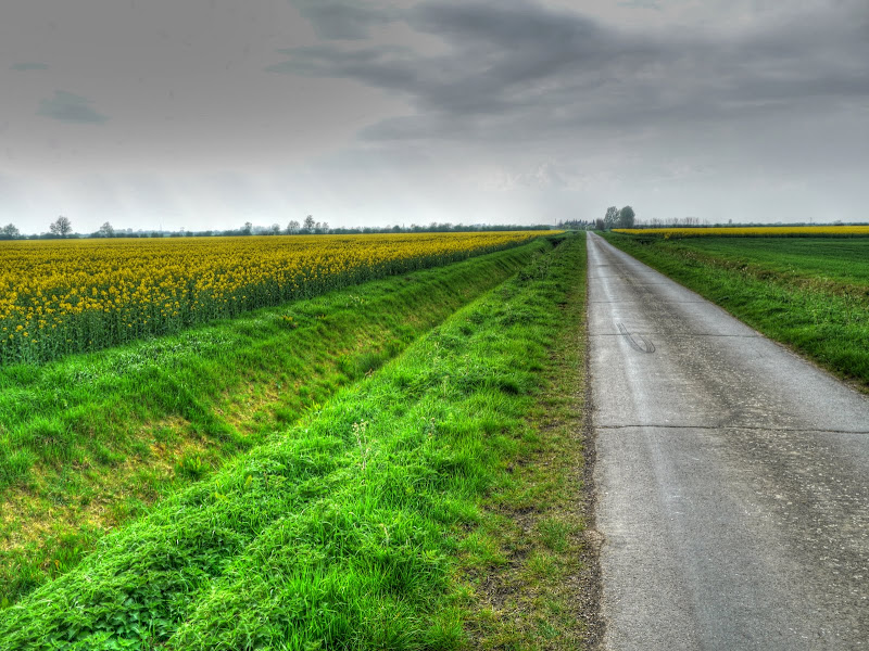
Once I reached Irlam Drove there was the familiar pungent smell of the Oilseed Rape growing all around for what seemed like miles and miles (or should that be kilometres and kilometres). In fact it seems that Oilseed Rape is taking over the planet – here is a field receiving instructions from head office through beams from outer space.

Irlam drove looking towards Willingham (although you can’t really see Willingham in the distance). What is amazing is how uniform the flowering has been across entire fields.
This picture is made from two pictures stitched together side by side and the field still goes on beyond the picture..


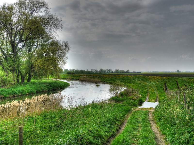
It was time to head up The Aldreth Causeway. You can cycle off-road virtually from Histon but this route is also pretty quiet as far as traffic goes. I joined at the point where there is was a Traveller Caravan with a dog as mentioned by the Cottenham Cyclist. Last week there was a deserted caravan, this time there wasn’t even a caravan, just a bonfire after the space had been cleared.

As I cycled up the causeway I passed one or four traveller horses staked along the path enjoying the spring grass. At least I assume they were enjoying it, they looked at me with mild disinterest as I cycled by.
Off in the distance was the water tower and Communication Tower at Haddenham. The tower almost seemed to be floating like a giant octopus with its tentacles hanging down. (Yes there was yet another yellow field there as well.)
The causeway crosses the River Great Ouse by High Bridge Farm – although the farm is now only a dilapidated tin shack. The OS map shows a Ford marked alongside and here it is. There is also a footbridge for walkers to use.
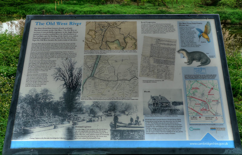
There is a picture on this Information Board near the bridge over the River Great Ouse of the 1947 floods as well as a map of the area.
This is the bridge with my bike propped up against the railings. It does service for the farm traffic in the area.

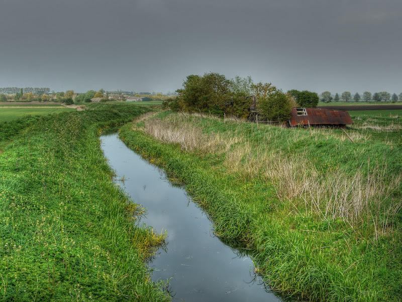
To the right is “High Bridge Farm”, not that the bridge looks very high. The water is Catchwater Drain although on the map there are several ditches running in parallel and only one has a name.
Just by the bridge is a trig point and there is apparently a geocache nearby. On the map the nearest elevation number is 3m but there is also a 2m near-ish as well. It gets a score of 6/10 on TrigpointingUK! If you follow the link then it seems to be at an elevation of 3m above sea level.

My route turns off West just before cycling into Aldreth. Farming must have changed quite a lot over the recent past – there seem to be quite a few dilapidated famr buildings around and about – including this one just off from The Boot (a road)

Looking in the direction of the Boot – this is the sort of empty road I like to cycle along.
This is either Frog’s hall or Haddenham Engine Pumping Station. I think it is Frog’s GHall but can’t quite remember in which direction I was looking when I took the picture. A quick search and it also seems to be called Frog Hall Farm.
After a while the road turns right (and is called Long drove) and then you end up on byways to get to the road near Earith. as you can see we have had so little rain in the past few months that the farmers are having to irrigate just to get plants to geminate. (Or perhaps to soften the ground.) If you look at these graphs for April there is barely a bump in the rainfall all month. It makes you wonder why there has to be so much drainage – where does the water come from.

This is Upper Delph Grove (via Gravel Pit Drove), in this dry weather they are quite passable as long as you don’t mind your teeth rattling out unless you have suspension on your bicycle.

You can’t these deserted byways for a great ride out. To be continued…
No comments:
Post a Comment