Saturday, 30th October: So it was coming up to the end of the month, but because of the school-half term the Saturday shopping had been done on the Friday and after taxi duties (for my daughter) I had the whole afternoon free. As an added bonus it was also sunny and, for this time of year quite warm. In fact the only slight cloud on the horizon was the clouds that have been on the horizon and rained over the last week or so. As a result the byways and bridleways that offer some great and quiet cycling would probably be a little trickier than usual. So how could I not waste this opportunity? A quick look at the map and I had the answer. Whenever I have cycled on the NCN11 south of Cambridge towards Saffron Walden and then later looked at my route on the map I have thought I ought to have taken the opportunity to try out some of the byways/bridleways around the Strethall and Langley area. I wanted to get off-road, but not commit myself to slogging through sticky mud all afternoon, so a trip down to Strethall following NCN11 followed by a bit of off-road to Elmdon. I did wonder whether I might then carry on to Chrishall along a byway called Parkhouse Lane but thought I'd leave that for another (drier) day. Along with Common Lane past Chrishall Common.
The route is shown below and available on this BRT link. The out route pretty much follows NCN11 to Strethall, not far from Saffron Walden and then heads back via Duxford, Whittlesford and Little Shelford. I also checked out the new Addenbrooke's Relief Road. I find Bike Route Toaster a great way to map out my routes and have gotten used to its little foibles, some of which are probably to do with the fact I use Chrome as my browser. I had a few problems routing the ride automatically though as the underlying data (OSM Cyclemap) does not always seem to be totally consistent or up to date. At least that's my guess. (There were some gaps at different zoom levels today)
The route as shown is around 63Km/ 40 miles long and gets to a height of around 130m above sea level at its peak down near Strethall. In fact the noticeable hill starts just after Ickleton The down hill is good though my peak speed was around 55Km/h which is about 35mph - and that was without trying. The fastest speed I have recorded, whilst cycling on my bicycle is 74.3Km/h (46.4 mph) whilst cycling in the Lake District, it does not sound like much, but it felt fast at the time.
The NCN11 route from Cambridge to Saffron Walden is an interesting mix of different roads and terrains and it has hills. It also seems to encompass every type of cycle route from shared path to country lane. It starts with a great path out of Cambridge - The Addenbrookes Shelford Cycleway which heads out of the hospital grounds on a shared use path of moderate width and in places lights at the side of the path. (It also has a colour representation of a Human Genome down the middle as well.) Then you end up ducking through the back streets of Shelford before leaving Shelford and the path is a pavement that has been designated as a shared-use path. It is a really only pavement, but arbitrarily can also be cycled on. I say arbitrarily because around these parts the logic of some of the shared-use cycle ways is not always easy to follow. Or rather the logic has nothing to do with the width and type of the path, more with the expediency of calling it a shared use path. I shouldn't complain too much, this approach helps to eke out what is a limited budget. The shared-use pavement carries on into Sawston and then you switch to cycling on the correct side of the road before reaching another shared-use path and the left side of the road. You then have to cross the A505/A1301 roundabout - there are islands on the A505 but not on the A1301 which you end up crossing as well, as the shared use path is on the right-hand side going south.
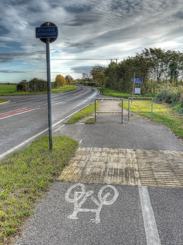
This is a shared use path with a white line down the middle though. It is also on a busy road and I don't remember seeing pedestrians on it and have only seen a handful of cyclists on it either. (whereas I nearly always see cyclists around the Lodes Way area near Wicken Fen.) This photograph shows the end of the shared-use path where the route switches to country lanes. Note the strategic use of railings to nobble any cycle foolish enough to be cycling down here at night without lights. Although you can see where a path on the grass has already been worn down by cyclists negotiating the barrier. At least someone has put a little bit of tape around the barriers, presumably it has some reflective properties.
So in theory they have built a fairly reasonable path which is around 0.5 miles/ 0.8km long which requires you to cross a busy road at one end and then dismount at the other. So you can either not cross at the roundabout end and cycle on the road, indicating as appropriate to turn down the small lane or, more likely, cycle down the shared-use path and then cycle through or around the barrier and straight onto the lane. I really don't believe that these odd constructions (the barriers) encourage cyclists. At best they are irrelevant at worst they increase the danger for the path sharers.
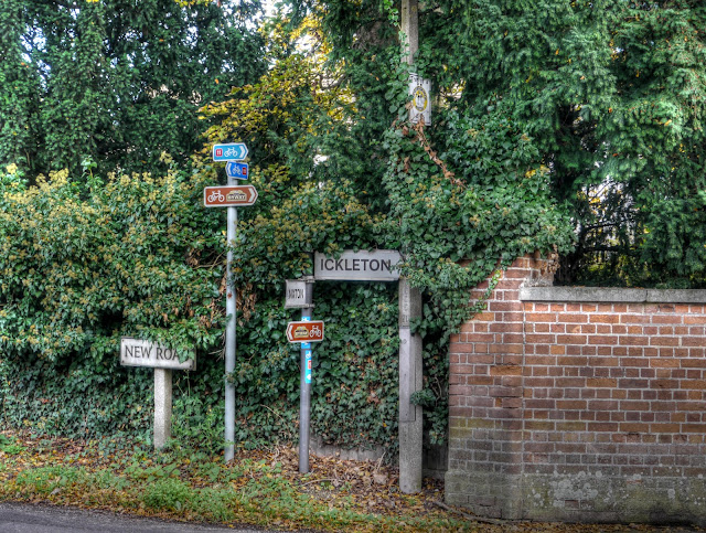
The lane leads to Hinxton, a nice village although I found myself face to face with a bus coming the other way which was having to negotiate various parked cars. The bus driver waved his thanks though - it was not his fault they had set up an obstacle course for him to drive through. I also found more evidence of the elusive and secretive National Byway Society. It has put signs up around Cambridgeshire, but will not publish a map to indicate where they might be heading because they have not sorted out the Essex bit. it looks as if they are piggy-backing on the NCN11 just here!
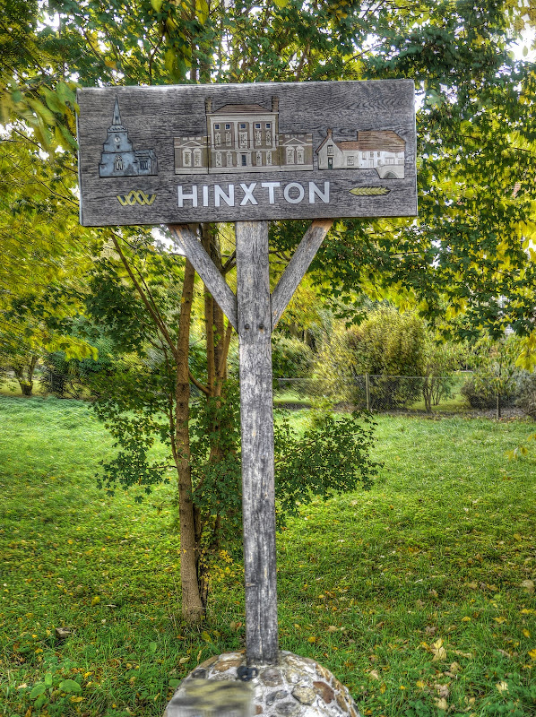
The Hinxton village sign.
The route then heads through Ickleton before climbing up Coploe Road and crossing the M11 motorway and into Essex. The road is a narrow country lane there is barely enough room for a car and a bicycle to pass by. Unfortunately whilst the road is not too busy it is is not that quiet either. There were around 15 cars when I was cycling along it. most slowed down, but for a tractor followed by a convoy I had to get on the grass verge. There was one car that seemed not to want to slow down and whizzed by, but it was the exception.
I have not really paid attention to Sun Dogs before and only learnt about them this year from MikeC. They are like buses it seems, you see none and then three come along - well I have now seen three of them. This one was in the sky as I was cycling up the hill towards Strethall.

Once I got to Strethall instead of following NCN11 I turned right and kept going. (Next time I might try another byway - Birch lane - towards Littlebury and then along a bridleway along the other side of Free Wood.) The road quickly turned into a track and it was a byway, so hopefully was not going to be too difficult to navigate on a bicycle. It is referred to as the Icknield Way Path on the map and runs alongside Free Wood. It was also clearly a working track with a few not too badly worn ruts with a few puddles here and there.
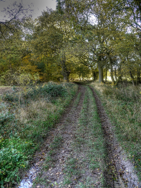
The path never got too bad, but I did dab my feet down a few times and once or twice had to stop and switch tracks. There were places I could have done with a little bit more tread as I got a bit of wheel spin as well.
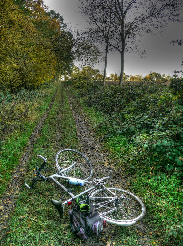
The view north from the path was wonderful, the skies were blue and the autumn colours were coming out on trees in Strethall Wood to the right of the picture.
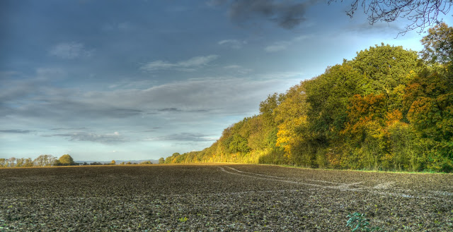
This is the view looking along the edge of Strethall Wood - you can see the undulating countryside rolling away in the distance. It does not seem like the high spot of the ride though.
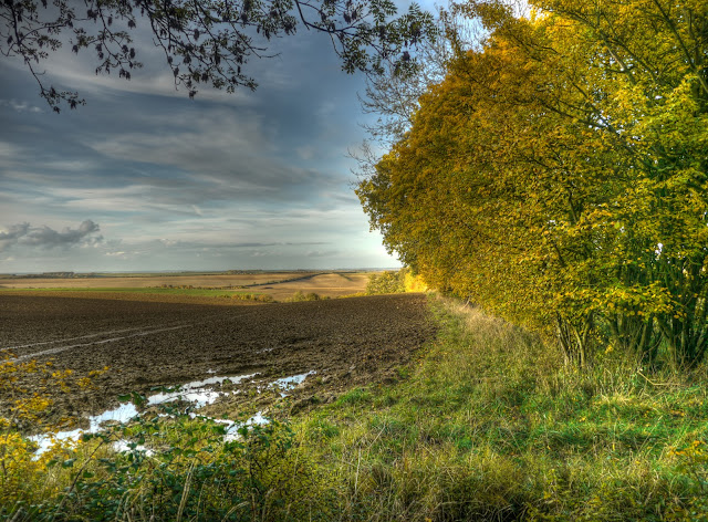
This was about as bad as the path got - my wheels picked up quite a lot of mud but did not clog up completely. I also managed to keep moving and avoided dabbing my feet in the muddy puddles.
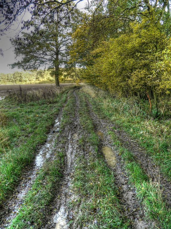
The byway then reached a junction with a choice of road or bridleway. In my mind I had already picked the bridleway, but rather hoped it wasn't going to get any worse than the byway I'd just come along. (Normally I find that byways are better than bridleways, at least for cycling along.) I needn't have worried the bridleway was actually along a farm road with a tarmac (or similar surface). The route passed through Freewood Farm (to be expected on the edge of Free Wood I guess) and then turned right along Freewood lane ( a bit of a theme is developing here!). The lane definitely was a tarmac road and really quite pleasant. I wish more bridleways were like it. This is the view looking south from Freewood Lane.
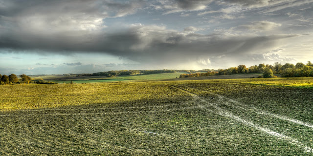
Next time, at a drier time of year I will definitely have to explore a few more tracks around the area - Parkhouse Lane looks good as does Dark Lane - I might even get off my bike and take a walk on the Dark side! This time around I headed out of Elmdon on the Quickset Road, it was pretty much downhill all the way (to Ickleton) and as mentioned earlier I got close to my highest speed for the year. (The highest speed was when I visited Wimpole and was on Church Hill near Barrington - 57.82Km/h) To avoid re-tracing my steps (pedals) too soon I took the Duxford Road on the edge of Ickleton to Duxford. The last time I cycled along this road I did not enjoy it - this time an Audi Estate whizzed past me as if I wasn't there. He gave me no room whatsoever, the gap was less than 15cm/6" and his speed was probably 60mph. Idiots like that probably don't use their rear-view mirrors either so he (yes it was a he) would not have picked up on my non-verbal communication.
I went into Duxford and along the Moorfield road towards the A505. There appeared to be another National Byway sign pointing to a gap in the hedge on the right. It did not seem to go anywhere and I carried along the road only to find that road traffic had to turn right left (who said I can't tell my left from my right!). I realised that the earlier sign meant for cyclist to ride along the pavement and use the pavement crossing point. There is a traffic island and helpfully there was another National Byway sign pointing the way. Looking at the OSM Cycle map there would appear to be a cycle route to NCN11 by heading right just after crossing the A505 and then after passing Whittlesford Parkway (Railway Station) you join a shared-use cycle path alongside the A505 which brings you back to the A1301/A505 roundabout, which I had crossed earlier whilst cycling down the NCN11.
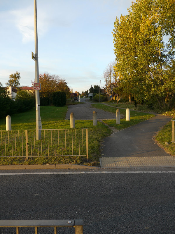
Further along the road in Whittlesford I missed out on exploring the Whittlesford-Sawston Cycleway. (Actually on the current view of the OSM cycle map it is shown as the Whittlesford-Swaston cycleway). It emerges onto the A1301 near Spicers Paper Mill. I am not sure whether it is my poor Web search skills or a strange variability in the level of detail published on Cycle path/route improvement schemes in the County (of Cambridgeshire). Sometimes you get the detailed drawings of the route and the work - too much detail even. Whereas other times there is nothing at all, or maybe a spreadsheet showing some cryptic costings. Yes I am being picky and Open Government is not as easy as it sounds but I do wonder whether the various administrative County Regions - East, South, North, City, Huntingdon get in the way of clarity and efficiency. It is a good job we have the Cambridge Cycling Campaign - here is their take on the various improvements - dated Jun/July 2010.
The sunset was looking pretty good by the end of the day - it rather looked as if the sun was some strange fire with smoke (clouds) billowing up into the sky.

I then went through the Shelfords and instead of re-joining NCN11 carried along the Cambridge Road.Shelford Road to join the new Addenbrookes relief road. The Shelford road has had fairly decent cycle lanes marked on the road for some time (years). There is one bit that has always struck me as bizarre, where the road passes Scotsdale Nursery and Garden Centre. The cycle path is "randomly" steered onto the pavement on both sides. if you follow the link you can see from Streetview that the pavements are none too good, the only concession to cyclists is the addition of painted cycle symbols. It is lumpy and it passes by a bunch of garden entrances and at least one road on each side. The cycle route then rejoins the road with painted cycle lanes again after passing the Nursery.
The reason, well I can only assume it is because the road has a short turning lane down the middle for the Nursery on one side and Shelford Rugby Ground on the other. So the cyclists are "dumped" onto the pavement and then back again. Except of course in the risk assessment I carry out as I cycle the diversion seems random, it seems to increase the hazard level as it forces me to take to a path with uncertain priorities over adjacent entries and certainly lower priority than the two side roads it forces me to cross as a pavement user. So the road planner had a choice of either a gap in the cycle lanes, because the road is not wide enough to support two cycle lanes and a mid road turning lane, or to take make the pavement shared-use for the sake of continuity of the cycle-friendly route. Is it the safest thing to do - I doubt it myself. But in the game of road planner trumps - bureaucracy beats safety every time it seems.
The new road in the link shows a picture before the road was completed - although if Google update the picture in the future it might not. It has much wider cycle lanes and a hill - well a bridge over the railway line, which in these parts is bigger and steeper than most hills. It ain't really that steep though - just not normal for the flatlands. (To borrow and (para) phrase - NFN - Normal for Norfolk).
I would have taken some picture - but it was too dark - next time.

No comments:
Post a Comment