
September 2: There are times in life when it feels as if it is one step forward and two back and that is how I feel at the moment - at least from an IT point of view. My Internet Service Provider ( a small company) had a breakdown during the Bank Holiday weekend and as a result decided that it was going to withdraw its "unbundled" service. This means that I go from a headline speed of 24Mb/s to 8Mb/s. Unfortunately they seem to have migrated me early and the speed I am actually getting is 2Mb/s. Now I know there are lots of people who would say I am lucky to get any decent bandwidth, but to go backwards and so far backwards is very difficult. If I take the train to London it takes around 50-60minutes, an equivalent slowdown would be 10-12 hours - well I can cycle the distance in 4-5hours so the slowdown is much worse than the transport equivalent of switching from a fast train to a slow bicycle. Except it is worse, at least with a bicycle there are the benefits of fresh air, exercise and some pleasant countryside.
To make matters worse my Off-line Editor Zoundry has been having more problems with pictures and so I have had to delete this Post (in draft form) and reload it. At the Internet speeds I am now enjoying it took around an hour for these pictures to upload. (Upload -is always much slower than download). That is an hour to find out whether I have fixed the problem with Posting or not. It sometimes feels as if the UK is in the dark age, both in terms of Technology and Customer Service. My ISP has not covered itself in glory with its customer service and lack of communication.
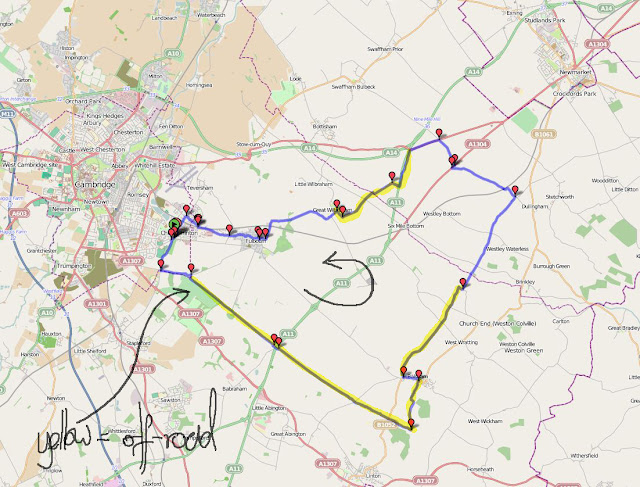
So here I am back with this Post having written and posted the other one. I must try and catch up a bit and get closer to real time. For this ride as I was trying to get a few miles in my legs and I wanted a bit of peace (from cars and vans) a trip up the Roman Road, between Cambridge and Balsham, seemed to be a good idea. This route also includes a bit of hill, for the Flatlands anyway and reaches around 110m above sea level. The route is only 44Km long, but it can be quite hard work depending upon the state of the tracks. I reckon that just under 60% of the distance is on byways. The total ascent/descent is 230m.
I first noticed Apple trees along the byways last year it was the fruity smell that alerted me. Now that apples are once again ripening as we approach the end of Summer I thought I would pay a bit more attention. My theory is that the trees are seeded from discarded apple cores left by walkers using the byways. Apples do make quite a good snack when walking or cycling and the cores are bio-degradable as well. I don't see many apple trees in the hedgerows alongside roads though so perhaps walkers eat more healthy snacks than car passengers who eat crisps and sweets.
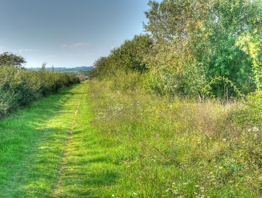
To get to the Roman Road I cycled out of Cambridge along Wort's Causeway named after Sir William Worts a member of St. Catherine's College up the first hill of the day (well late afternoon). On the OS 25K map this is also referred to as a Roman Road and passes Beechwood (yess you've guessed it a Beech Wood) which seems to be a popular place to walk dogs. The hill is not long but rises from 20m to 70m, so for a flatlander it can feel steep. At the top you turn off the road and then onto the byway. The route passes through a tree-lined avenue of beech trees and passes Wandlebury as the track undulates. The surface also varies a bit and in places can be a bit tricky with loose sandy gravel.
Once out into the open I soon came across my first apple tree - with apples nicely ripening.

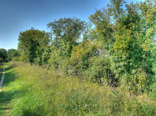
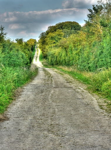
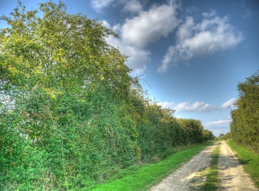
Although it is called a Roman road and appears on the map as a byway the track varies from single-track as in this picture through to farm track, reasonably well-used by passing tractors. I have not really paid that much attention to the way it changes, but here you can see along with a "bunch" of apple trees it is a single mud strip of path set between two hedges. The hedges are reasonably far apart though and you could imagine it being used as an ancient road. Although they are not so easy to pick out there were three apple trees in the bit of hedgerow.
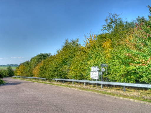
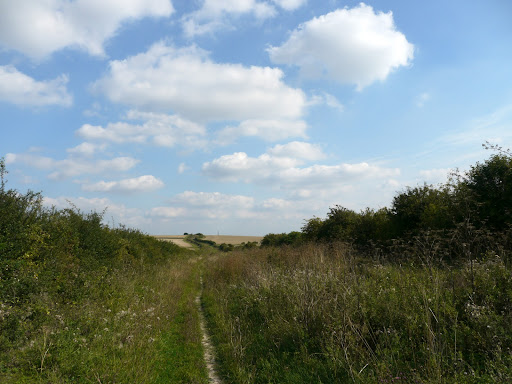
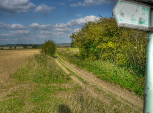
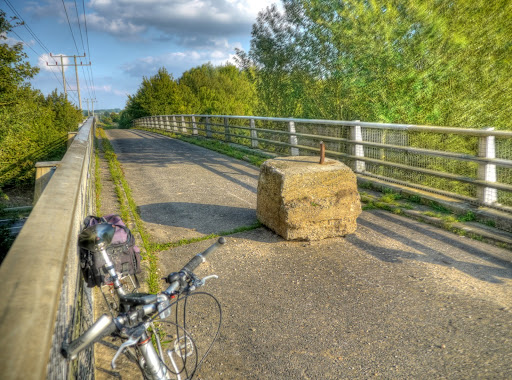
This must have been an important byway as it got a bridge over the A11 - a dual carriageway it crosses at Worsted Lodge. There are many paths that don't have bridges over large main roads. I wonder what the criteria is for building a bridge or not and who decides it. There were two reasons I took this picture - you can already see early signs of autumn. The leaves are already going golden on one or two trees. The other was the signpost shows that there is a cycle route that passes this way. I assume it shows the route between Balsham and Babraham - although I can't help feeling it is a bit of an orphan route. The Roman Road to Balsham is certainly readily passable, but not what people think they are signing up to on a signed Cycle ride. A quick search on the Internet has not thrown up any references to this as a formal route. I can't imagine that they imply you should cycle along the A11 ( although I have).
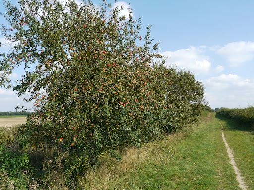
In all I reckon I passed around 10 to 15 apple trees on the Roman Road these apples look to be ripening nicely.
I did not stop to diligently make a photographic record of each and every apple tree on the Roman Road, you'll be pleased to know. However here is another one.
In places the Roman Road seems to be suffering an encroachment and the "navigable" strip has gotten quite small. I had not really noticed this before - I have seen areas where this has been cleared and indeed the Friends do undertake clearing on a voluntary basis, the last reported activity was mowing and clearing the bank opposite the golf course - 21 March 2010. I am sure that keeping the road clear takes a lot of effort. I did pass one or two hedges that looked as if they had been recently sheared - I hoped there would not be any thorns around. They looked as if they had been done by tractors and flails.
The Road undulates and as it rises to around 70m there is a bridleway leading of towards Hildersham in the other direction there is a farm track leading to Gunner's Hall, it is not a right of way, but I believe the whole path is known as Gunner's Way. The is looking North towards Gunner's Hall. This direction is not a public right of way according to the Cambridgeshire County Council Rights of Way Map.
This is the view of the bridleway towards Hildersham - a grass track but nice to cycle along.
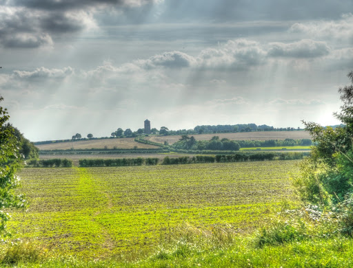
A bit further along the Roman Road, through a gap in the hedgerow there are views of the old water tower above Linton. Somewhere in the middle between here and there is the Chilford Hall Vineyard - it is just out of shot to the right, you can see the track leading to it though. I once went to a company Christmas Party there - we had dinner in the Great Hall.
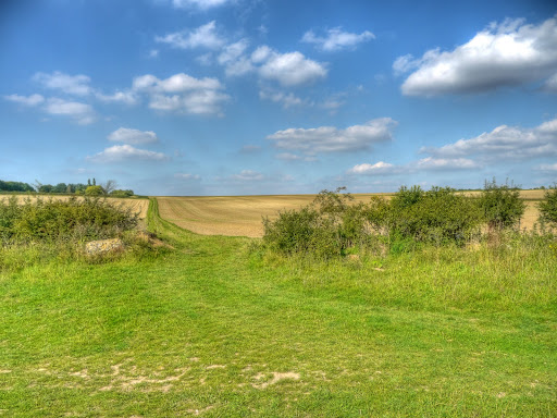
Shortly after crossing the B1052 road between Balsham and Linton I turned off towards Balsham along the Icknield Way path another byway which becomes a road into Balsham (Woodhall Lane). It brings you out on the East side of Balsham and you can find the continuation of the Icknield Way by heading to the West side and turning off in a Northerly direction first along Fox Road and then it becomes another byway. In this picture, not too far from Balsham, the "tree" in the middle of the picture is an apple tree. The ruts caught me out a bit on this track. They are quite deep and one edge caught my pedal - but I managed to stay on and cycled in the middle of the track after that.
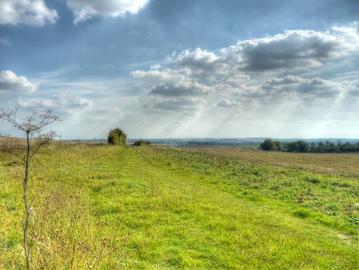
Although it does not look steep this picture was taken at around 100m above sea-level it drops to around 80m (but then climbs back up again.
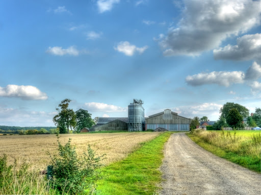
For regular listeners of the Archers here is Grange Farm - not really - I mean it is Grange Farm, just nothing to do with The Archers.
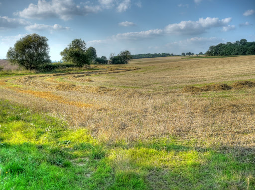
As you can see there was a bit of climbing after passing Grange Farm. In the middle there is a byway to the right that takes you to a road between Balsham and West Wratting. One of the advantages in looking at a route after you have cycled it is that you see new places to explore on future rides.
And yes - there were quite a few apple trees along this byway as well, probably another 10. The byway went past Green End Farm and crossed Six Mile Bottom Road before heading down towards a pumping station. This bit of track was probably the most bumpy - its only saving grace was that it was downhill - not that I dared get up too much speed.
I took this picture alongside the Pumping Station, Carlton Grange New Wood is to the right and in the centre is Cherry Bush Wood.
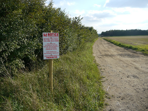
There were other apple trees on the byway - but no pictures. After returning to the road to Dullingham and turning right along Station Road, over the railway line and up the hill (20m of slope) I passed this unusual sign at the entrance to a farm. Am I just paranoid or are there some farmers who really do hate the idea of people enjoying "their countryside". Funnily enough there are no footpaths in the area as well - what a coincidence.
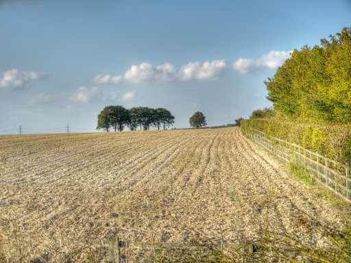
My route then took me in the Swaffham Bulbeck direction but after riding along the A1303 for a brief and unpleasant spell on a busy road I turned off along a byway again. This was probably the second worst surface to cycle along - but also downhill to a "farm bridge" over the A11 carrying the Heath Road, another byway. This link shows the bridge from the A11. After crossing the bridge I stopped for a drink and took some pictures - well it would have been rude not to! This one was to capture the group of trees at the top of the recently ploughed field - a shame about the pylons in the shot. If you don't like them then the Campaign for Rural England has just the campaign for you.
The view of the bridge from the Heath Road - someone conveniently arranged somewhere to sit, in the middle of the track.
After that I headed down towards Great Wilbraham on a byway called the Streetway and then back to Cambridge. There is nothing like roaming the byways on a sunny warm day.
Great Stuff! I'm writing a book set in the UK during Roman times so your descriptions are perfect for me to capture what my characters would see traveling across Britain 1500 years ago. Thanks a lot!
ReplyDeletehttp://roundtableprojectmanagement.blogspot.com/