
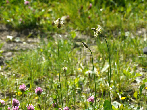
The bumpy bridle path that I had been on came to a small wooded area with a convenient bench to sit on. So I stopped had a drink of cold lemon squash and took a picture of this Ribwort Plantain - Plantago lanceolata. This is a standard one-shot picture, I tried taking multiple exposures (for recombination as an HDR picture) but the stalks kept moving in the breeze. As a boy we would use these as "guns" by looping the stalk around itself, about halfway up and then pulling the stalk so that head moves back towards the loop and it would "shoot" the head off. I know not very impressive - but hey at least we made our own entertainment. (I never lived in a paperbag though!)
The last longish ride had been along the wet and muddy Roman Road near Balsham. It had been so muddy that my brakes were clogged up and the mud acts like a grinding paste wearing the brakes away really quickly. A good job I had adjusted them before setting out on this ride. Although I was not wearing my helmet - since most of the route was on-road I did barrel down this dark path into the woods - it looked steeper if you were there. In fact I think that living in the Flatlands is seriously affecting my perception of what a hill is - this is not a hill! It was fun though.
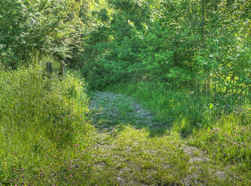
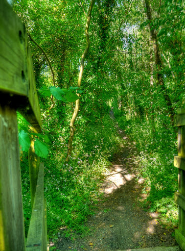
This picture was taken at the bottom of the "hill" looking back through the woods from where I had come. Its real attraction was that it was a narrow path in the dark woods leading to a wooden bridge over a mighty river small brook - Bourn Brook (sorry got a bit carried away there).
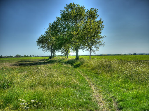
The vista opened up with a few small trees showing the way to wide open countryside after the bridge over Bourn Brook.
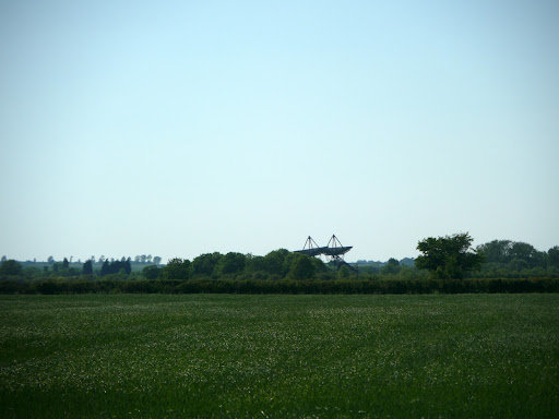
To the right of this "plain" were a bunch of Satellite Dishes and I don't mean the sort of things you see on rooftops and house walls. I mean Satellite Dishes. These dishes form part of the Mullard Radio Astronomy Observatory (MRAO). Some of the telescopes are at fixed intervals and some move along the track bed of what was once the Cambridge to Bedford Railway Line - the Varsity Line. Martin Ryle pioneered the use of synthetic aperture astronomy using arrays of movable dishes. Essentially a number of small dishes can be made to perform like one really (infeasibly) large dish and so give better "visibility" into the Universe. Apparently they also have a System here built using the same principles but with telescopes operating in the visible light spectrum and that use light pipes to combine the images.
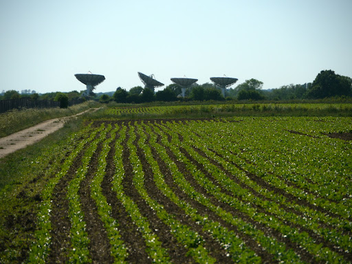
There are quite a few dishes on the site, doing various different tasks - they seem to be a bit random in the directions they are pointed.
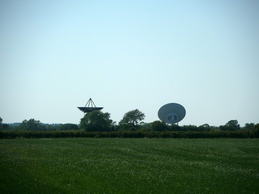
I am not sure why but I took pictures of all the dishes I could see. The MRAO is to the right hand side of the track and on the left is Cantelupe Farm. When checking the Web to see what history there might be for Cantelupe Farm (did they grow them for instance. I came across a mention in the Cambridge Cycling Campaign FAQ section. On the OS map the road I took is shown as a byway but there is also a private road from Grantchester (only to be used with written permission from the farm Owner).
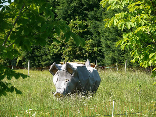
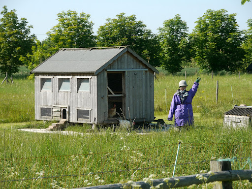
The track and public road down past the farm are delightful for cycling on. I passed other cyclists going the other way - it certainly seems peaceful despite the proximity of the M11 on one side and the A603 on the other. I passed this "pig sculpture" next to a Hen Coop.
The Hen Coop - with a friendly wave from the "farmer". I wonder if it will play a part in the Haslingfield Scarecrow Festival in September 2010? The Scarecrow website has a history page - apparently the village was not connected to mains services (sewage and piped water) until the 1960s.
I soon reached Haslingfield where I am sorry to say I got lost. It is tempting to think that these small villages are so small you don't need to check the map. I went up the Harston road instead of the Harton Road - what is an "S" between roads?
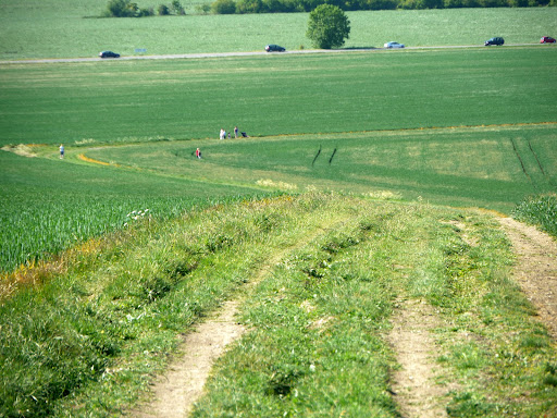
The route out of Harton I had chosen was along a track called Whole Way. It neatly avoided the A603 (an old Roman Road) which is quite busy. the track climbs up a hill toward Barrington - on the map it is called Cracknow Hill and reaches all of 69m - so not difficult really. Mind you when you live in the flatlands even a small hill has some good views. This picture is taken looking back down the path from the "top". You can see there were quite a few cars speeding along the A603 in the distance and a few people out walking along the Whole Way track.
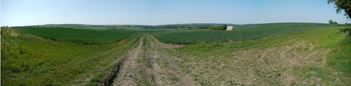
This is a picture made up of 4 pictures taken from the top and taking in around 160degrees, which is why it looks a little strange. Not a cloud in the sky though.
The next bit of the track was a little more rutted and headed down between some trees towards Barrington. Where unfortunately I once again did not check my map until reaching Barrington and I realised I was supposed to be in Orwell. So I had to backtrack a little up the road (and hill) towards Orwell.
is this Ontario? i never knew somewhere this beautiful existed!! :D
ReplyDeleteSorry - it is near Cambridge England. :-)
ReplyDelete