
When my Mum came to visit a month or so ago we generally went out for a walk most days. She turned down my offer of going out on the Tandem. Since neither of us is into shopping we tended to head for more picturesque places to visit. One of the places we did visit was Bury St Edmunds where we visited the Abbey Ruins. To make the car journey more picturesque I took the route that I would normally cycle. (I would say sorry to any cyclists out on those roads that day - but there weren't any). Whilst en-route I noticed that it looked as if the Sustrans 51 had been signed between Newmarket and Bury St Edmunds. Previously Sustrans Route 51 has only had signage from Cambridge to Newmarket. At the time I thought it would be good to go and check out the route.
Judging by the differences between the Sustrans Map and the OSM Cycle Map there have been some challenges plotting the route. The OSM Cycle Map appears out of date and incomplete and the OS Map has yet to show the cycle route at all (from Newmarket). So my plan for the day was to get work done as soon as possible with an early start and then head out with some water bottles full of lemon juice and ice, a packet of jelly babies and some money in order to catch the train back from Ipswich. To make it more interesting I did not take anything showing the actual Sustrans route - I just followed the signs on the road. This was partly because I did not set off until 11.30am and partly because it adds to the adventure. (I did have my Garmin GPS if I really got lost and if that failed my phone also has GPS - so not quite like wandering into the unknown - but my legs would pay the price of any mis-navigation.)
The warm weather allowed me to cycle in sunglasses, shorts, sandals, t-shirt and a windproof and I carried a pair of leggings along with pump, patches, inner tubes and a multi-tool and of course my camera. I figured that if it rained travelling light was easier than with waterproofs as well. . Cycle clothing does tend to dry pretty quickly. I am not a great fan of Lycra - but it does have its uses. Oh yes - I also took a front light (and the bike also had a rear light) - just in case. Without actually working it out I assumed that the ride would be around 120 - 140Km (75 - 90 miles) depending on whether I caught the train all the way back to Cambridge or got off early for a bit of extra cycling. I also tend to allow myself an average of 20Kph / 12.5mph - not at all fast - but it is easy to calculate how long I will be on the road and with stopping to find the route, take pictures and eat and drink it works out to give me a small safety margin as well.
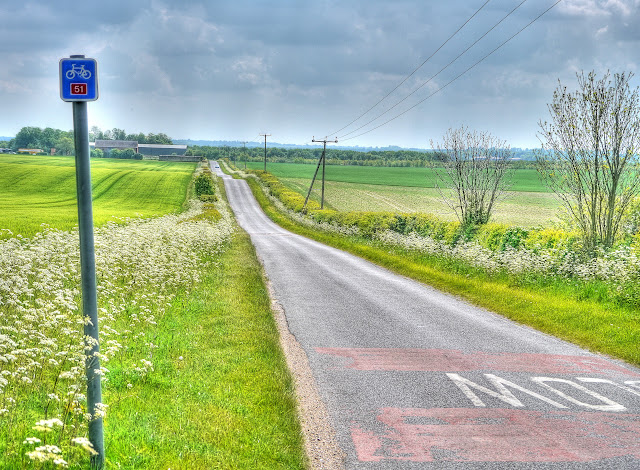
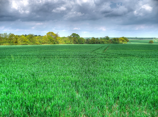
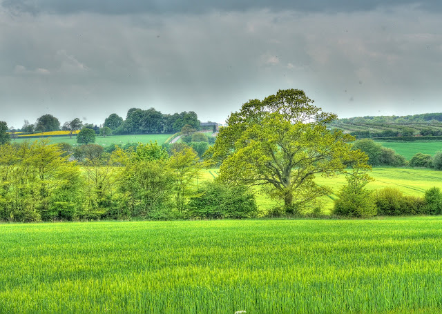
As I have taken pictures of much of the early section of Sustrans 51 Cambridge though to Burwell I did not stop much - although I did follow the detour from Swaffham Prior to Reach to Burwell - although there is a shared cycle path between Swaffham Prior and Burwell and the shortcut would have knocked some distance off the journey. I took the first photograph on the Heath Road between Burwell and Exning - although it is a country road some cars will whizz by very quickly. There are also occasional lorries because there is some warehousing - which you can see to the middle right of the picture. I have not found the lorries to be an issue compared with high-speed cars though. There are a few houses just behind the spot at which this picture was taken and they presumably suffer from high-speed vehicles as well judging by the painted "SLOW" on the road. At this point the Sustrans signage has been excellent with route markers and sign posts with distances on them in places.
The route after Exning takes a path through the outskirts of Newmarket (which is good because the Exning Road is not pleasant to cycle along. At this point I tend to take a more direct path through Newmarket and head for the Moulton road near the top of the town. If you look at a map you can see it is easier to remember and so I cannot say whether the route signage in Newmarket is ok or not. I find the Sustrans routes can be trickier in towns because the signs have to compete with all of the other signage and you have to pay far more attention to traffic and quite often they snake around the back streets leaving you uncertain just what direction you are heading in.
The Sustrans route out of Newmarket is the Moulton Road - and takes you up the first hill - a sign that you are leaving the Flatlands of the Fens. According to Google Earth the climb is from around 33m to 85m - this is it. It is quite short and if you cycle along here in the morning you will see racehorse being exercised. If nothing else Newmarket is famous for horse-racing. There are also some magnificent houses dotted around as well - many forming the basis of the Studs where race horses are bred and trained.
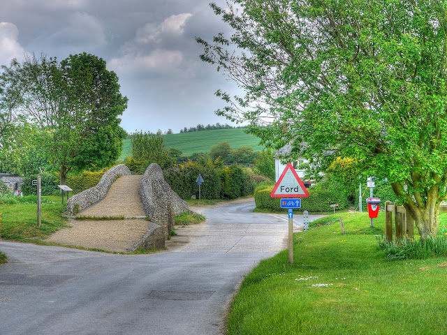
I like undulating countryside for cycling - you never find yourself cycling up for very long without a down to compensate. (Unlike cycling for 20-30Km upwards in India - it was relentless.) After a brief climb out of Newmarket then the road descends into Moulton where after crossing the main road you come across this old Packhorse Bridge across the River Kennet. As you can see the cycle route continues to be well signed. I have visited Moulton quite a few times and never ever seen the road flood - although if you want to cycle through a Ford there is one further up the village which has always had water in it when I have been through it.
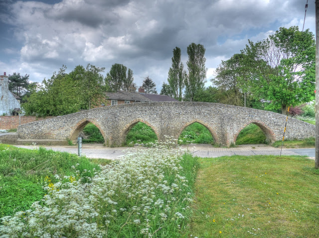
A side view of the 15th Century Packhorse bridge. Apparently the sides were kept low to prevent impeding the horses and mules slung with goods. This road was the main route between Cambridge and Bury St Edmunds at one point.
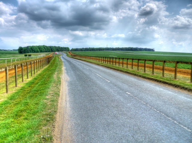
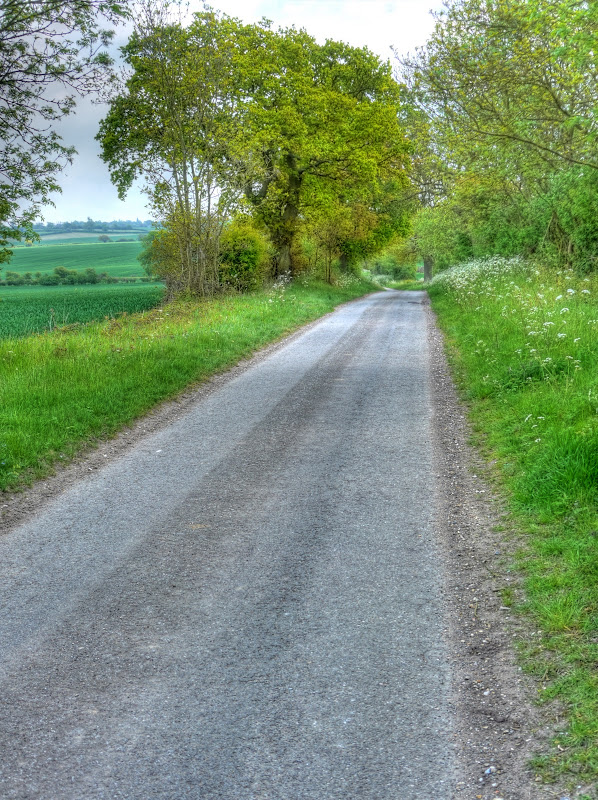
The road then climbs quite steeply out of Moulton from about 35m up to 90m. The road is narrow and a bit of care is required as cars come down quite quickly and then is not much room even for a bike to pass a car. The next village along is Gazeley and then after a right then left through Gazeley the Sustrans route leaves the small road for an even smaller one. The views are wonderful and I did not meet any other vehicles for the next few miles/Kilometres - just a couple of people walking. This view is form the smaller road and you can see the course of the larger road - it follows the hedgerow. The larger road is the Higham road - although the smaller road seemed to be a more direct route to Higham!
Although the lane was little used the road surface was good - better than some of the country lanes I have been on. It was so quiet that I stood in the road to take some of the pictures.
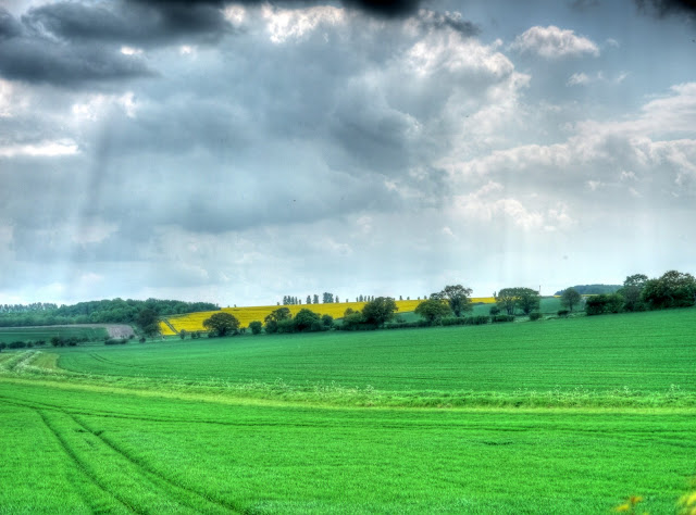
On my way to Higham I stopped to take a picture of the Oilseed Rape in the field on the ridge. According to Wikipedia the church is one of 38 round tower churches in Suffolk. Next time I must have a closer look. There is a short climb up to Higham and then the route follows the Burgate Road past Denham Castle with Europe's largest Fallow Deer Farm.
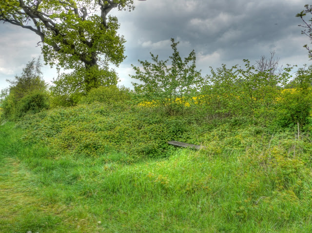
The route then turns to the left and down to around 70m before a 20m climb - look I live in the Fens even 20m is a climb to me. There is a bench here on the outskirts of Denham End near Barrow. It is a good place to stop and have a snack (jelly babies) and a drink. When my son and I cycled in India we took some insulated drinks bottles (CamelbaK Chilljacket) - they are great, even here in the UK it is pleasant to have a chilled drink rather than something lukewarm. I fill them with ice and then add lemon squash and top up with water.
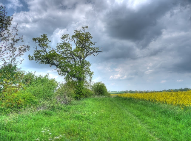
It looks as if the Oak trees around here are also suffering Acute Oak Decline (AOD) - or perhaps they have always been a bit "scruffy" and I have not noticed.
The view from the bench across towards Denham Castle. At the time I took the picture I did not notice the rows of trees or vines in the background. At first I assumed it was a vineyard, but after looking at the website it might be Apple trees. In fact using Google Earth I am sure they are Apple trees.
This is the bench - it is well hidden - but a nice place to sit.
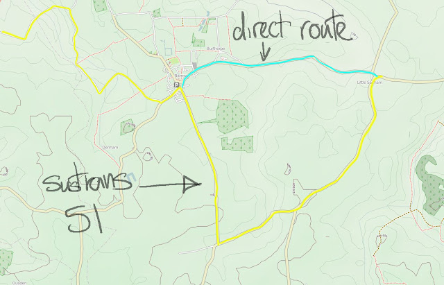
When the route reaches Barrow it detours and I am not quite sure why. I have annotated an OSM map - the yellow track is the Sustrans 51 route - the blue one is the route I usually take.
The "detour" was not unpleasant - there were some nice views - but the more direct route was similar and I did not feel the traffic levels on either route were dissimilar. It could be there are plans to introduce an off-road segment at some stage perhaps. This picture was taken on the "detour" route and there were some picturesque cottages.
After Little Saxham the next stop is Bury St Edmunds - although I would normally take a short-cut this time around I am going to check out the Sustrans 51 route through the town.
You do well not to try follow NCN51 through Newmarket, it's the most tortuous route you can imagine. Did you see the "Cyclists dismount when horses present" signs?
ReplyDeleteMoulton's fords :- the Packhorse Bridge ford floods a handful of times each year, generally after a thunderstorm. The tarmac road called Brookside, on the Gazeley side of the stream, can sometimes be awash too. No more than once a year though. The other ford, by the church, can be very slippery, and I always use the bridge next to it.
Off this route (but I can't find my comment of a couple of weeks ago...) the steelwork for the Reach Lode bridge arrived earlier this week in several pieces and is currently being welded together. After that it has to be inspected -- ultrasonic test of the welds mainly. The crane to lift it into position should arrive during next week (24 May), so it should be put into position end of next week or the week after.
I agree the ford on the other side is slippery. Mind you I almost slipped of my bike on a cattle grid over near Ditton Meadows this afternoon.
ReplyDeleteYour last comment is still there: http://keeppushingthosepedals.blogspot.com/2010/05/road-works-on-horningsea-to-fen-ditton.html#comments
I have added a picture of the Reach Lode Bridge being built by the side of one of the ramps on today's post
---Jamie