
After joining the on-road part of Sustrans 30 the route switched to an Easterly heading, so although the wind was strong it blew across me rather than against me. At this point you can see giant "golfballs", part of an Air base at Feltwell and RAF Lakenheath is only a few miles further South. it is quite common to see large planes along with smaller fast jets patrolling the skies around here. There were a couple flying around as I cycled along. The airbases are actually being used by the US and so the planes were possibly F-15s - although I did not look too closely - there were miles to be cycled. Although I record my distances, speeds and the like in kilometres I still think in terms of miles as a word to describe distance. Whilst looking for information on Lakenheath I came across information on Lakenheath Railway Station. It is described as one of the least-used railway stations in the UK. There is one train in each direction on a Saturday and three on Sundays. The station is three miles north of the village of Lakenheath and despite a population of around 10,000 within five miles it is not within "convenient walking distance". It is amazing how car-centric we have become. Mind you, here in the UK petrol is at its highest price for some time and the numbers of cars on the road has dropped for the first time since the Second World War. The report suggests that this is a blip as the population is forecast to grow by 10 million over the next couple of decades "and these people will need to get about".
When cycling over longer distances my mind tends to ramble - just as I do when actually writing these Posts for my Blog. After passing through the interestingly named village Hockwold cum Wilton the route also passed Weeting Heath - 138ha. of Breckland grass and lichen heath. The "visitor centre is 2.5Km" west of Weeting - I wonder why they chose to use Km - perhaps for continental European visitors?
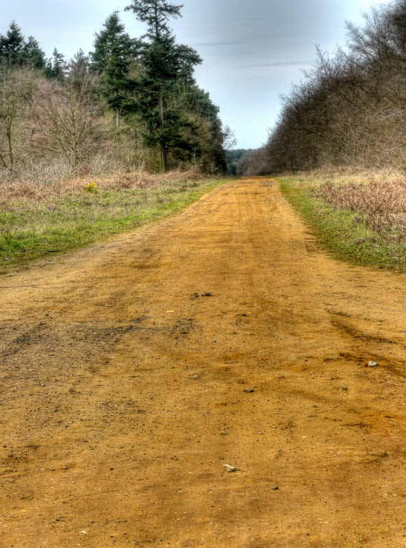
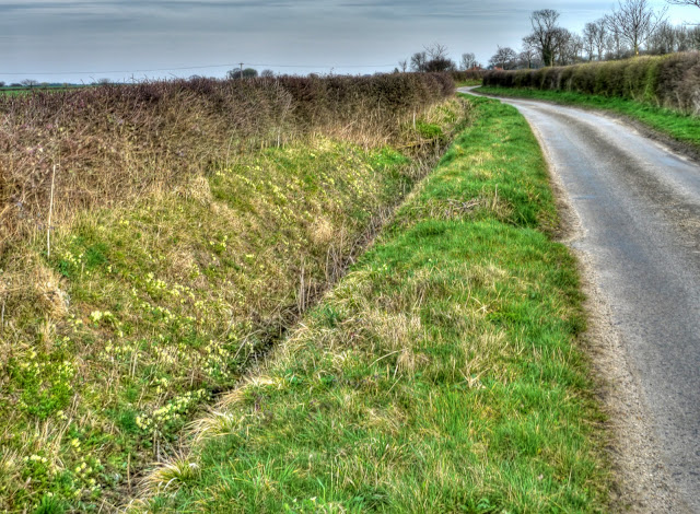
The route (Sustrans 30) continues along a series of rougher and rougher tracks through Thetford Forest. Starting with pot-holed tarmac, progressing to pot-holed sandy tracks through to deep sand - well it felt like deep sand. I did pass some form of snake basking in the sun, it was almost black in colour- but I was too busy swerving at the last minute to avoid it to take note of what it was. When I lived in Somerset you had to be careful up on the Mendips as there were Adders basking. A quick look on the web suggests that both grass snakes and adders can be found in Thetford Forest.
The route also climbs a bit up to the dizzy heights of around 30m - I know not much, but hard work on rough tracks. There were quite a few yellow butterflies (Brimstone) and one that looked like a Tortoiseshell or perhaps a Peacock fluttering around.
The track was quite peaceful, at first, the trees helped to cut the wind, although it does pass quite close to the Norwich/Ely railway line (the Breckland Line) - it is a little strange to hear an unseen train through an otherwise quiet forest.
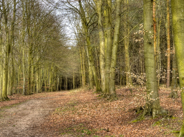
The trees around me were mainly Beech with the ground still carpeted with their leaves from last Autumn (Fall).
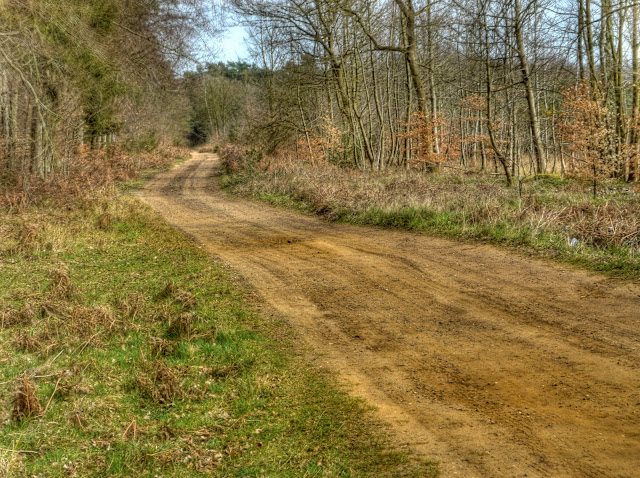
The track does become very sandy. At this point I gave up cycling and started walking - hot work with no wind to help keep me cool. I know, one minute complaining about the wind, the next complaining about the absence of wind - cyclists eh.) I also passed a car driving down this track, why - well they were taking their dogs for a walk, one was the size of a small horse, the other a little Scotty dog. I am always a bit wary of dogs in the wilds when cycling - but even more wary when walking and have no chance of hopping onto my bike and speeding off. (I figure that people come to wild places when they have wild dogs.) Neither dog paid much attention to me though. I stopped for a few jelly babies once the ground firmed up.
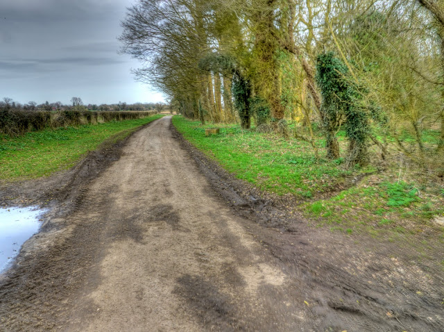
I was also overtaken by a 4 wheel drive, which I then passed as it struggled on the rough ground. I also came across a van that looked as if it were part of a camp. They had a fierce looking dog barking so loudly that it brought them out of the van to see what the fuss was about. (Me cycling past) A good job the dog was tied up I think. After crossing a couple of roads things got easier and the track became a road again, after a short while you start seeing Danger signs in the fields to the North along with warnings about unexploded ordnance. I followed the Sustrans 30 route even when it headed south towards Croxton. I should have gone straight on as this would have been shorter and taken me past the Devil's Punchbowl - an interesting hole in the ground - caused by ground subsidence associated with the limestone bedrock.
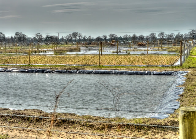
Instead I went past this odd place that looked as if it as either some form of fish farm or a rice paddy farm - or rather a site carrying out research of different types of rice cultivation it looks like this on Google Maps. Using the power of Google Streetview to snoop have a look at the place there are signs for a company called Salix which provides "Ecological Engineering" Systems - quite an interesting company take a look.
The route switches North again where you turn back onto Sustrans 30 just before the village of Croxton along the Hereward Way before going East past some Army camps (Thorpe and Wretham "A") through East Wretham then Stonebridge and then along the route of the Peddar's Way & North Norfolk Coast Path. There used to be a railway line branching from the Thetford line up through to Swaffham.
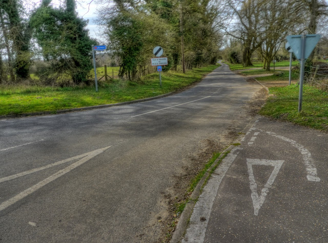
This is where Sustrans 30 emerges onto the Stonebridge road after passing through East Wretham - no military vehicles down here please.
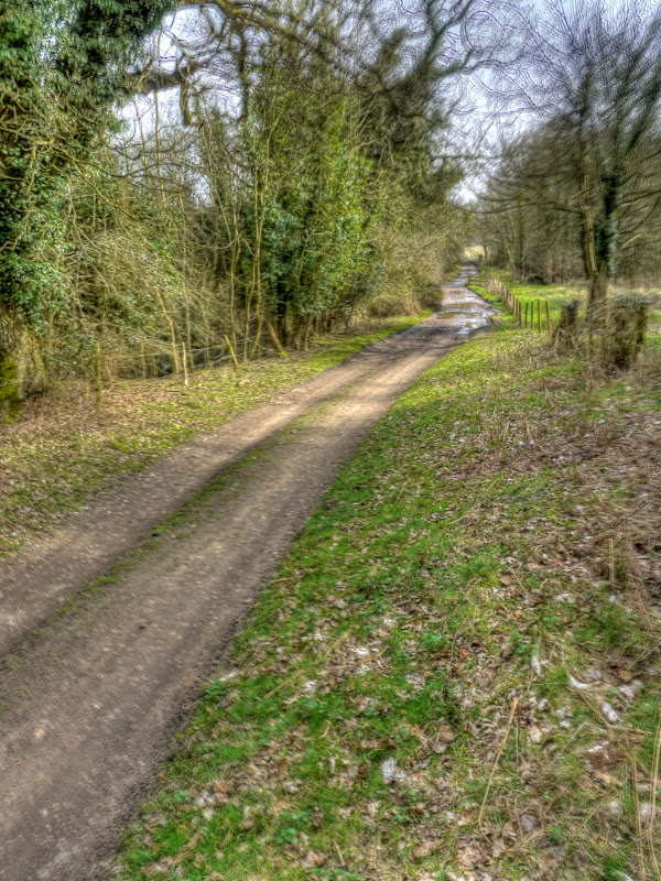
The route quickly leaves the main road heading off down a country lane before turning off along the Peddars Way, here on this bit, it follows the route of a Roman Road. At this point the off-road starts again and it was fairly pot-holed with some deep puddles. Also because it was the School Easter Holiday there were a few other groups of cyclists and walkers around. I tried to cycle around the edges of the puddles, which in places were as wide as the track.
I sat down ate some jelly-babies and drank some more water. So far I had covered nearly 100Km/60miles but I had reached Watton which was not that far from Norwich. from memory 32Km/20miles or so.
As you can see in the picture the path skirts Army training grounds and here a notice warns of the possibility of the sound of gunfire. I was once cycling somewhere in this area and out of the blue heard machine gun fire, my first thought was that there was an armed robbery taking place - although the nearby village did not look as if it had a shop let alone a bank. I then saw MOD signs and realised my mistake.
The Peddars way continues but the cycle route takes this lane towards Thompson where I got lost. This part of the route seemed to have fewer and less prominent Cycle route signs and after meandering around I headed North using my GPS to get me to the next largish town on my route Watton. I ended up on the A1075, not pleasant but only for short while before reaching Watton. Now I have cycled along here before but for some reason was thrown by the lack of signage in Thompson and unfortunately this area was not one of the ones I printed a map out for.
Watton was better signposted and I was soon on my way on Sustrans 13 heading North through some lovely Norfolk countryside. the only problem was my map showing where Sustrans 13 joined Sustrans 1 did not appear to have Watton on the map - how far was it? I was getting tired at this point and just kept pedalling, it was getting into late afternoon and I needed to make progress. Eventually I reached the town of Dereham. I realised that in my mind I had confused Dereham and Watton and so "forgotten" a big chunk of riding North, which meant I would have to head South again as I overshot Norwich. (Dereham lies to the West of Norwich and the Sustrans 30 route continues on North for a reasonable distance.)
At this point I realised that I would certainly be cycling in the dark when I got to Cambridge, a good job I had bought a light... I then realised that my front light must have jumped off the handlebars when cycling "over" one of the large potholes. I must have missed it, either in Thetford or along the Peddars Way. Still the sun looked reasonably ok and when I reached Dereham I had covered 130Km/80 miles and it was around 6pm. Should be ok, but dependant on the track conditions to come. Hum I might have to buy a light on my way if things get bad, unfortunately I had only brought enough money for snacks and a train ticket. I needed to push on and forgo some snacks. Hopefully the roads were not going to get worse. Photography took a back seat (not that I was on my Tandem really). A good job I was heading North though and had the wind behind me - although at this point every extra mile/kilometre North meant the same back South again to reach Norwich. Most of the route was on almost deserted country lanes with a brief off-road section near East Bilney. The track whilst not too bad was hard going - it would be tough if the Marriot's Way into Norwich was like this I would struggle to keep up any pace.
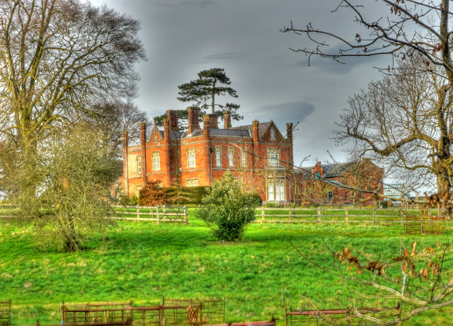
There was a rather nice House on a hill - called Hungry Hill.
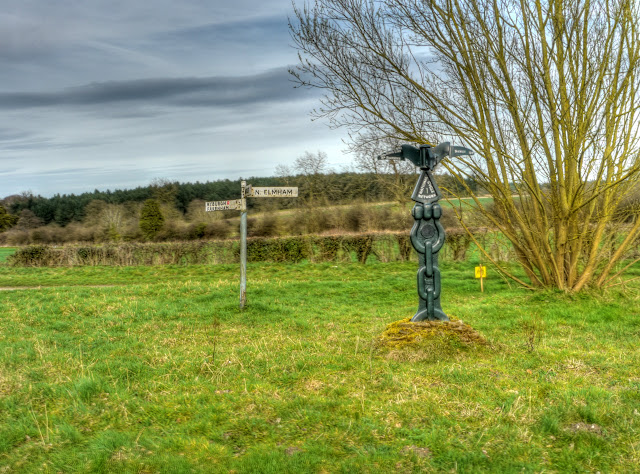
Eventually I reached the point where Sustrans 13 met Sustrans 1 just past Gately. Hopefully the signage would improve although 13 had signs many of them were small square "13"s stuck either side of a signpost to indicate that you had to go straight at junctions. once or twice I was worried I had taken a wrong turn. On this picture you can see how they're are red dots on the signpost - they have numbers on them indicating the Sustrans route. The Large sculpture also had Norwich on the signpost - 24 miles - hum it was going to get dark pretty soon - current distance cycled 150Km/90 miles and counting.
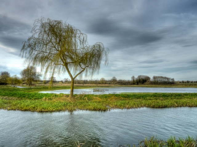
The route carried on going North in places although I did stop to take a picture of this tree by the side of the River Wensum near Bintree Mill, it was at Bintree that it went North again through Foulsham past the route of the disused railway line the Marriot's Way used closer to Norwich.
After what seemed like a lot of Northerly cycling the route turned South-East at Guestwick. Although it was into the wind the high hedgerows gave some shelter. Although I had passed many clumps of Primroses in the ditches I could not be bothered stopping - eventually I did. My last photograph before it became too dark.
Sustrans 1 was better signed although there was at least one missing sign, a good job I had a map for this bit of the journey. As I was passing through one village a Volvo driven by a women would not wait for me to ride on my side of the road, even though her side had parked cars. There was a loud bang she clouted wing mirrors with one of the parked cars. A good job it was not me she clouted with her wing mirror.
I reached the village of Reepham where Sustrans 1 briefly took the route of a disused railway line - it was quite muddy and hard work. My heart sank - I was tired enough I hoped that the last part of the route along the Marriot's Way was not going to be as bad, or maybe even worse. At Reepham I was dehydrated and bought some drinks and a Cadbury's cream egg - well three actually - they were 49p for 1 and £1 for three a bargain and I needed some sugar for energy.
Just outside of Reepham at the site of the Whitwell and Reepham railway station I saw signs for Sustrans 1 -but pointing the wrong way so carried along the road after a short while I realised I would have to go back. You have to turn right along the side of the track and then double back towards Norwich. The path was not too bad but it was getting dark and with trees on either side it was made darker still. Near the old railway station two youngish girls asked me where they could get picked up - they had walked from Norwich, my heart sank again when I heard that it was around 12 miles to go!
The route of the old line follows the River Wensum, occasionally detouring where it crossed roads. In the main the path was ok, a little sticky but despite the darkness it was not too difficult to stick to see the puddles - that's the benefit of eating carrots when you are young! In places there were dog walkers that I had to slow down for and some cyclists, without lights as well.
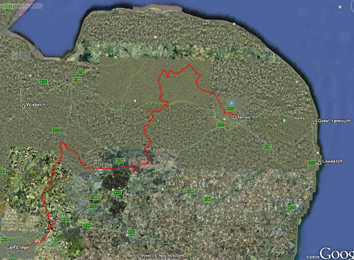
Once I reached the end of the path things became tricky, even with a cycle light it would have been impossible to see the Cycle signs easily. Perhaps that is why some cyclists use both a handlebar mounted light and a helmet mounted torch. The trouble with the off-road cycle paths is that they generally are not well lit . At one point I stopped and asked another cyclist where the station was and he gave me concise and accurate directions. Phew - was I glad to get to the station, I bought a ticket and stocked up on some more drinks - in the end I had 6 litres of fluid, two bag of jelly babies and two cadbury cream eggs. My wife picked me up at Cambridge station, I did not want to cycle in the dark without a front light on the roads. With the delay for the next train, I had only just missed the 8.15pm and so I got home around 10.30 - around 12 hours after starting out, the total distance was around 200Km/125miles, 50Km/30miles further than anticipated. You can see from the red line the route I took was rather indirect. The sustrans Routes are generally optimised to be picturesque rather than fast and direct. The signage is a bit patchy in places as well. I am glad they exist though - next time I will be a little more careful in the planning stage and take note of the road/track surfaces. Next time I will give the route through Thetford a miss - it is was too sandy and hard work in the middle of a long cycle ride.
Oh yes - the last 24 miles was more than 30 miles! Next time I will stick to plan A and catch the train to Norwich and explore the Marriot's way in a more leisurely way.
No comments:
Post a Comment