
I got caught in torrential rain and hail when I cycled around Cambridge in a largish loop - so with the recent more sunny weather I took the afternoon off and cycled around the wrong way (well the other way to the last time) taking more pictures and the last time. It was raining and hailing so hard water seeped inside my waterproof jacket and gloves and even if my camera had been waterproof I would not want to have taken my gloves off to take pictures. In fact I took so many pictures that I split the Post into two, because the Zoundry off-line editor seems to have problems rendering the pictures if there are more than about 16 in a post. Which makes it hard to write the post if I can't see the picture in question.
(I tend to dump my pictures into a directory, combine any HDR multiple exposures and then use Picasa to checkout which ones I like. I then export the pictures after a bit of tweaking/cropping/straightening into a new file. I then open a new Zoundry Post page and copy the entire set of pictures into it. I then reduce each picture to the right size (600pixels) for the Blog and add a border. I then put some dummy text between each picture (Tx - in Arial Teal) and centre each picture. I add a title and then Post a draft of the Post. This then downloads each of the pictures onto my Picasa picture archive from which the Post actually references the picture. I then add the text and publish the Post for reading. I find this way of working seems to minimise any hassle with HTML.
This path is part of Sustrans 51 from Cambridge to Burwell, it is a shared use path and quite well used. It is a bit trickier at night though as there are no lampposts, or markings on the track itself. I have noticed that quite a few night time dog walkers will stick led lights on their dogs or reflective collars - very helpful when cycling along there at night - but a bit odd at first because all you can see are red dots of light bouncing along. The bridge in distance on the right is where the Kings Lynn to Cambridge railway line crossed over the River Cam. There is a small wooden bridge underneath to connect Ditton Meadows (this side) with Stourbridge Common on the other side of the railway line. A few years ago I fell off cycling on the wooden bridge which runs under the railway bridge alongside the Cam on a cold and icy day. I banged my head so ended up in Casualty (no I was not wearing a helmet) but got glued together had an X-ray but did not get injured badly. I had a business dinner that evening and got a few funny looks in the restaurant.
You get cows grazing here from time to time - occasionally blocking the path - but they are pretty docile. This path follows the line of a disused and dismantled railway line running from Mildenhall to Cambridge. It joined the main line at Barnwell Junction up on the right. It is a pity that the route was not kept for horse riding/ walking and of course cyclists. It would have been a great route out towards Wicken Fe.

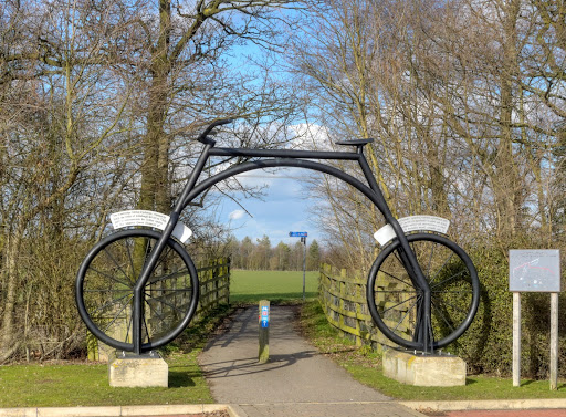
The route crosses Ditton Lane (there is a Light controlled crossing - but it can be a bit slow) before heading along Fison Road and on a tarmacked track on the edge of a field towards Newmarket Road Park and Ride where you pass under a Bike sculpture - shown here. There is a good bit of signage as well - in this case the sign points the way to the City Centre. A bit of care is required navigating the P&R site - and then the path arrives at the Newmarket Road. Here there is also a shared used path which I always use. It is not fantastic, but is much easier than cycling along the road. It is what I call a tidal way path and is used by cyclists commuting into Cambridge in the morning and back out to the villages in the evening. If you are with the flow it is fine - if you are against the flow then a bit more care is required.
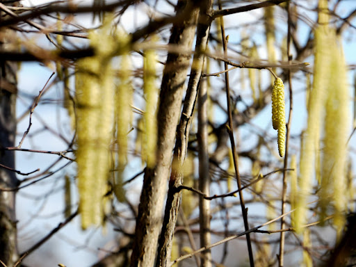
Nature waking up after the Winter - catkins. I went to a village school down in the Mendips with two classes, two teachers and around 60 pupils. The Head was keen on nature and we would be encouraged to bring in flowers to put on display. Of course at this time of year there would be catkins. We also used to have flower tests each year - lots of different flowers were put in jars around the classroom and we had to go round writing their names onto a piece of paper. I used to be pretty good - but I have forgotten many of them now.
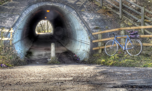
The Sustrans 51 route avoids crossing the A14 by road because a tunnel was built connecting Newmarket Road with an old road through to the Quy Mill Hotel. This is the view back through to Cambridge. Once again a bit of care is necessary as the far end has quite an abrupt turn and on this side there are vehicles on their way through to the Hotel.
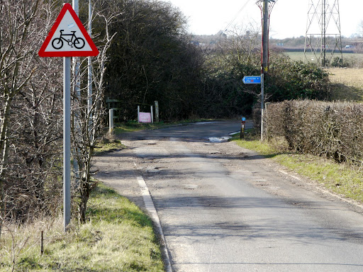
There are signs warning motor vehicle drivers but the road surface is also quite bumpy. Just down by the far red sign it looks as if a car has smashed into the fencing. Once again good signage - Cambridge is 5 miles away at this point.
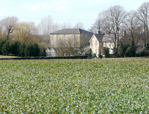
Quy Mill Hotel - a 3 star hotel set in 11 acres of land based around a watermill. They also have a Health Club. I have been to a few things there (company meetings and a birthday party).
This part of the route also has the benefit of Lampposts and runs alongside the A14 dual-carriageway.

I am note sure what the status of the road is - but there are one or two potholes on the way, generally they get fixed though.

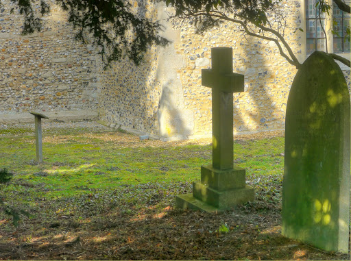
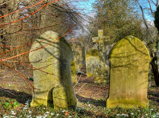
The route crosses over towards St Mary's Church - Quy with another traffic light controlled crossing. This one can take ages to stop the traffic - but you have to be careful as the traffic can be whizzing along at this point as the road is a spur of the roundabout junction between the Newmarket Road and the A14. I took quite a few pictures of the graveyard - the range of dark and light was huge so it was a good chance to try out the HDR results. This picture was almost just black and white before combining the different exposures. It also gives an interesting soft quality. Actually the place is called Stow cum Quy as it combines two settlements.
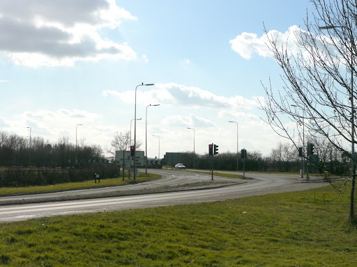
The A14/A1103/Lode Road junction complex. The roundabout is further down these lights control the traffic from the Quy and Bottisham directions. It can be quite jammed in the morning rush hour as the traffic is also held up at the roundabout as cars drive in off the A14 on their commute to Cambridge.
Another view of the Graveyard - a wooden cross in the foreground.
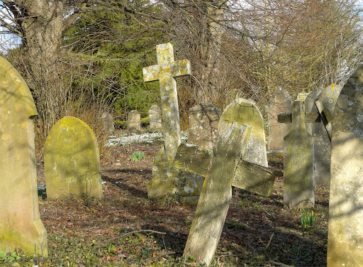
Yet another picture of the graveyard with snowdrops in the foreground.
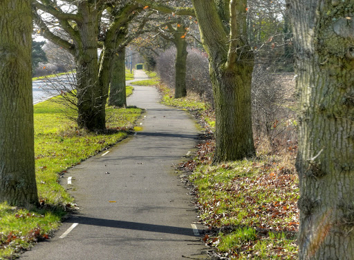
After Quy Sustrans 51 follows a shared use path - basically the pavement that has been called a shared path again. Councils are happy to criticise cyclists using pavements illegally and then happy to claim credit for all the cycle paths they have created by naming a pavement as shared-use. Small wonder cyclists get a bit confused. This has white dotted lines along it - which is good for cycling at night and these trees form a natural chicane. Personally I prefer to keep the trees - but would like to see wider paths were possible.
The problem with these types of paths is that when they cross side roads, generally the bicycle has to give way. But cyclists hate to lose momentum - it costs energy and is very tiring. Here is a building that was called the Prince Albert pub - but after a period of disuse is being renovated and to be called the Missing Sock. - they aim to provide a "special brand of hospitality". I hope they will have some cycle racks for cyclists to lock their bikes up to. Beware the windscreen glass just to one side of the cycle path Give way sign.

To be continued (the photography of the cycling loop that is.)
No comments:
Post a Comment