
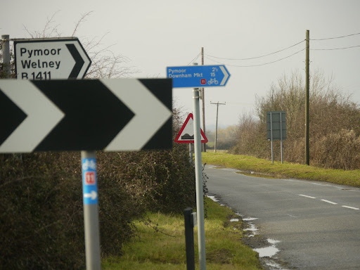
The Sustrans 11 route out of Ely drops down to below 10m and follows a moderately busy road the B1411 to Little Downham, although the Sustrans website shows an alternate route in development along a smaller road/track called the Downham Road. I must try it out when the weather is a bit better. Little Downham is also on a hill almost as high as Ely so there is another small climb up into the village where it continues along the B1411 to Pymoor and Welney.I mentioned that standard of Sustrans signage - they not only indicate the route number but in this case the towns and distances as well. Very reassuring when you are on a bicycle - but they must assume that cyclists have better eyesight than car drivers!
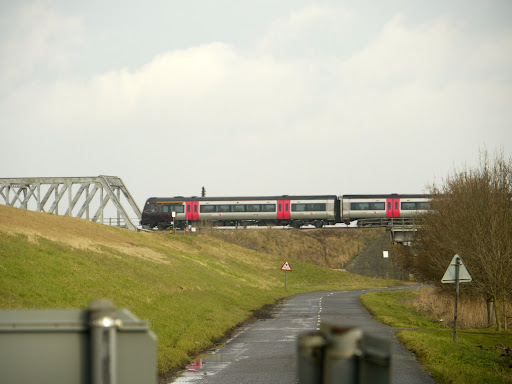
The road runs alongside the New Bedford River (or Hundred Foot Drain) and passes under the Ely to Peterborough railway line. Ely is well served for railway lines despite the small size of the station. with services to Cambridge, Kings Lynn, Peterborough, Ipswich and Norwich (and of course beyond). I travel to Manchester a couple of times a year and there is a very convenient direct train from Manchester (Oxford Road) to Ely - much easier than driving.
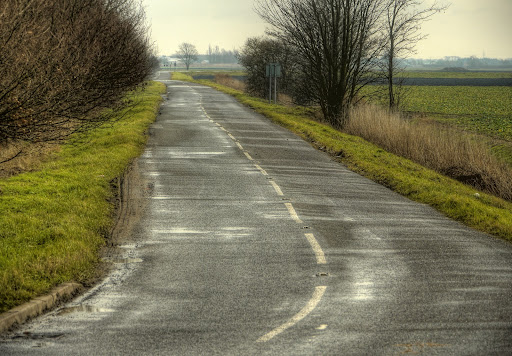
Despite this being a B road there was hardly any traffic at all on Friday, it was lovely to be away from the noise of cars and lorries. There were some fighter jets flying around from time to time though. Although they were flying quite high they seemed to be flying with after-burners on and so making a huge amount of noise.
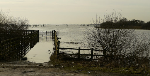
The route then heads close to Welney and Welney Washes where it briefly joins the A1101 (again not too busy, although busier than the B road.) It is is a natural flood area. The A1101 has signs alongside the road to indicate how deep the floodwater is. At this point the Sustrans 11 route leaves the A1101 and passes alongside the Welney Wetland Centre on an unclassified road. This is looking south near the A1101/Country road junction.
The road is on the right below the bank of the New Bedford River - seen here looking towards the North. The washes are actually called The Hundred Foot Washes.
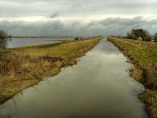
The route then heads east to a place called Ten Mile Bank - a group of houses on a crossroads. Where a bridge crosses the River Great Ouse. At this point the route turns left (North) and heads towards Kings Lynn. I normally cycle on the route from the south direction which is more direct from Ely and Littleport (known as the Fens Cycleway - Southern Loop on the Sustrans map). It is a small road which follows the River Great Ouse from Littleport. There is a main road the other side of the River, the A10 which syphons off all but the farm and angling traffic.
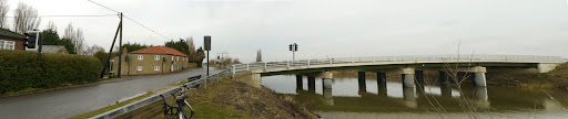
This is a composite picture made up of three photographs of the cross roads and bridge of Ten Mile Bank. With my bike in the foreground. I often stop at this point to drink and eat. Did I mention that I had brought some Jelly babies with me on this ride - but of course. I stopped to eat some as well. A pity I had forgotten to bring anything to drink.
The route carries on North up near the River before detouring through Downham Market. Here the Sustrans 11 route wiggles oddly through the town. It is not really odd - it is more a local route good for cycling to school (it passes at least two schools). Here the Sustrans map shows there is a plan to bypass the main road out of Downham Market. It then heads off onto C-roads again, with the river(s) old and new to the left one wiggling, one much straighter. The cycle route then joins with Sustrans Route 1 from Wisbech where the Sustrans map shows it as Route 1. I must check out the Sustrans Road Signs the next time I head that way.
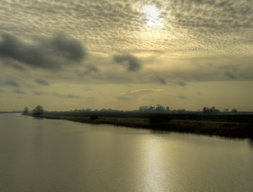
This is a picture looking south down the Relief Channel - quite a substantial chunk of water. You can just make out St Peters Church Tower in silhouette. (This picture and the next were taken from Wiggenhall Bridge.)
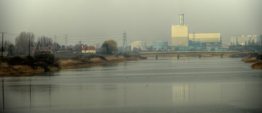
To the North of the Relief Channel is Kings Lynn Power Station - framed by electricity pylons, although these pylons don't seem to have anything to do with the Power Station.
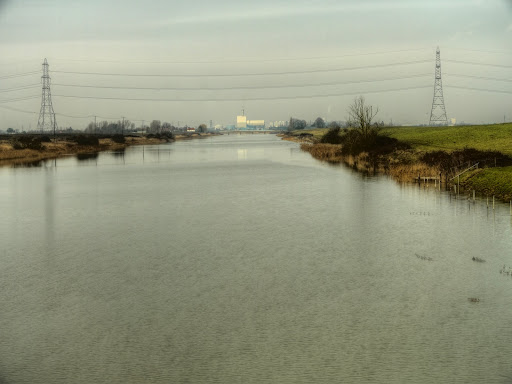
A closeup of the Power Station with Saddlebow Bridge in front. Apparently it is a Combined Cycle Gas power station capable of up to 325MW
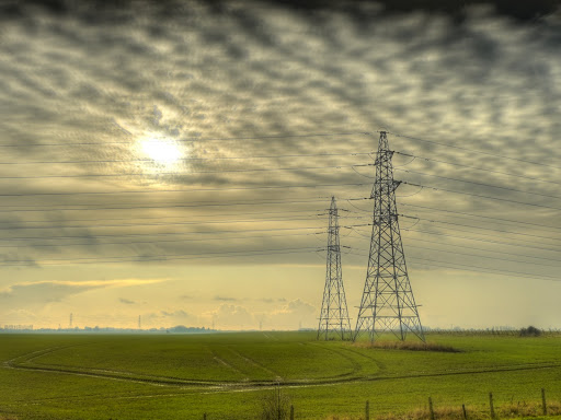
There are pylons coming out of the power station though (not literally though) here are two near the Tail - more to come on that subject. It was the clouds that inspired me to take this picture.
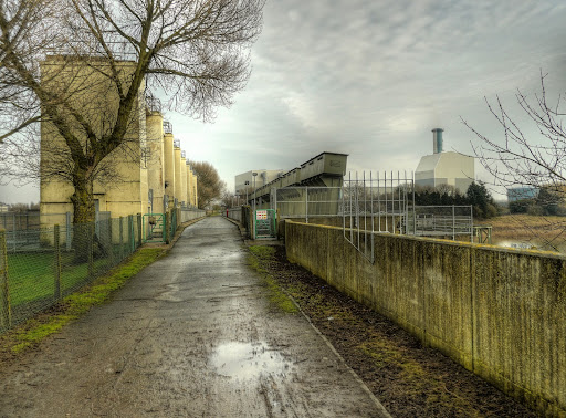
Again Sustrans have done a great job of developing a cycle route, in this case into Kings Lynn. The cycle route detours around the Power Station and then follows the River Great Ouse under a couple of bridge into Kings Lynn. The path is tarmacked and so easy top cycle along.
The path passes this construction known as the Tail on the maps. It is a series of gates used to control the water flow in the Relief Channel. If you walk by a loud voice warns you not to go on the machinery and to stick to the path. There are sensors at each end that trigger the warning. They don't seem to work if you cycle by them above 10mph/16Km/h though. I passed through to take this picture and then headed back to rejoin Sustrans Route 1.
The next stop is Kings Lynn.
No comments:
Post a Comment