
I had a free day on Friday - my wife was visiting her mother and so it was a chance to spend the day cycling. The weather forecast was not too bad, possible rain in the morning, but it was definitely warmer down here than it has been.
With the bad weather and my cycling on very muddy tracks and on the gritted pot-holy roads my Marin has taken quite a lot of punishment. I was going to do a "service" myself, but in the end there was so much that needed doing and I wanted to cycle so I popped the bike into Ben Hayward's "new" cycle shop located at the Notcutts Garden Centre on the outskirts of Cambridge (Horningsea). It is much easier to get my bikes there - they have loads of parking and they can be more flexible about leaving bikes there as they have loads more room. They also have a lot of interesting bikes and kit on display.
It is not going to be cheap, the bike will probably need new rims, brake blocks, chain, rear cogs and front cogs, but it is a good bike, with its flat bars it is good for cycling along rough paths in town and in the country. But it is also quite a fast bike, I have cycled over 200Km/125miles in a day on it without problems.
In the end though I decided to head for Kings Lynn in Norfolk along the Sustrans 11 route. Depending upon how fit I feel and what the weather is like the route roughly follows the railway line between Cambridge and Kings Lynn. So I generally incorporate the train into the journey. The train is also useful backup if I have a mechanical.
The bike of choice was my drop-handlebar touring bike - my Longstaff. As you sit in a more stream-lined position it is also faster than the Marin for longer distances. I normally also find it slightly more comfortable, especially with the Brooks leather saddle, which conforms to my shape. (My son found the saddle a little uncomfortable when he borrowed the bike though.)
I was also interested in whether my GPS, (Garmin Edge 605) which has been reporting low battery levels on switch on would work over the duration of a longer cycle ride. Garmin have suggested getting it repaired and quited around £80 which is cheaper than a new one, but I still have my suspicions that the problem is a "software" problem so this trip will help me make up my mind what to do. I am also wondering whether to upgrade to the Garmin Edge 705, which has a more accurate altimeter - decisions, decisions.
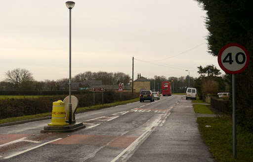
The Sustrans route 11 is a work in progress at the moment there is a branch that follows the Cam but then stops at Waterbeach and another branch from Burwell. The Waterbeach route is waiting for completion of a Connect 2 initiative. I took a more roundabout route on Sustrans 51 up through to Swaffham Bulbeck and then down to Lode on a shared use cycle path. This picture is taken of the approach into Lode. Note the van blocking the pavement/cycle path. There is also traffic calming here along with a 40mph speed limit. It is not unusual to see damage to the islands in the middle of the road. It would be interesting to know how many accidents occur at this type of Traffic Calming island and then compare it with the reduction number of accidents predicted by putting in place such traffic calming.
I am not a great fan of traffic calming as it seems odd to try to make the roads safer by putting "arbitrary" blockages in the way. I have seen cars overtaking and have to "overtake" the island as well. I do wonder whether it was deliberate or accidental. The other aspect I don't like is that when cycling on the roads these road restrictions can make motor vehicles seem even more threatening to slower moving traffic such as cyclists. In my experience cars do not really start to slow down until they arrive at the speed limit sign. So if a cyclist is passing the island at the same time you have a motorist responding to the speed limit sign (I hope), taking into account the island, which are not too common an occurrence, and also slowing and trying to squeeze past the cyclist. That is why, I (an experienced cyclist, driver and motorcyclist) use the shared cycleway. I firmly believe that cyclists have a right to the road, but, frankly, I do not trust motorists in their cocooned worlds.
Mind you whilst I am on a rant, it also irritates me that cyclists are "told off" for listening to music whilst cycling - it is "dangerous". Actually it is the distracted motorists that are the danger. However the real noise comes from the cars, buses and lorries as they hurtle along the roads. You'd be amazed at how loud the noise coming from a small car's tyres as at 50-60mph. Actually I think that cars are worse than lorries. Although the lorry might have a louder engine the high pitch of the car tyres is really unpleasant, I can't even hear my MP3 player they are so loud! :-). Car noise pollution seems to be getting louder I think.
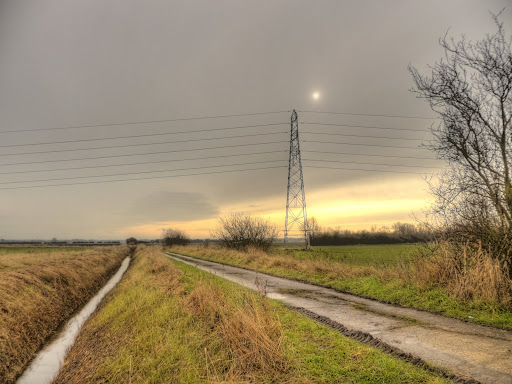
The beauty of the Connect 2 route through White Fen is how quiet it is. This picture was taken on the Lode side at the entrance to White Fen (entrance to the left). It was quite a dull day the sun was barely shining through the clouds.
My route then took me through Upware and I joined Sustrans 11 near Wicken Fen village via Way Lane onto Lower Drove. This is where the beauty Sustrans plays to its strengths. They have found a route from Wicken Fen to Ely that uses a "no through" road and a farm track up to the Great River Ouse which has been complemented by a tarmac path alongside the river for the final stretch into Ely.
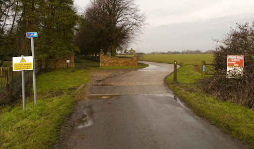
The "No-Through" road passes through Padney and then Sustrans have negotiated a route through to Goose Fen Drive along a Private Farm Road. It has gates/blocks in the road to prevent unauthorised use, along with a gate for permitted cars. The great thing is that the road has very little traffic, apart from farm traffic and I have found the tractor drivers to be very courteous (and safe). Shortly after taking this picture I realised that I had not put on the inner glover on my right hand. So I had to cycle back, fortunately it had dropped off my bicycle where I had propped it up next to the fence. Must check that I don't leave my head behind.
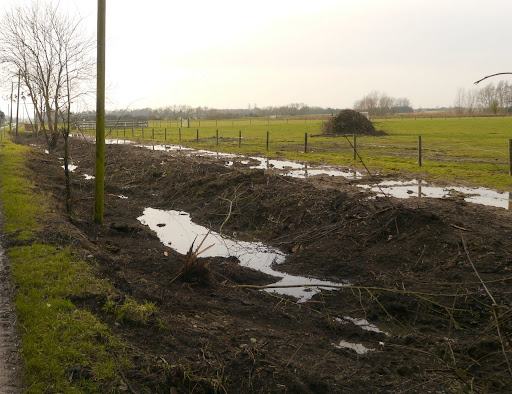
Winter is a time when various incidental jobs get sorted on farms - this last week must have been hedge sorting week. I had to stop and at least take one representative picture. The remains of the hedge appear to be in a pile in the middle of the field. I presume that in this case the important thing is to ensure the drainage ditch is clear. There has been a lot of rain over the last few weeks and some fields are looking water-logged.
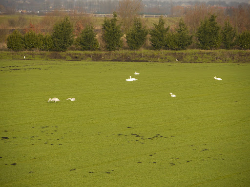
Actually the farm track from Barway through to near Ely was also quite water-logged. You have to watch where you cycle as the mud can get very sticky and you don't want to have to stop if you can help it. I did stop to take a picture of a bevy of swans.
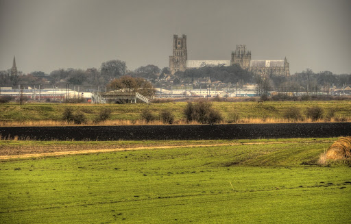
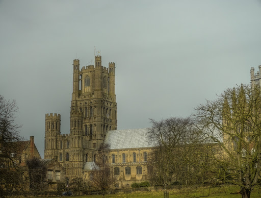
I could not pass up the opportunity to get a picture of Ely Cathedral sitting on the Isle of Ely. The railway station is in the foreground to the left.
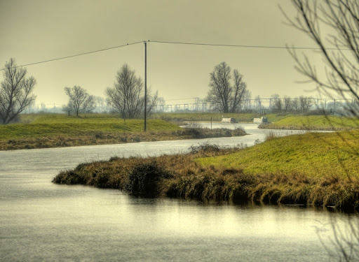
This is the River Great Ouse taken from the Pumping Station by Lode End bridge. It wiggles much more than it looks from the map. there were a pair of cycling sunglasses on the brickwork by the Station. It looks as if someone had put them down whilst stopping to take in the view and then set off without them. I am not the only forgetful cyclist.
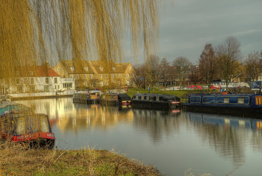
The cycle route end on the A142, a very busy road that can be quite tricky to cross. The cycle route crosses the road and shares the pavement on the other side, before dropping down just after the road crosses the river to follow a small track alongside the river. I generally take different routes through Ely (and to Kings Lynn) but today I followed the Sustrans 11 route. here is a picture taken from the riverside path - Ely is a popular spot for mooring boats. You can rent boats here for holidays as well.
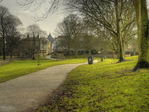
The Sustrans route through Ely goes through a green area called The Park. I am not totally sure whether you can cycle or not - but I generally do if it is not too busy. Here is a view of the Cathedral from The park.
This is the path through The Park it climbs all of 25m
The route then passes through an Archway past the King's School along Silver Street. It is not until you are going along Silver Street that you see a Sustrans sign confirming the way. Well at least I did not see a sign. It is unusual as I have found the signage in these parts to be normally of a very high standard.
No comments:
Post a Comment