
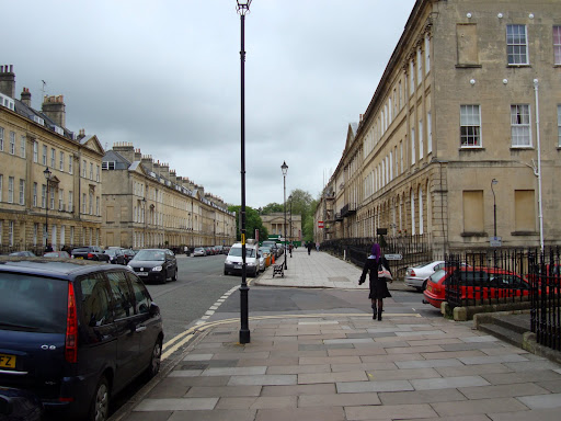
I have spent the last couple of days of the week down in Bath on business and it provided an excellent opportunity to explore other parts of the Sustrans route 4. I have cycled from Bath to Bristol and back a few times now and wanted to check out the route in the other direction. Normally I stay in a hotel called the Queensbury Hotel which is close to the circus. Unfortunately it was full so I ended up in "The Windsor" (their new website is here: Windsor) on Great Pulteney Street - which according to the hotel's website was reputed to be one of the finest Georgian Boulevards in Europe.
This picture does not really do justice to it - but I took it after my cycle ride and I needed to pop my bike back in my car and head home quickly or I would get stuck in the Friday evening traffic on the M25. Why did I take my car you may well ask. I have in the past taken my bike by train from London to Cambridge and then cycled across London and caught the train from Paddington to Penzance (when I cycled from Land's End to John O' Groats). It was not too bad - when I did it then I carried clothes, tent and a sleeping bag. The one snag is that you need to book you bike on the train from Paddington - for personal reasons I was not certain that I would be able to make my visit to Bath at all and so was reluctant to book. Unfortunately that is where a car scores hand's down - I don't have to book and it does not care whether I take my bike or not. I feel that you have to work at using public transport + a bike to get around. Oh and did I mention, the Cambridge to London (and return leg) does not allow any bikes at peak times. Which if I had gotten my timing wrong could have meant hanging around London until 7pm on the Friday.
I am sold on the idea that we need to be greener, I do more miles on my bike than in the car - but the way so-called public transport" is organised here in the UK it makes me wonder whether anyone in government really cares. Perhaps they are all to busy filling in expense claims!
As is usual with smallish hotels they do not have a parking garage - but on the website it suggested that parking was available on the street. It turned out that parking was free from 6pm to 8am and then I used on of the hotels Resident permits - which they let me have for half a day rather than the full day. So I parked around the corner from the hotel and left my bike in the back, covered with a blanket. On Friday morning - the meetings were the previous day as I checked out I asked if they knew where I could find the sustrans Route 4. I know I should have checked either before leaving Cambridge or using my laptop in the hotel, but their WiFi did not seem to work in my bedroom (which was a basement room). So I had to wait until Breakfast to catch up on email and by the time I had done that I was itching to get out and cycle.
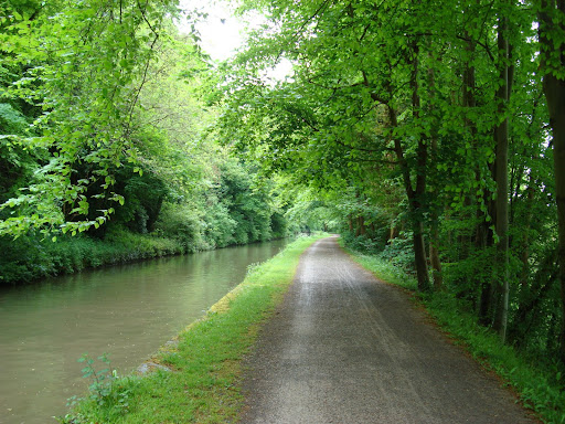
The girl at reception was very helpful, but was dealing with other people checking out so I just headed out. I thought that I would head towards the Bath to Bristol part of the route and then turn around. I quickly picked up the route. Bath has a number of one-way streets but some allow you to cycle along them on special lanes so it was quite a convoluted run. In the end onces I reversed my route I found myself cycling back along Great Pulteney Street, past the hotel. Within a short distance I found myself joining a canal towpath - the canal is the Kennet and Avon Canal - more on that later.
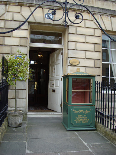
The front door of the hotel - I am not sure whether they offer rides in the Sedan Chair any more.
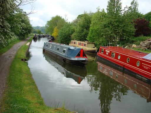
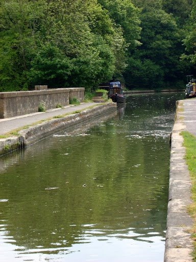
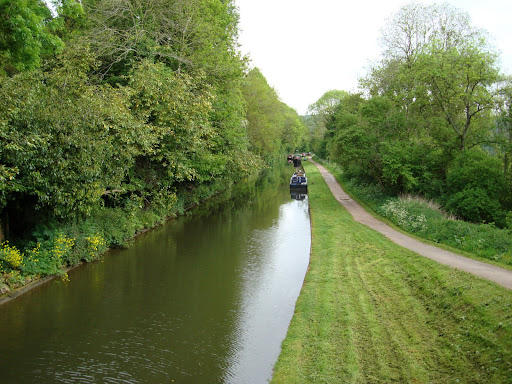
I was surprised at how many boats there were on the canal. In Cambridge there are a small number of boats permanently moored on the River Cam, which you can see as you cycle along sustrans Route 51. Here there was quite a community. It was not unusual to see small children playing and I heard what sounded like a young baby crying as I passed one boat. Some where ornately decorated others looked as if they were in camouflage. Frequently there were bicycles, either on top or on the bank alongside the boats. There were also boats for hire with holidaymakers navigating the Canal.
The track was not too bad, although in parts there were puddles that hid quite large holes. I tried to avoid them, I was using my Longstaff touring bike, and although quite sure-footed (tyred?) on the track it was very uncomfortable if it dropped into one of puddle filled holes. There were quite a few people walking at the Bath end as well some with dogs, so you had to keep your wits about you. As I was exploring it was very pleasant being away from traffic, but not the sort of route I would want to commute along. when you are off to work then cycles and dog-walkers and sight-seers tend not to mix very well.
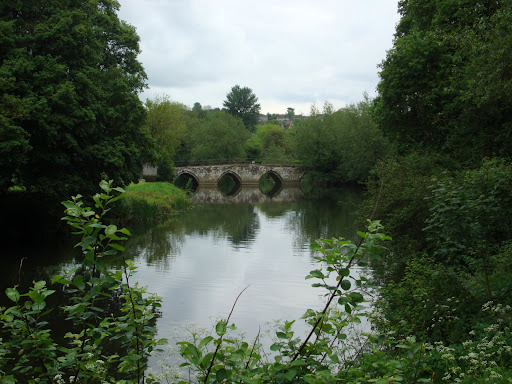
After a few kilometres I arrived at the Dundas Aqueduct, which according to one of the many information boards dotted along the path is one of two that crosses the Avon. Bath nestles in and on a variety of hills and so many of the routes in and out follow the valleys and this valley also contains the River Avon. The canal was finished in 1810 after 16 years of construction and was used to carry Bath stone and coal. Later it was also used to carry sleepers and rails for the construction of a railway, also passing through the same valley. This sowed the seeds for the canals demise and the canal fell into disuse.
In the '60s the Kennet and Avon Trust was formed to restore the canal and it was opened by HM Queen Elizabeth II in 1990. I went to school around 20-odd miles from Bath and when I was in the 6th Form (age 16-18) Wednesday afternoons were designated for sport and other activities. I used to go sailing in a local reservoir and play table tennis. However some of my friends used to come up to Bath and help in the restoration of the canal. I am amazed at what they have achieved, along with all of the other volunteers.
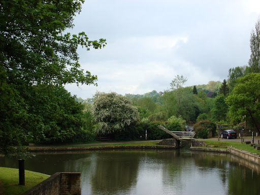
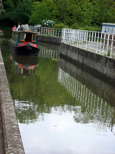
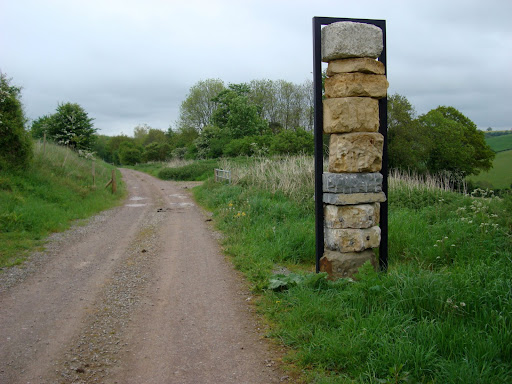
This part of the canal requires the boats to turn through 90 degrees which is shown here. They can also stop and pick up water. The Sustrans Route 4 also joins with Sustrans Route 24 which heads off to Radstock and beyond. Ass I passed I decided that I would cycle along 4 to Bradford Upon Avon and then return to this point and cycle to Radstock and back before returning to Bath
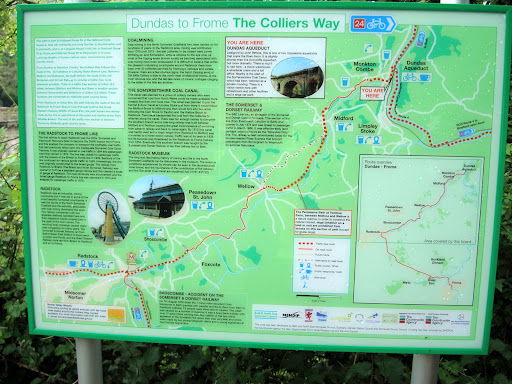
One of the many Information Boards along the way - I find that they provide both information and inspiration as it was this one that gave me the idea of popping over to Radstock and the Colliers Way, named for the railway line that was built to transport cola from Radstock.
Here is a boat moored on the Bradford Upon Avon side of the aqueduct. Even for the narrow boats it seems to be quite a tight fit.
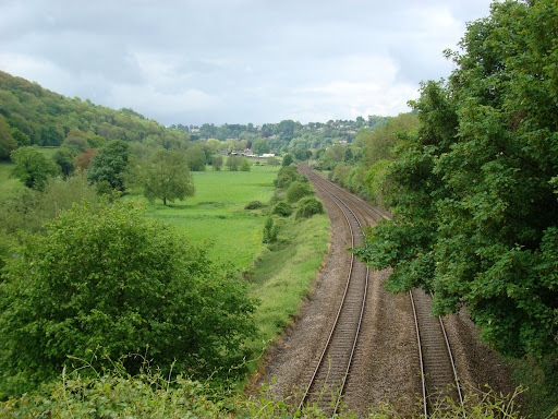
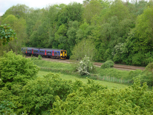
From the Aqueduct you can see the Bath to Bradford Upon Avon (and beyond) Railway line. After Bradford Upon Avon it seems to split a number of ways including down to the South Coast. You can see grey clouds in the distance - it was not the most promising of days for cycling.
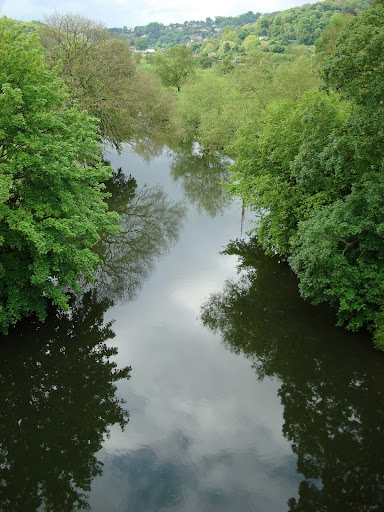
The Aqueduct also passed over the River Avon, looking inky black as it threaded through the trees.
Once past the Dundas Aqueduct the path crossed to the right side of the canal it also seemed to widen out in places. Although whenever a bridge crossed the canal the path under the bridge reduced down to a "single lane". The path also lost the benefit of a decent surface and care was required not to end up in the canal.
There were boats moored sporadically along pretty much the entire length of the canal. Here is a picture taken just before I arrived in Bradford Upon Avon when I arrived at a second Aqueduct - the Avoncliff Aqueduct.
Here is a train on its way through from Bath. A road also rungs along in parallel but we all see too may roads already.
This time I managed to get a picture of a boat crossing the Aqueduct. I think this was a hire boat - they took it cautiously anyway.
Nice views from the Aqueduct include this bridge crossing the Avon.
The path briefly moved away from the canal - but all credit to Sustrans it was still traffic free. I did find myself getting slightly lost at the Avoncliff Aqueduct - the cycle routes are marked with Blue signs and can be easy to miss sometimes. I normally then cycle for a few hundred metres expecting to see another and then when I don't I realise that I have to backtrack.
After getting to Bradford Upon Avon, my original goal I then set of back down the route to the Dundas Aqueduct so that I could then cycle along the Sustrans route 24 to Radstock (and Frome - pronounced Froom). The route is called the Colliers Way and in part follows the old railway line that was used to carry coal (hence colliers) from Radstock through to Bath.
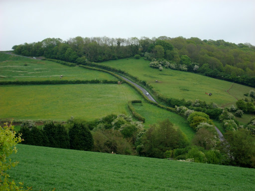
Living in Cambridge I tend to think a ride over the kerb is a hill, so I was a little worried that this might be quite a hilly route, in the end the actual route is pretty good - with reasonable cycling gradients in the main (10%) mainly because trains could not climb steep hills and so the old trackbed is very pleasant to cycle along. However not all the track bed has been made available for the cycle route and where the route follows roads through villages it can get a little more hilly - but still OK even for me with atrophied climbing legs.
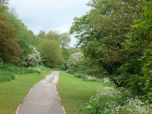
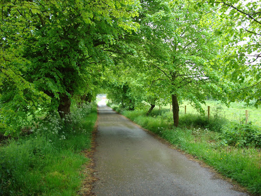
I enjoyed this part of the route even more than the canal part, as it wound its way along the contours of the hills. The path goes through the grounds of Monkton Combe School (which takes boarders and day pupils). Not all of the Sustrans routes pass along public roads or paths and many routes are due to the kind permission of the land owners and the result can be access to some spectacular and quiet routes. At one point there is a very steep foot path past the school where for safety you have to dismount and walk. I am not sure i would have been able to cycle it anyway.
Here is a pupil making a break for freedom! I am not sure when but it also started raining (drizzling) on the ride - so my sunglasses got quite steamed up every time I stopped or slowed down.
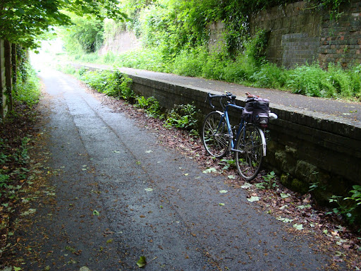
After cycling the the School grounds and village the route took the path of the old railway line. Again this was a permissive path - there is no public right of way it is generously permitted by the landowners. The slope is 10% - it was marked by a sign earlier on - this is quite easy on a bicycle and the path was in a very good state.
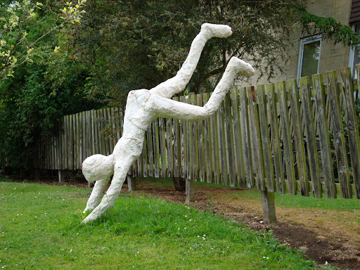
As is often the case with Sustrans routes art is used along the route with linkages to local history. (In Cambridge one such path has a DNA colour coded strip running along part of its length). These blocks of stone represent the geological strata of the area, it is by Jerry Ortmans. Since I grew up in the area I should have some insight into them - but geology was never a strong point of mine. Sustrans have more information here. The leaflet also references the DNA strip I mentioned.
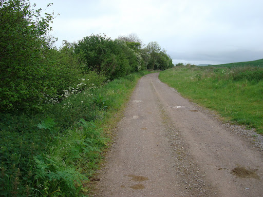
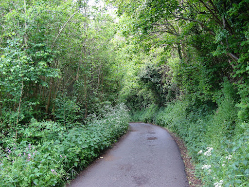
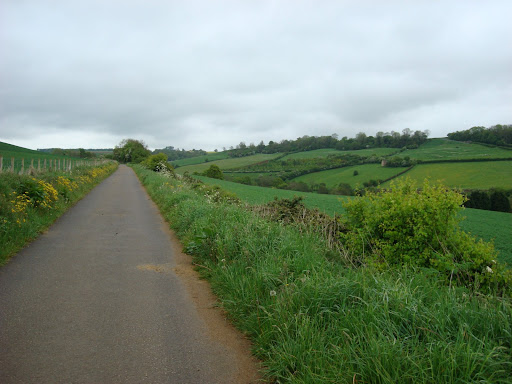
Where it is no longer possible to follow the trackbed the route follows some country lanes typical of the area -high hedgerows make it almost impossible to see anything. At the moment I am wearing my cycle helmet pretty much every time I go cycling, except when I pop down to the local shop. One problem I have noticed with it is that you get a lot of wind noise, so much so that you cannot hear vehicles travelling along the road. Once or twice I did come face to face with cars and had to literally squeeze past.
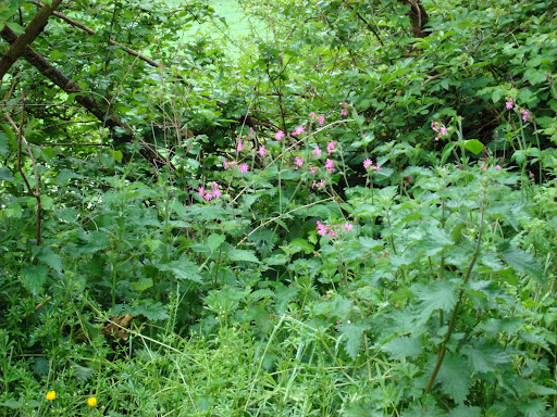
My first school was a small County Primary School, it provided education for ages from 4-11 and we had two classes and two teachers. It was quite traditional and in those days the aim was to help its pupils pass the 11 plus test to allow them to go onto Grammar School. However being a small village school it had its quirks, every year we had flower tests - various plants would be put around the classroom and we had to identify them. Cycling along the road I saw some Red Campion - a name I know because of my early schooling - it looks pink to me though!
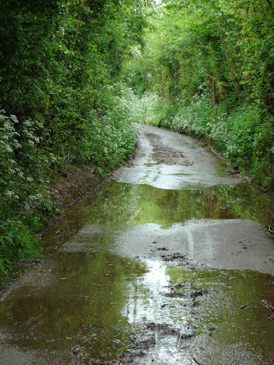
These country lanes can have drainage problems as well. In parts the middle of the road had a grass strip growing.
It was pretty hilly around these parts, although fortunately the route did not follow this road.
This was the cycle path heading off in the same direction but not so steep.
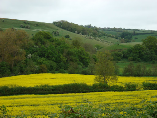
Round these parts much less Oil Seed Rape seems to be grown compared with the Flatlands of East Anglia - I brightened up the outlook on a drizzly day.
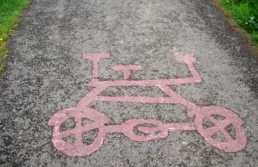
Some more Sustrans art - it looks a bit like a push-me pull-you bike.
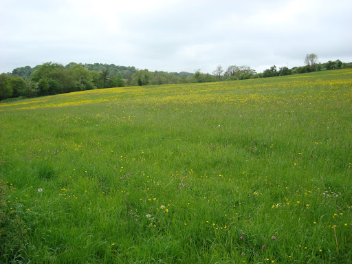
Probably nostalgia but I also feel that the fields have a wider range of wildflowers growing in Somerset than up in Cambridgeshire. Clover and buttercups along with dandelions can be seen amongst the grass.
Before rejoining the track bed before the run into Radstock I found myself climbing a really steep bit of country road, on reaching the top there was no sign of the Sustrans Route. I explored a little and found myself on a main road. At this point I was wet and decided to head back near the bottom of the steep hill I noticed the Sustrans sign I had missed. With misty sunglasses and the vegetation growing profusely I had missed it. Since I was so close I decided I would go into Radstock. The track re-joined the old trackbed although parts were tarmac'd.
There were even remnants of the railway days - "The Bicycle now standing at Platform 1 is the 12.00 for Radstock"
The final bit of the path required a bit of care - it was still along the trackbed but judging by the state of the path was also used by a large number of dogs whose owners did not give a toss about cleaning up after them. Having reached my goal on the way back on one of the permissive paths I stopped and had a pleasant chat with three horse riders - people charming when not in some sort of mad-dash.
No comments:
Post a Comment